
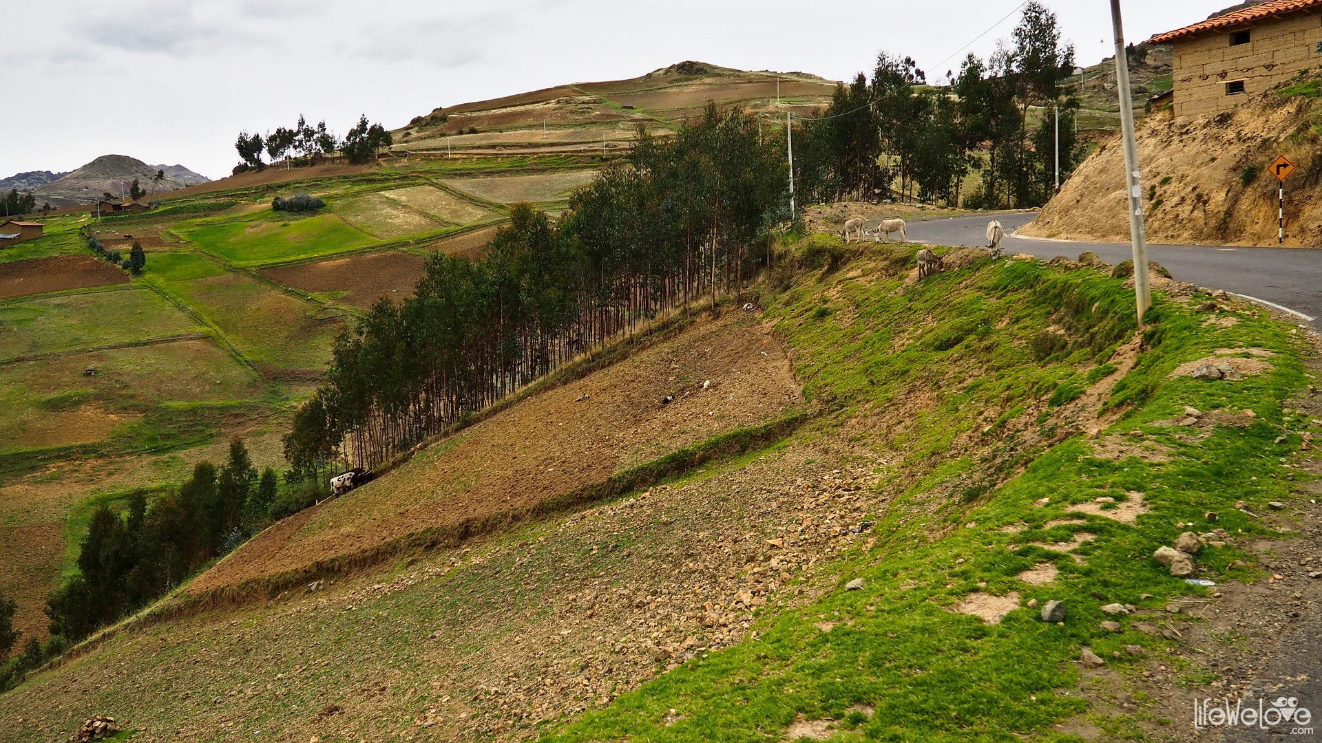
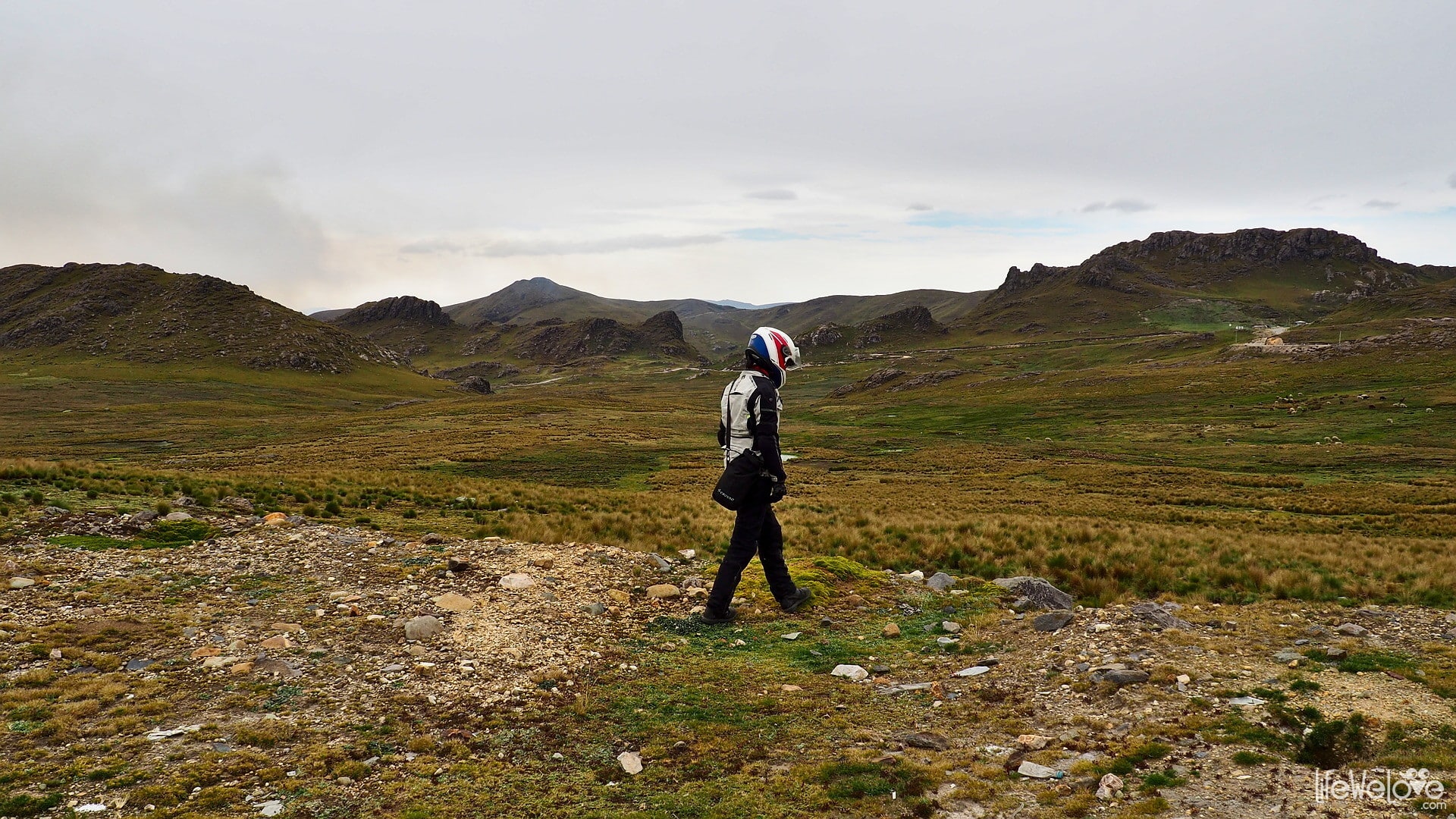
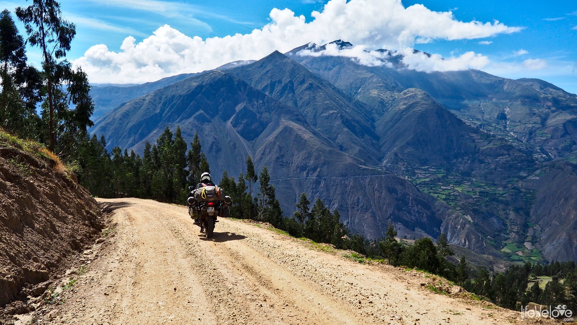
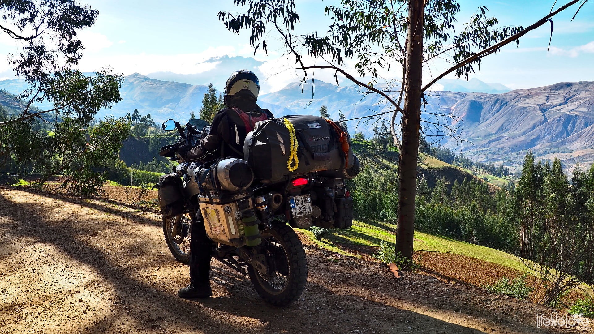
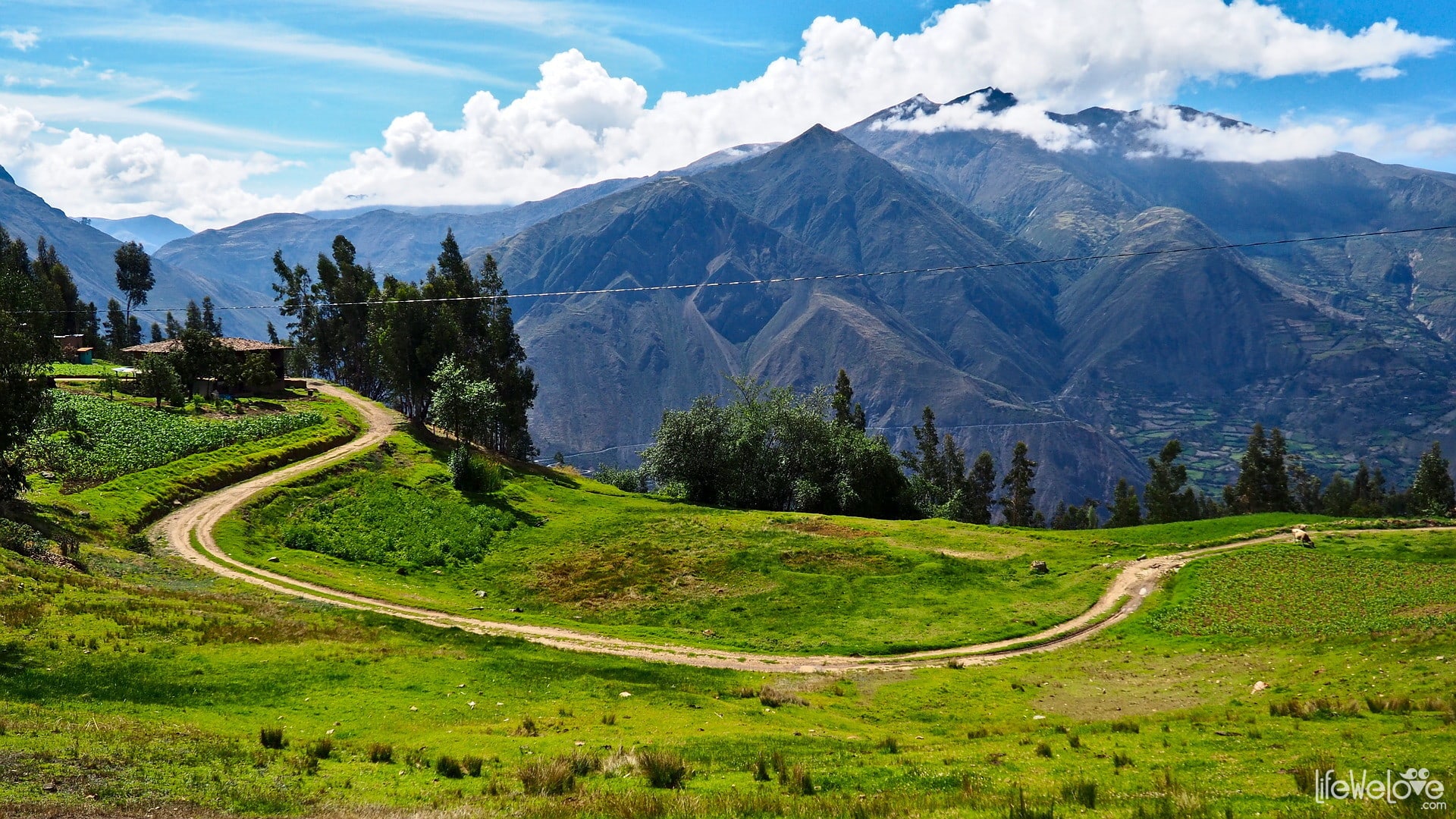
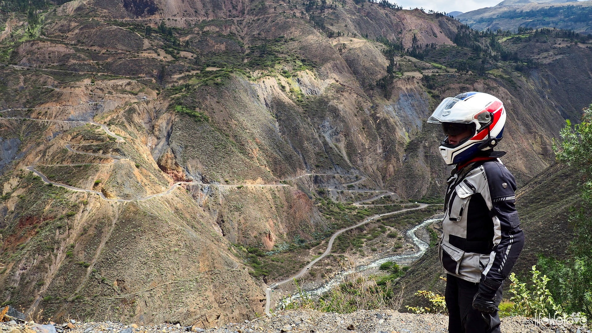
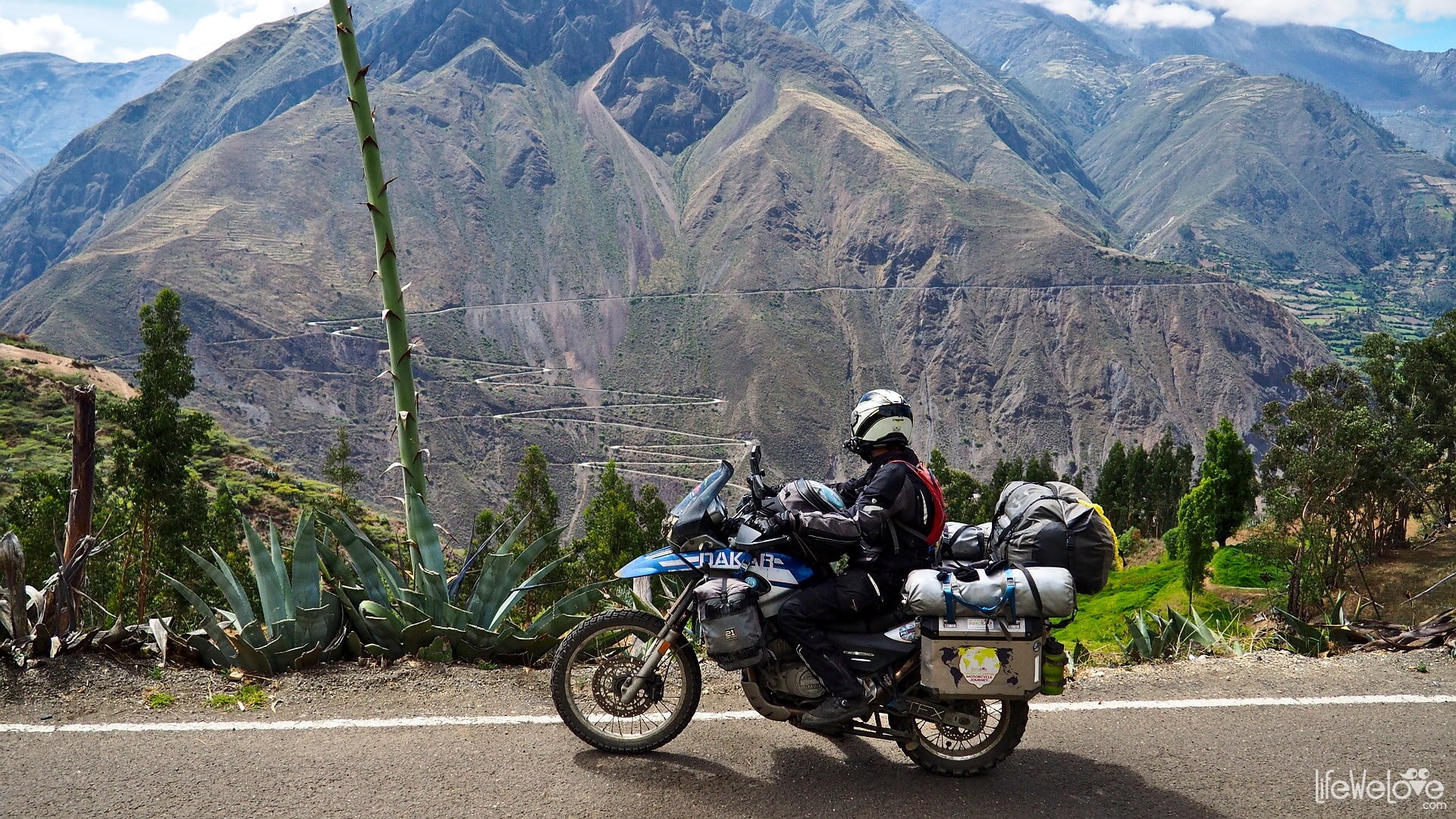
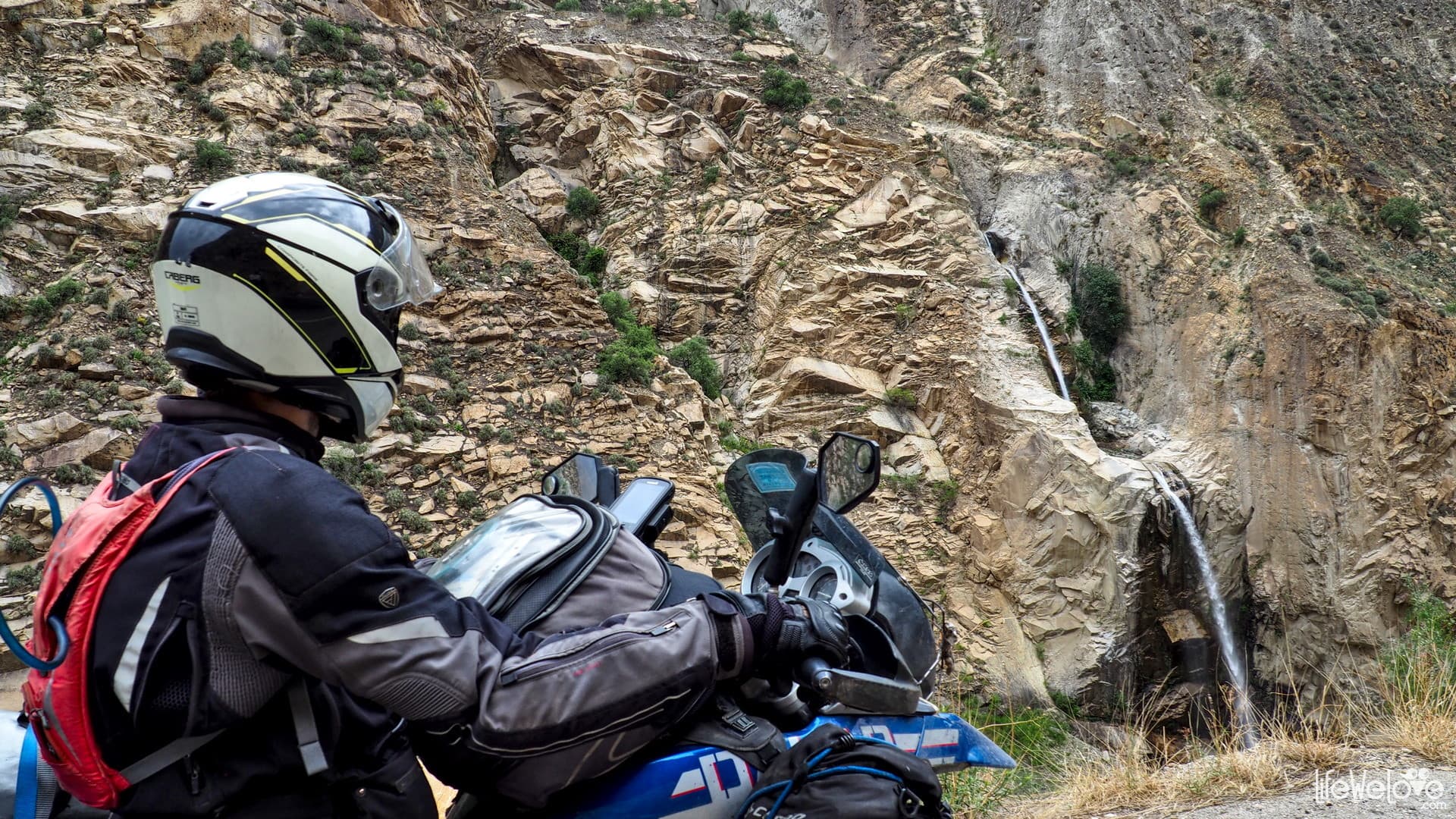
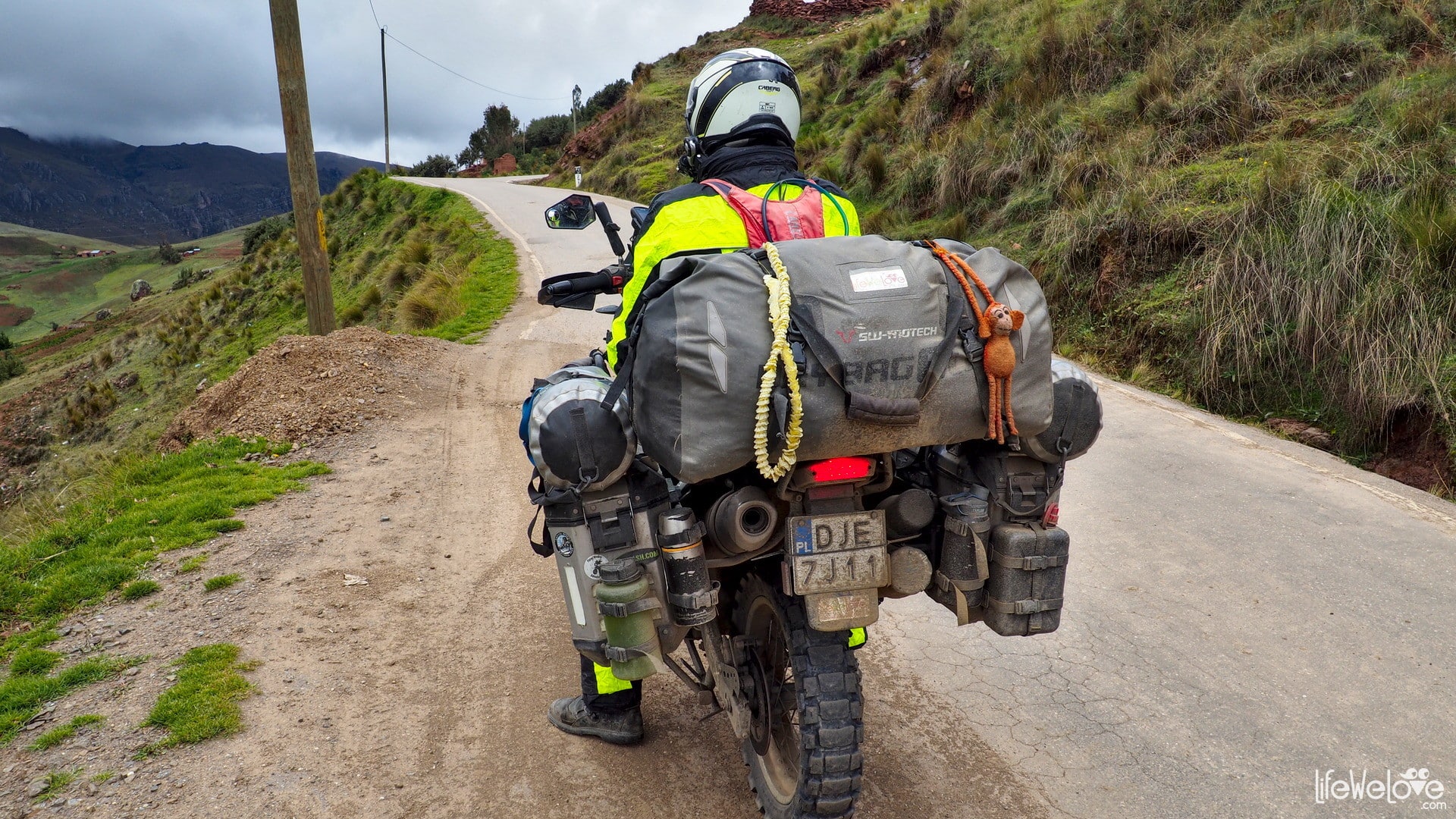
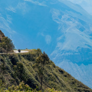
The alpine lands of the Inca descendants, winding, picturesque roads that reach over 4,000 meters high and breathtaking views. Colorful gorges, silver cords of waterfalls falling from Andean peaks and endless curves. Sounds like a dream of every motorcyclist? It is Peru, especially the national roads that lead up the mountains: PE-3N running from the north of this country and PE-3S coming from the south.
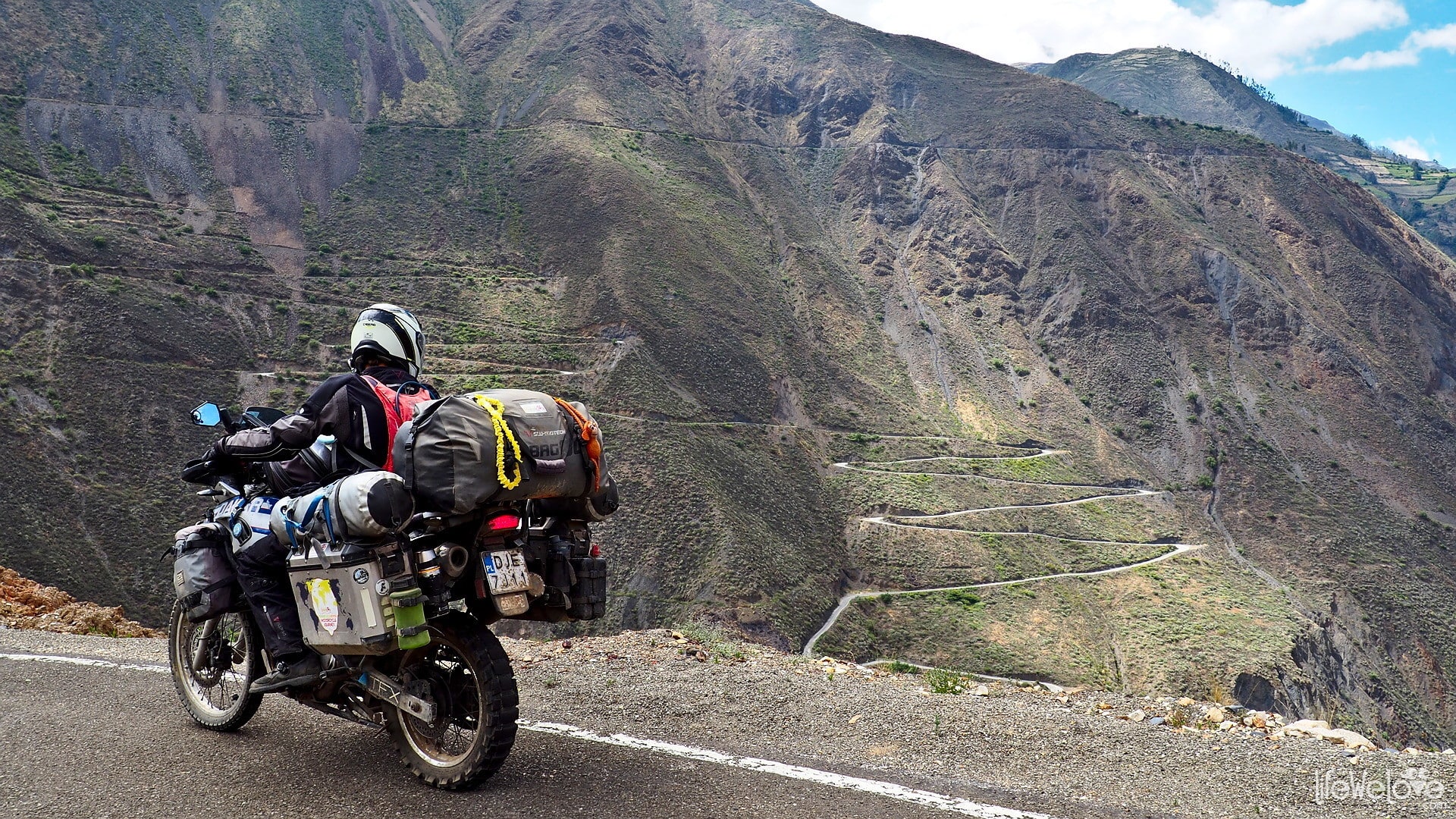
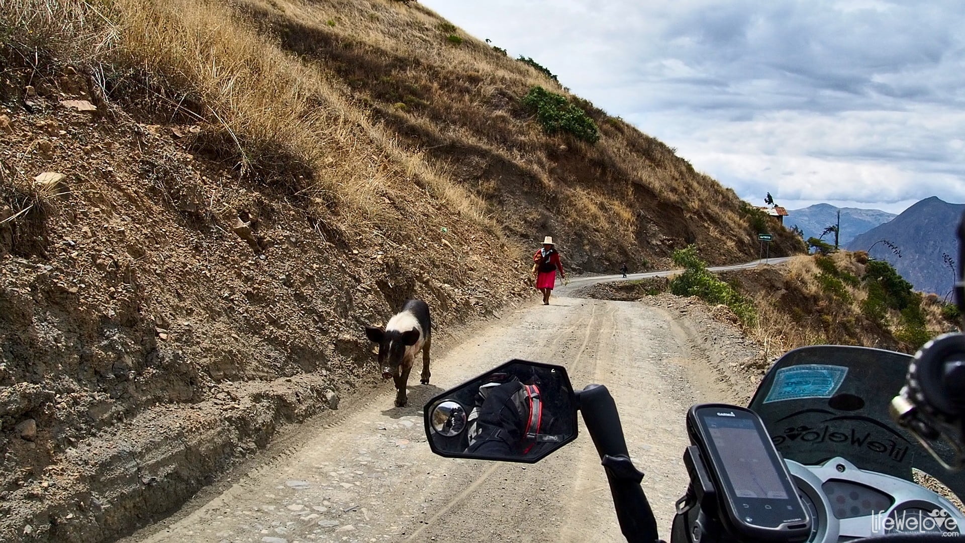
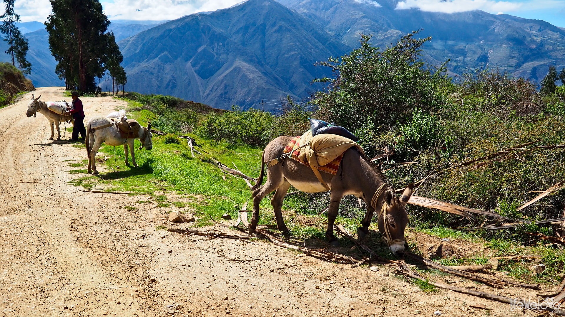
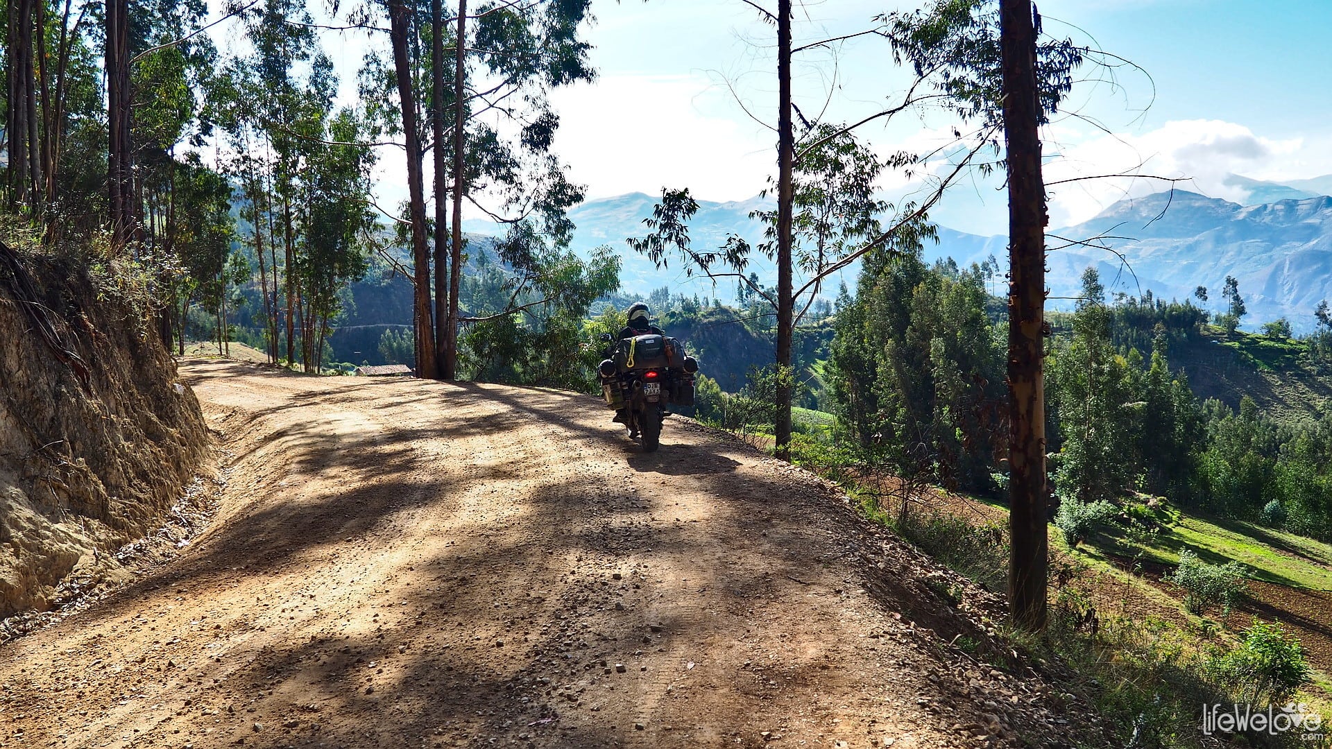
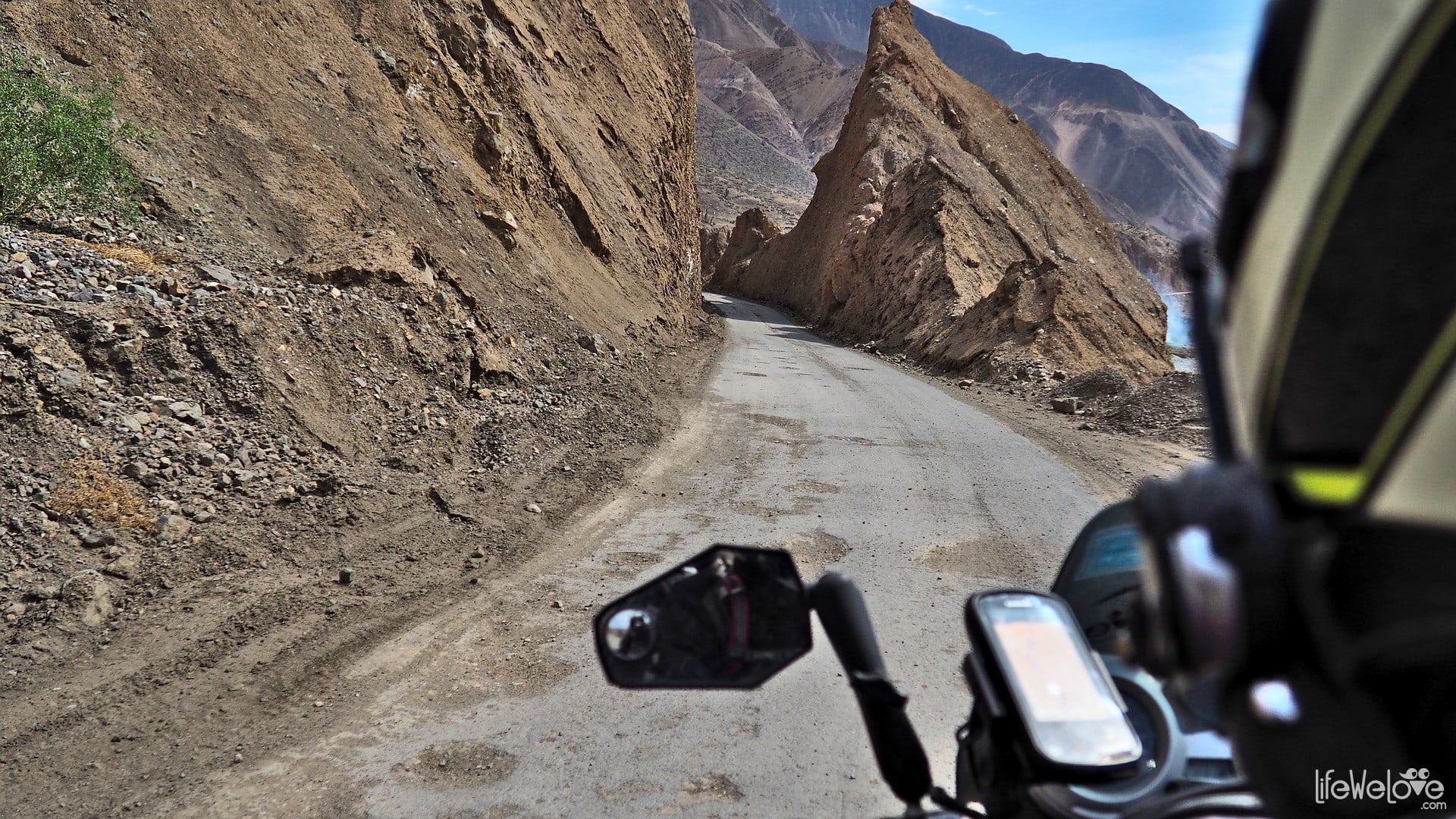
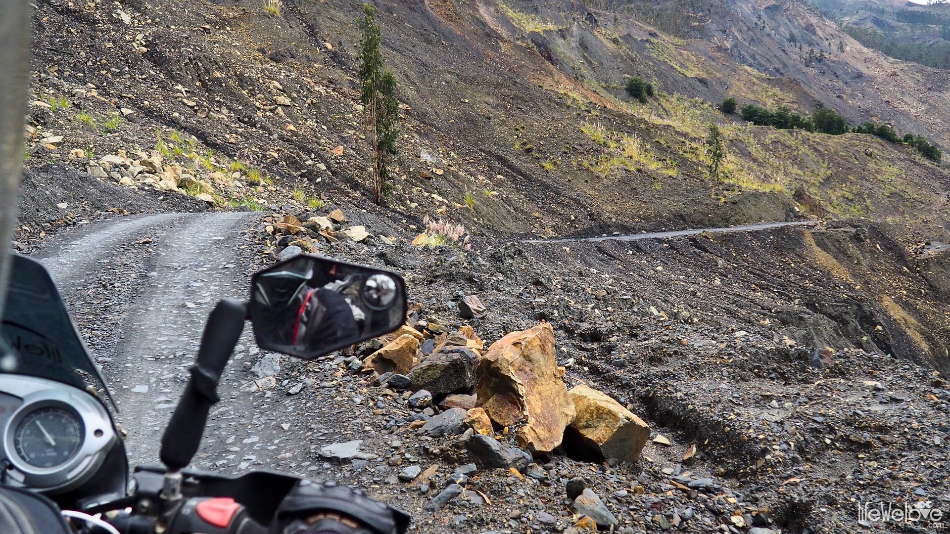
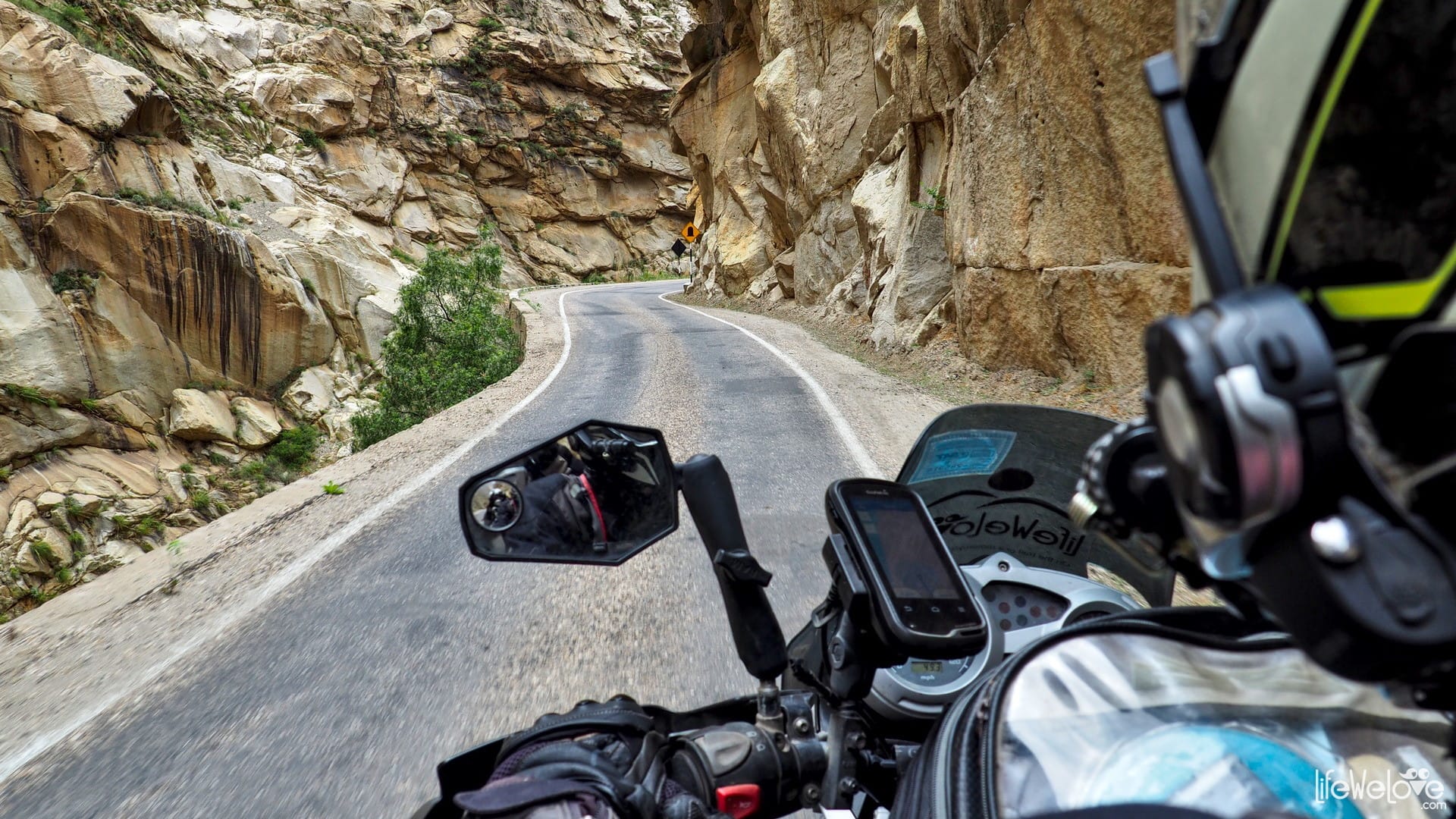
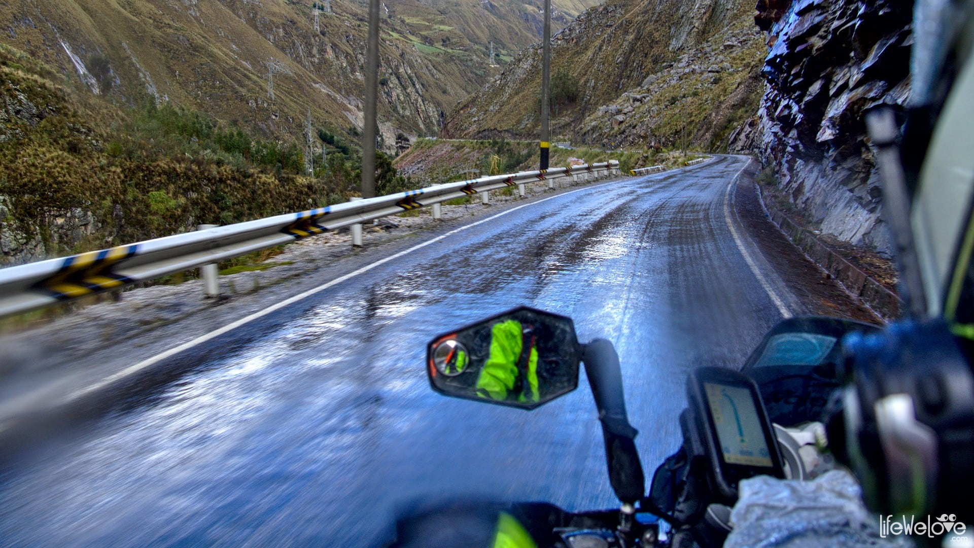
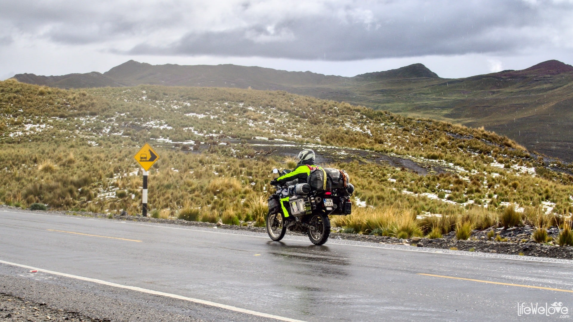
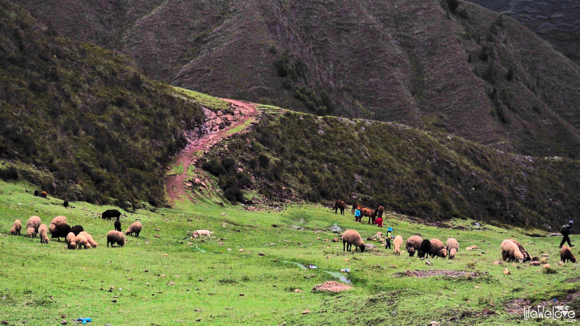
And although the road is fabulous it also carries a risk, because it leads through very dangerous sections. The Bolivian Death Road next to them is a piece of cake. In Peru, in addition to the blind corners, narrow road and deadly cliffs, you need to deal also with crazy Peruvian drivers. They apparently have the habit of cutting corners and speeding in their blood and probably nothing will change that. We even saw the police doing it, so you just have to take it together with Peru in one package and be very careful. It is advisable to use a horn at each corner to inform the driver from the opposite direction that you are on the road too. At some places there are even signs to use the horn. Usually they appear on sections with a narrowed road and sharp turns, where you encounter large buses as well. Sometimes you have to cross small streams of water. They were small, when we were there, but after a lot of rain it probably changes. You have to be careful about various animals which walk on roads and behave like holy cows. You can encounter horses standing along the street, sheep, goats, pigs running in front of you, and dogs attacking you from all sides. Even donkeys can be dangerous, when tied on one side and they walk to the other, stretching the rope along the road. And there are many more animal surprises like that!
Peruvian national roads number 3 cross the whole country from north to south, but these are not the main and most popular roads in Peru. Usually travelers would choose the route that runs along the coast, on the PE-1N and PE-1S, the so-called Panamericana. PE-3N and PE-3S are used by the local community inhabiting small towns along these roads. Or they are chosen by travelers who don't want to ride through boring Panamericana with a lot of crazy drivers and Lima on the way. Because Lima is one of the largest agglomerations in the world, where the population is over 8 million. Traffic is terrible there, it's very hot, and like in large cities in South America, it's less secure.
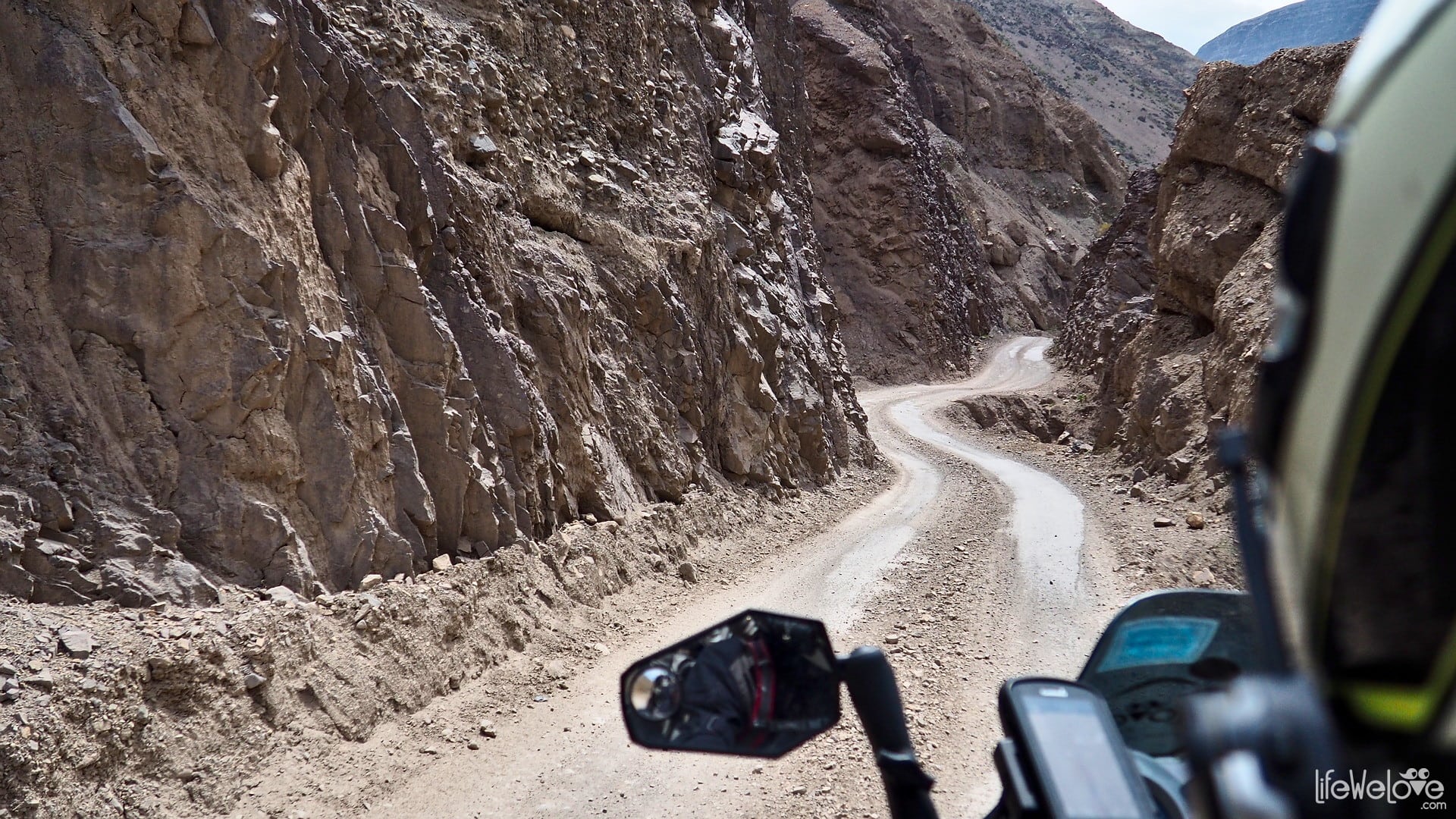
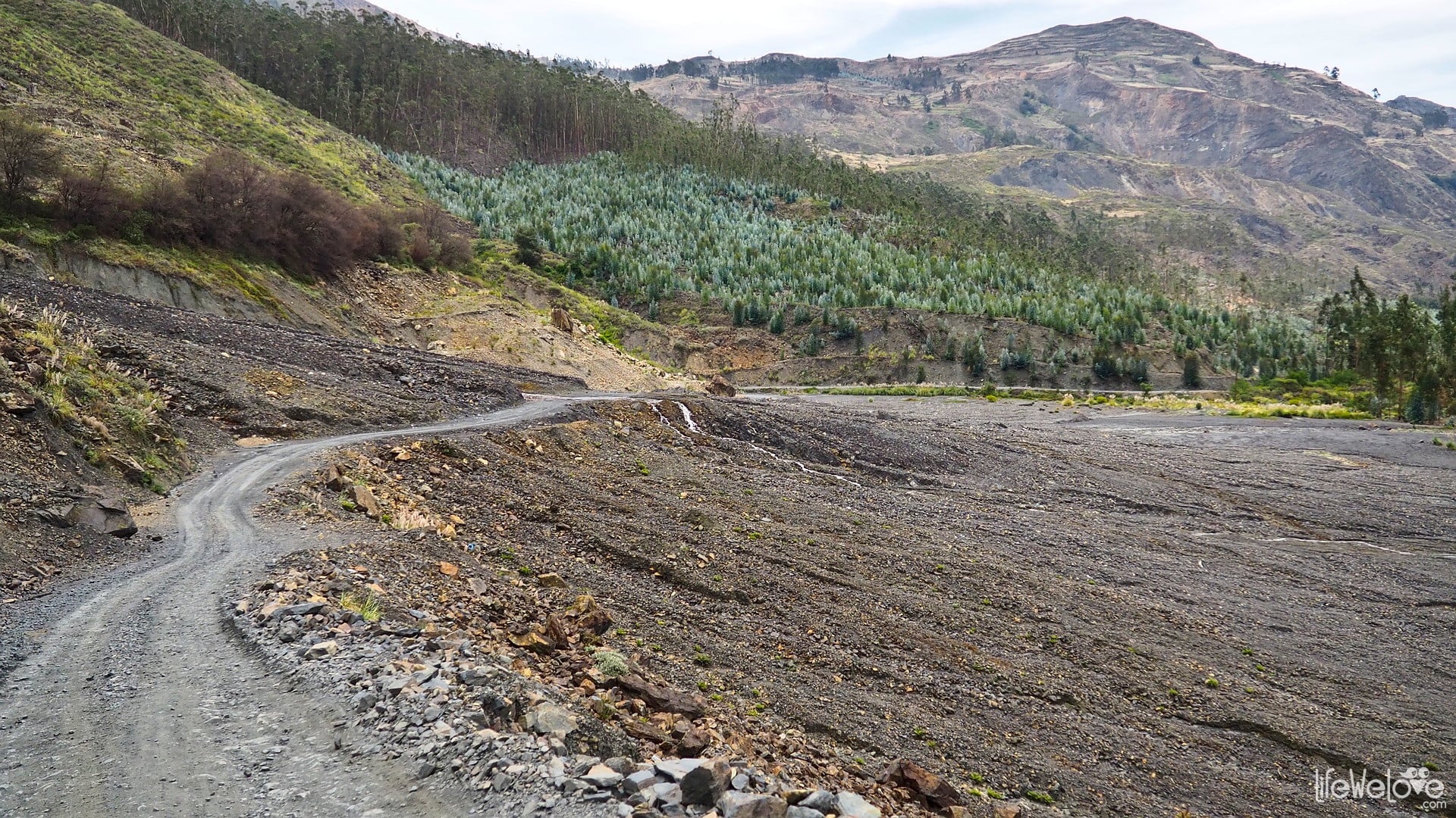
However, unlike Panamericana, where you can drive through Peru quite fast, but without special attractions along the way, for the roads number 3 you have to have some spared time to cross mountain passes. At many sections there is gravel, puddles and mud, many curves, what made us sometimes travel only 130 km during the day. Frequent roadblocks built by an agitated population may stop you for longer. It happened that because of the protest of Peruvian farmers, who were striking against the low prices of potatoes, we were grounded for two days.
Below we present a collection of PE-3N and PE-3S sections, which made the biggest impression on us.
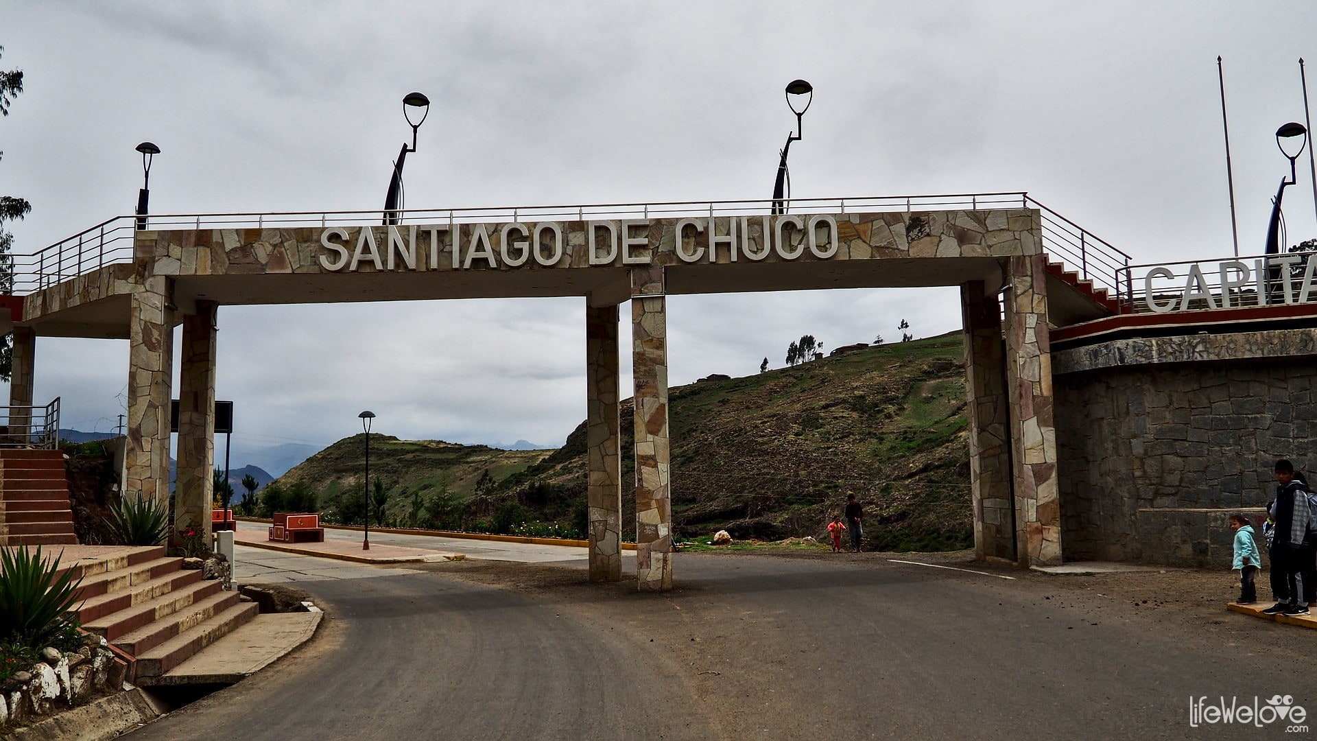
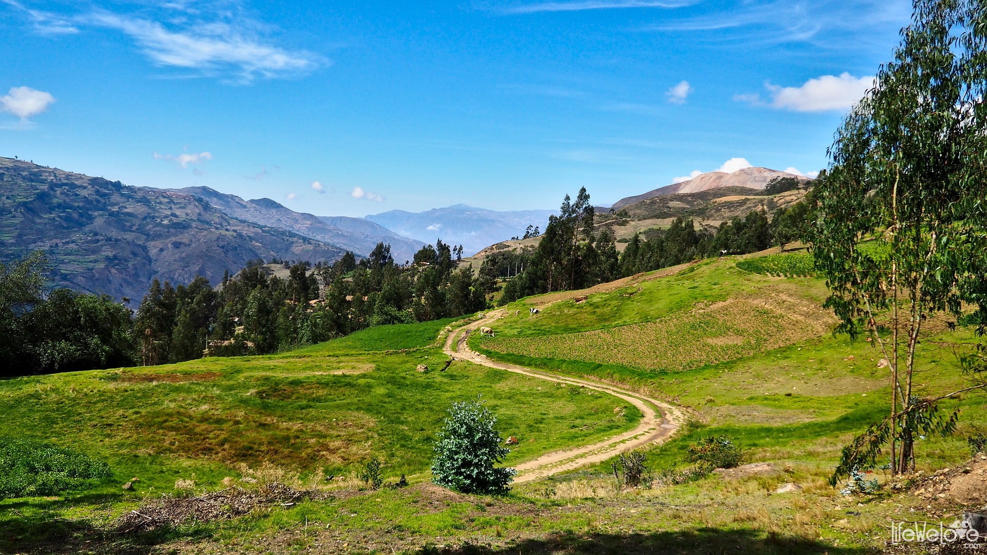
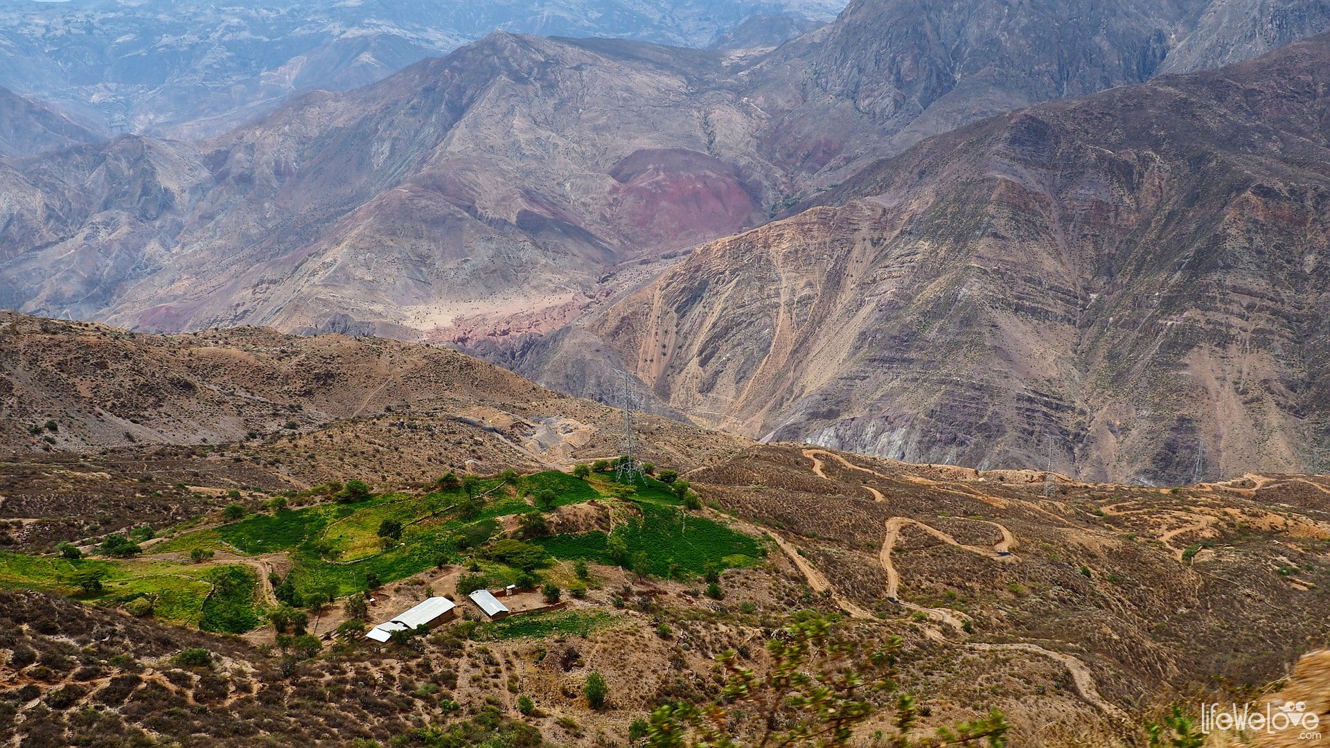
Road from Cajabamba to Santiago de Chuco
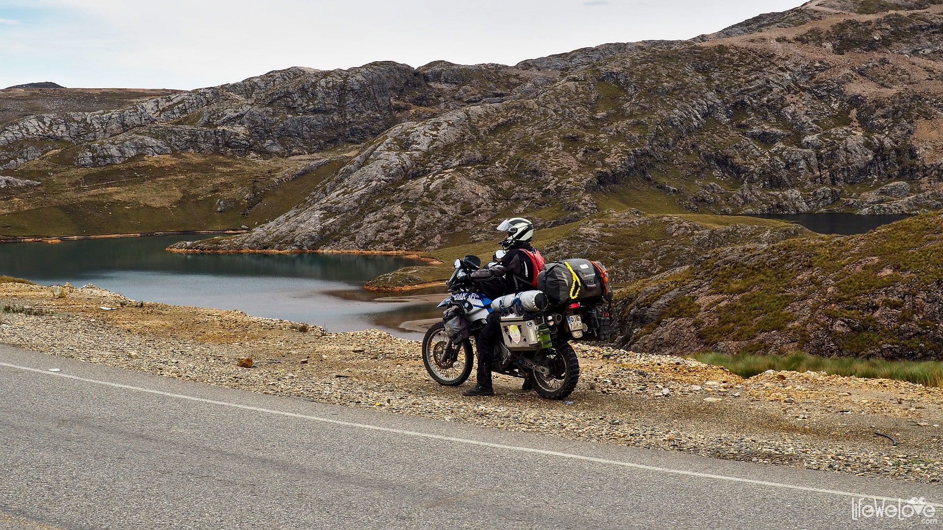
It's a 150 - kilometer section, where in Cajabamba you start your ride at an altitude of 2 654 m and then you reach even over 4 000 m (maximum 4 187 m a.s.l.) and finish in Santiago de Chuco (3 120 m). At the top you can feel the chill but the panorama of the lagoons, including the Laguna de Los Angeles and the El Toro Lagoon, and the view of the winding, well-paved road, warm your body up.
You can make this section of road in a few hours.
Info about the route
| Distance | 150 km |
| Start / end | Cajabamba / Santiago de Chuco |
| Surface | Good quality asphalt |
| Accessibility | Open all year round |
| Hazards | Peruvian drivers, animals on the road, tight, steep curves, riding at altitude above 4 000 m a.s.l. |
| Traffic | Medium |
| Attractions on the way | Laguna de Los Angeles, Laguna El Toro, many curves |
| Maximum altitude | 4 187 m a.s.l. |
Map of the route
loading map - please wait...
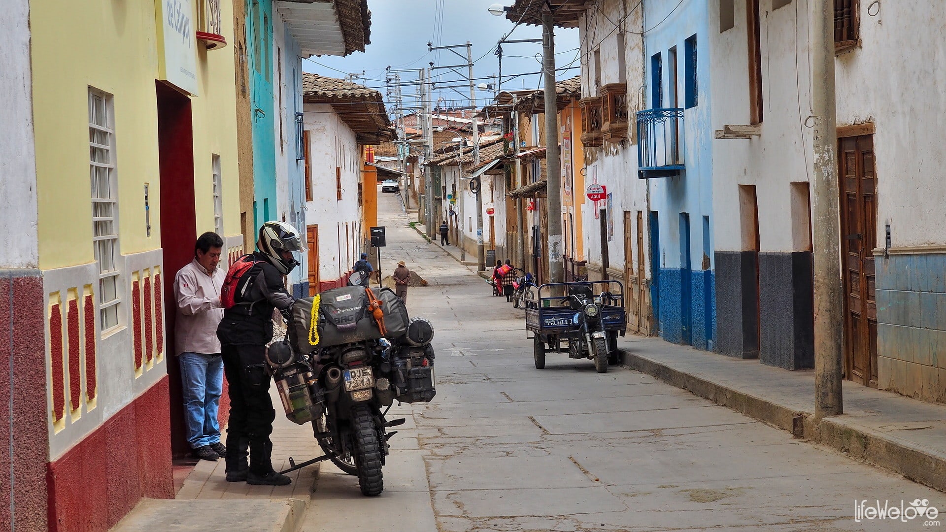
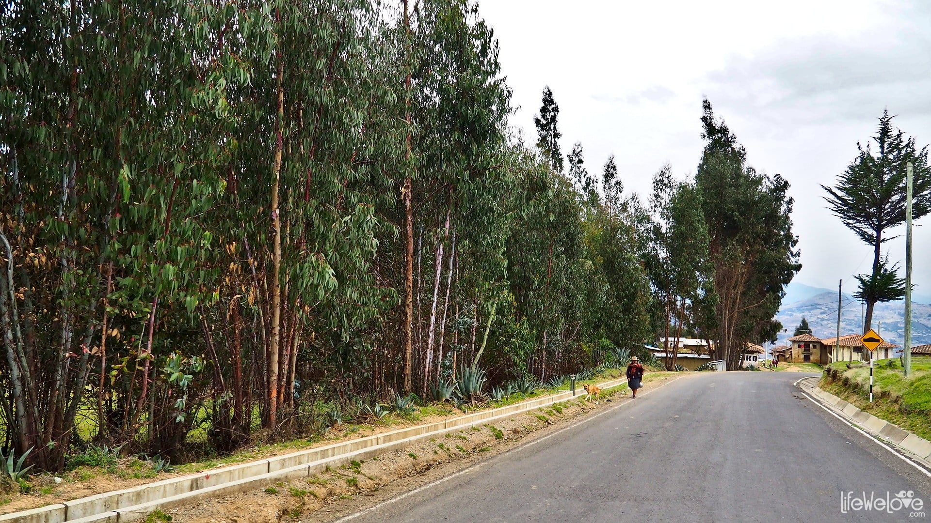
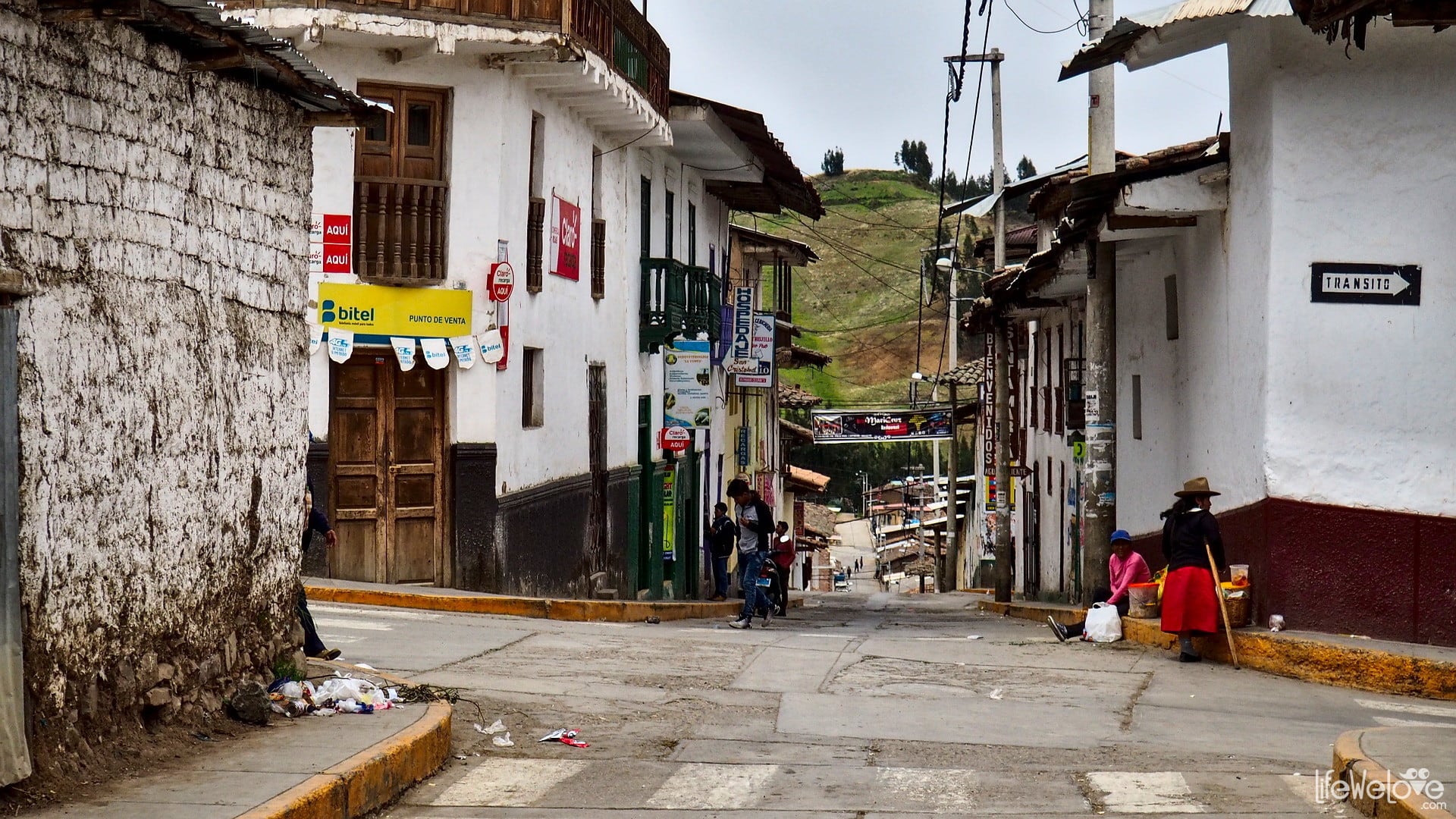
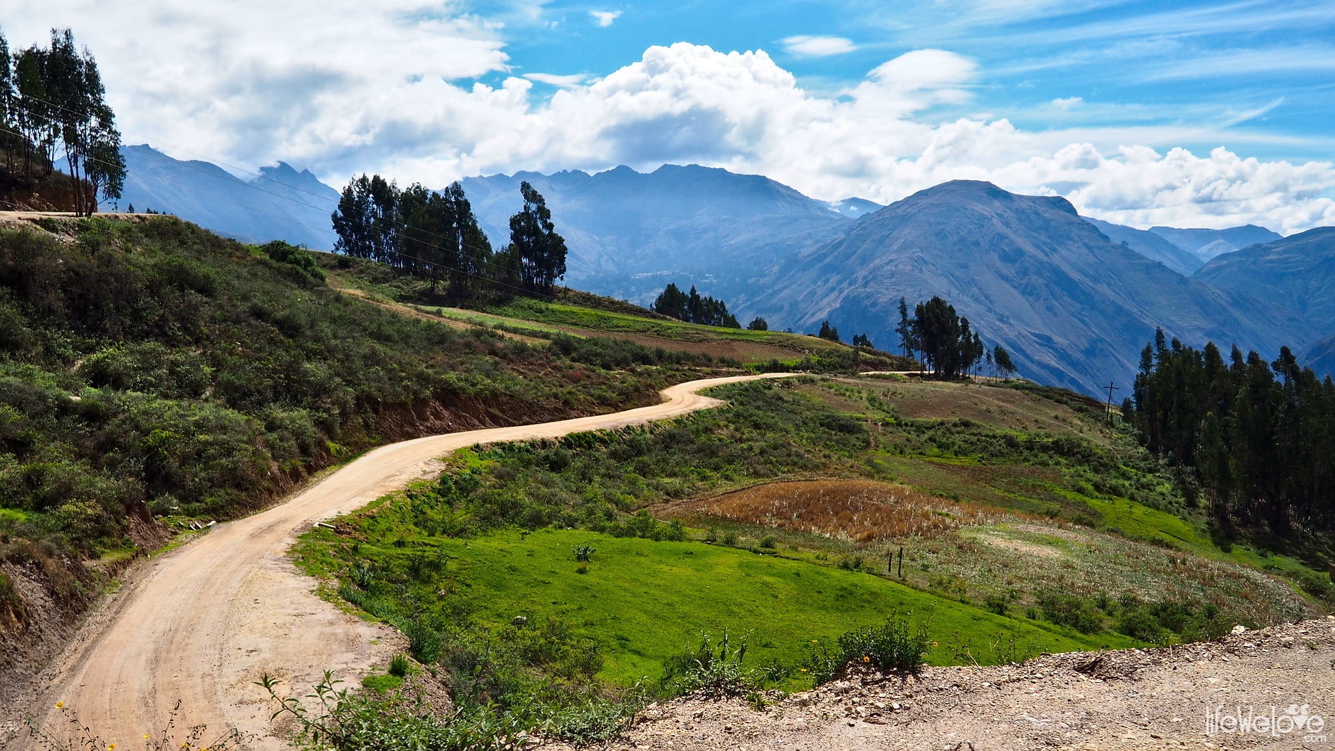
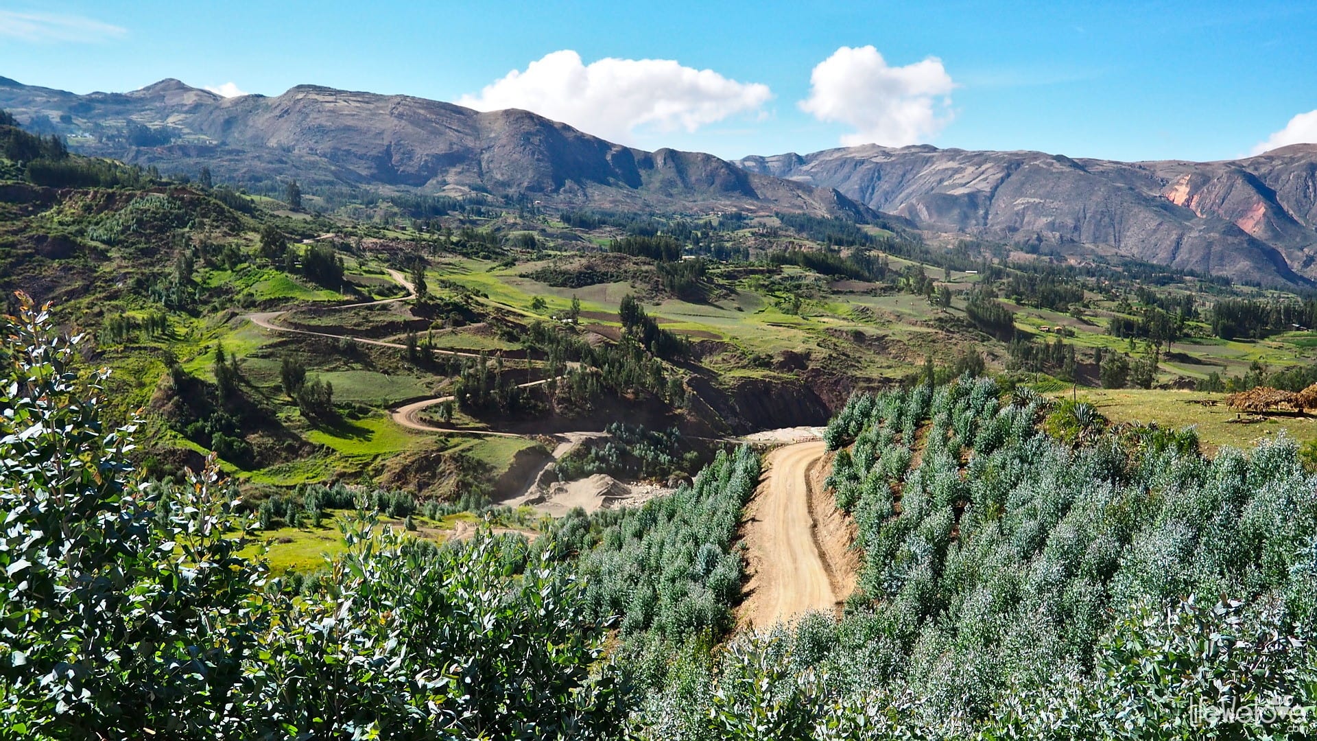
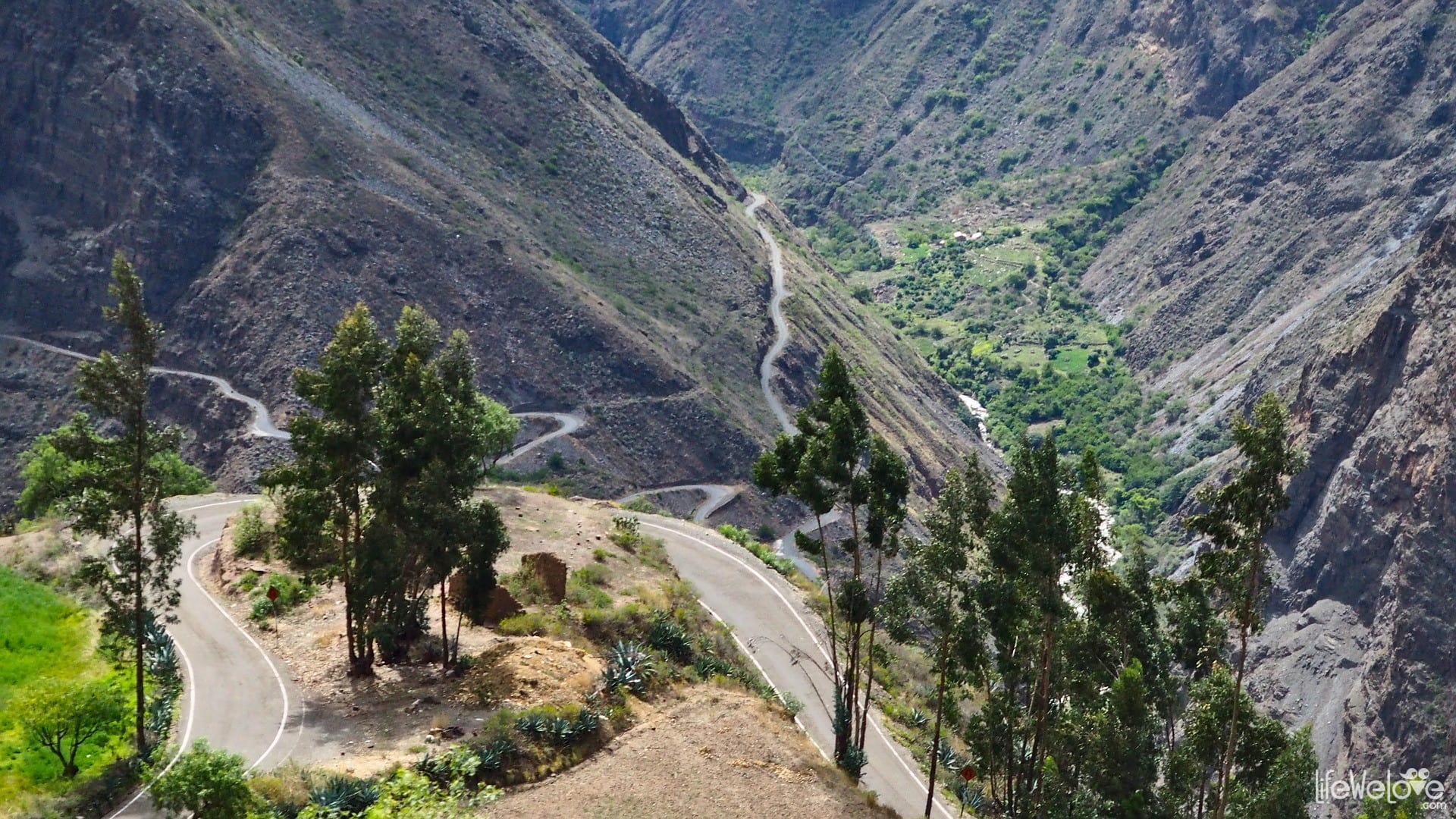
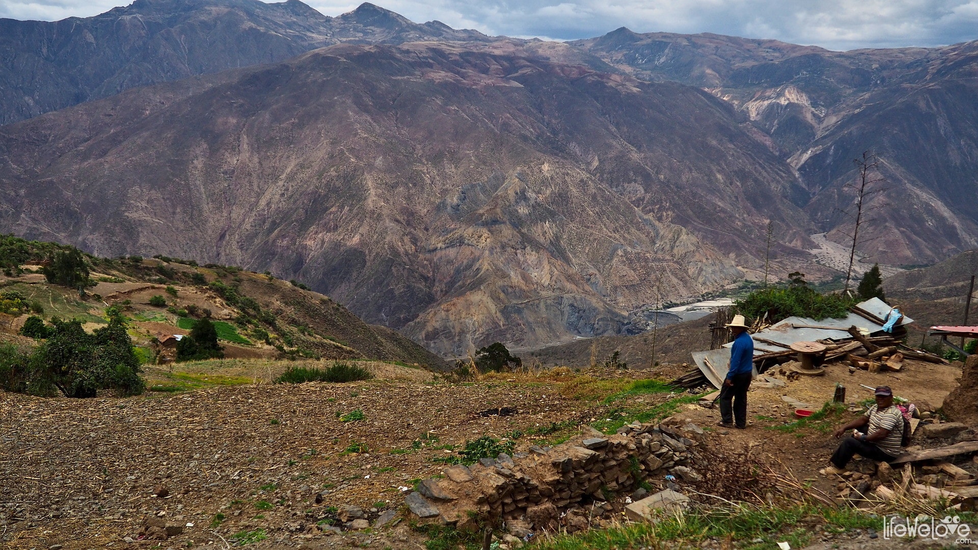
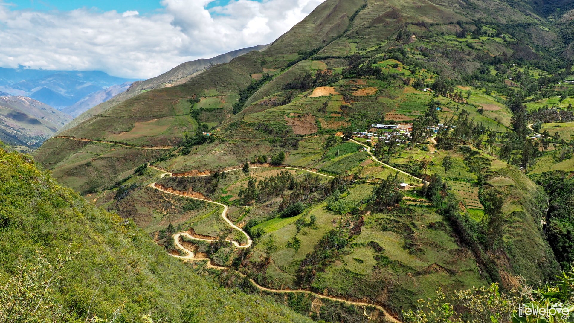
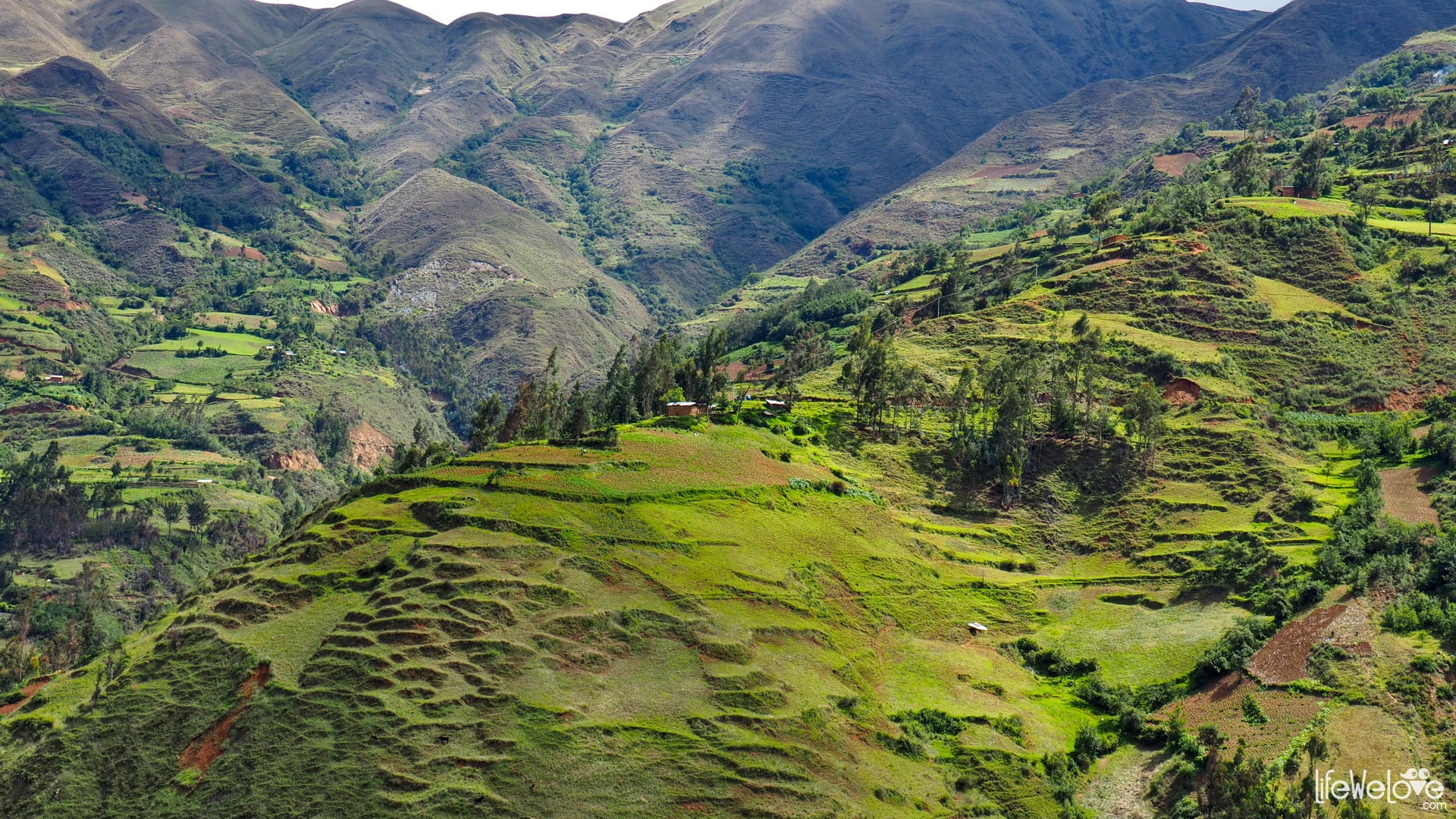
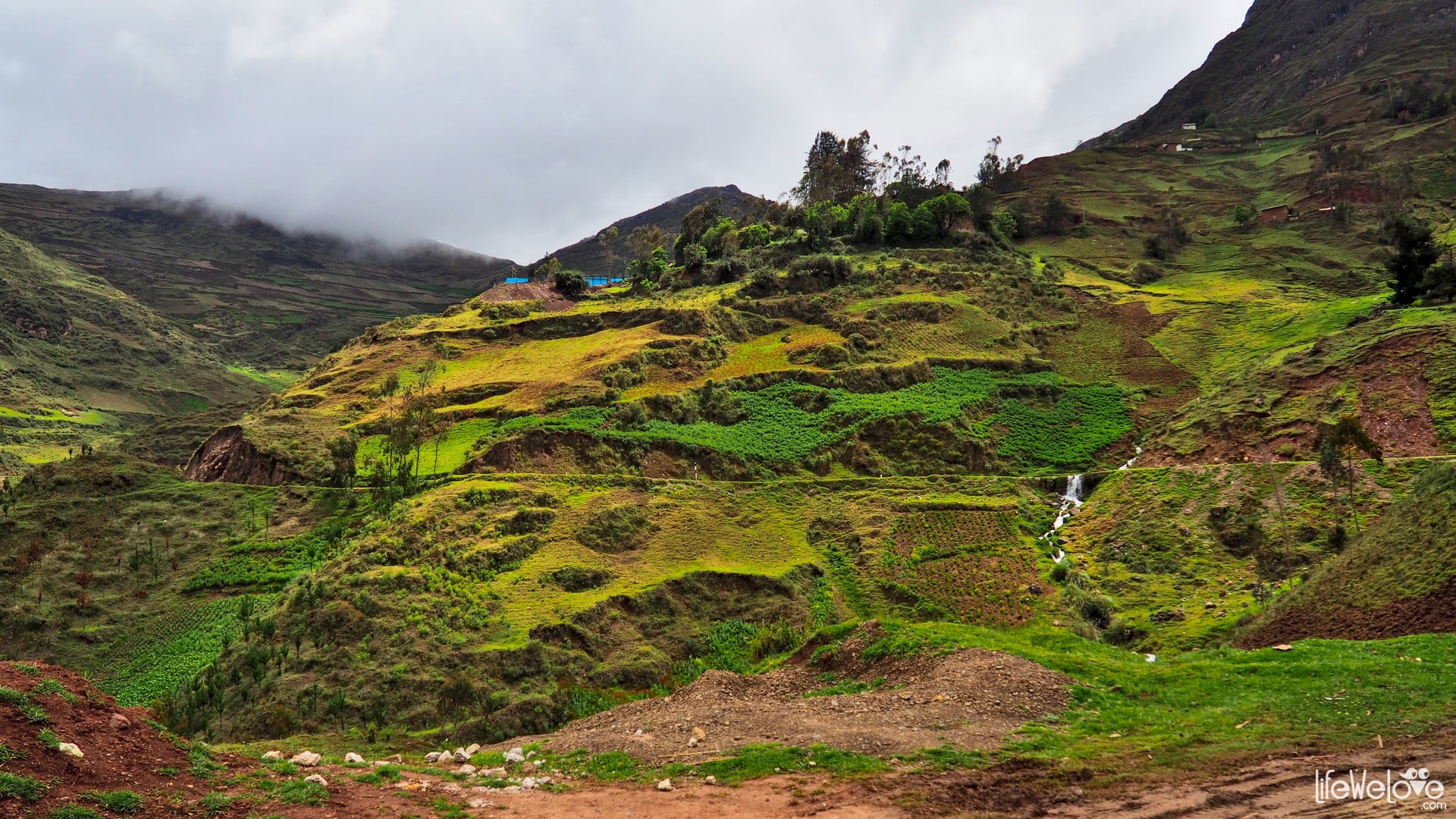
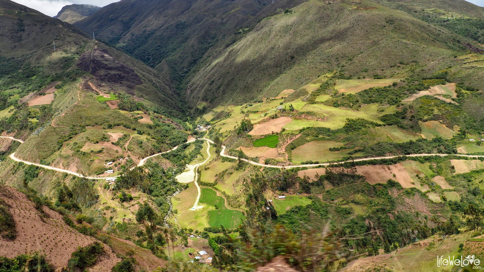
Road from Santiago de Chuco to Mellebamba
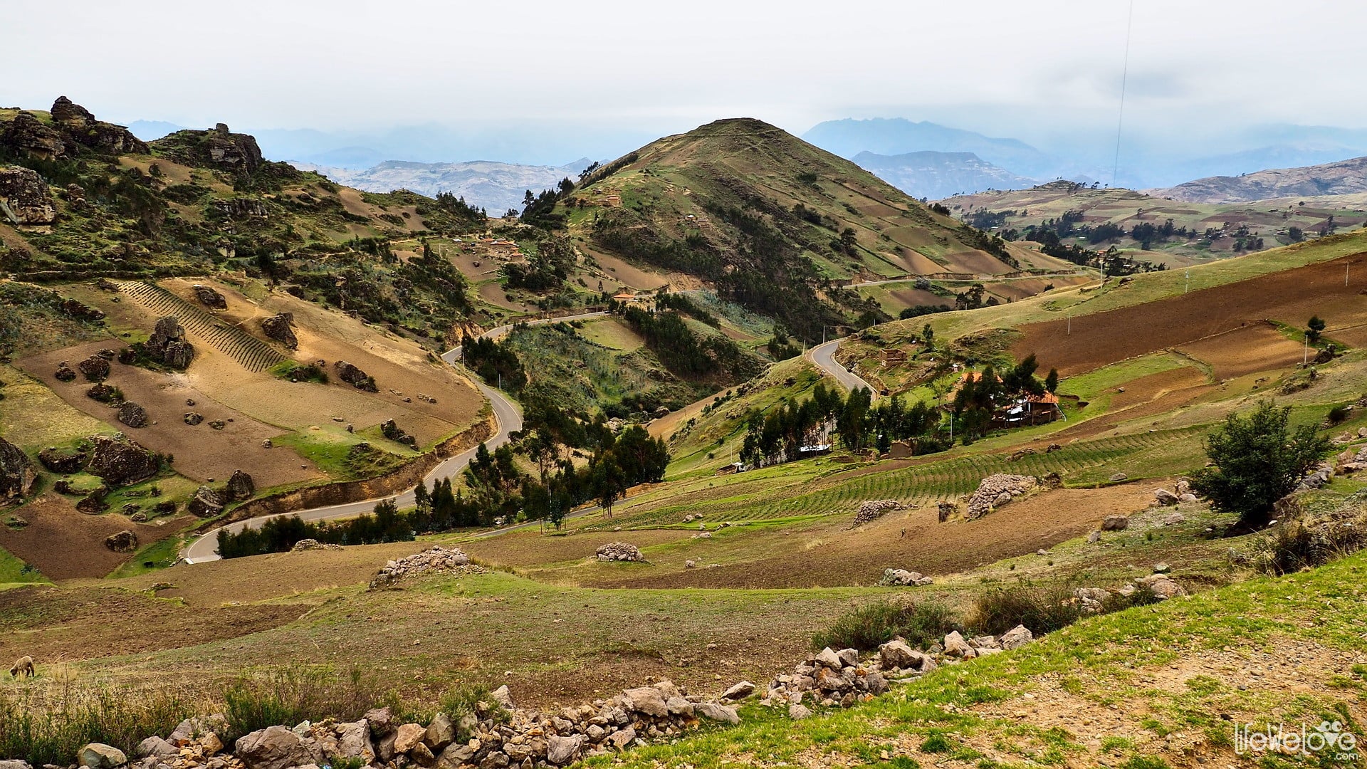
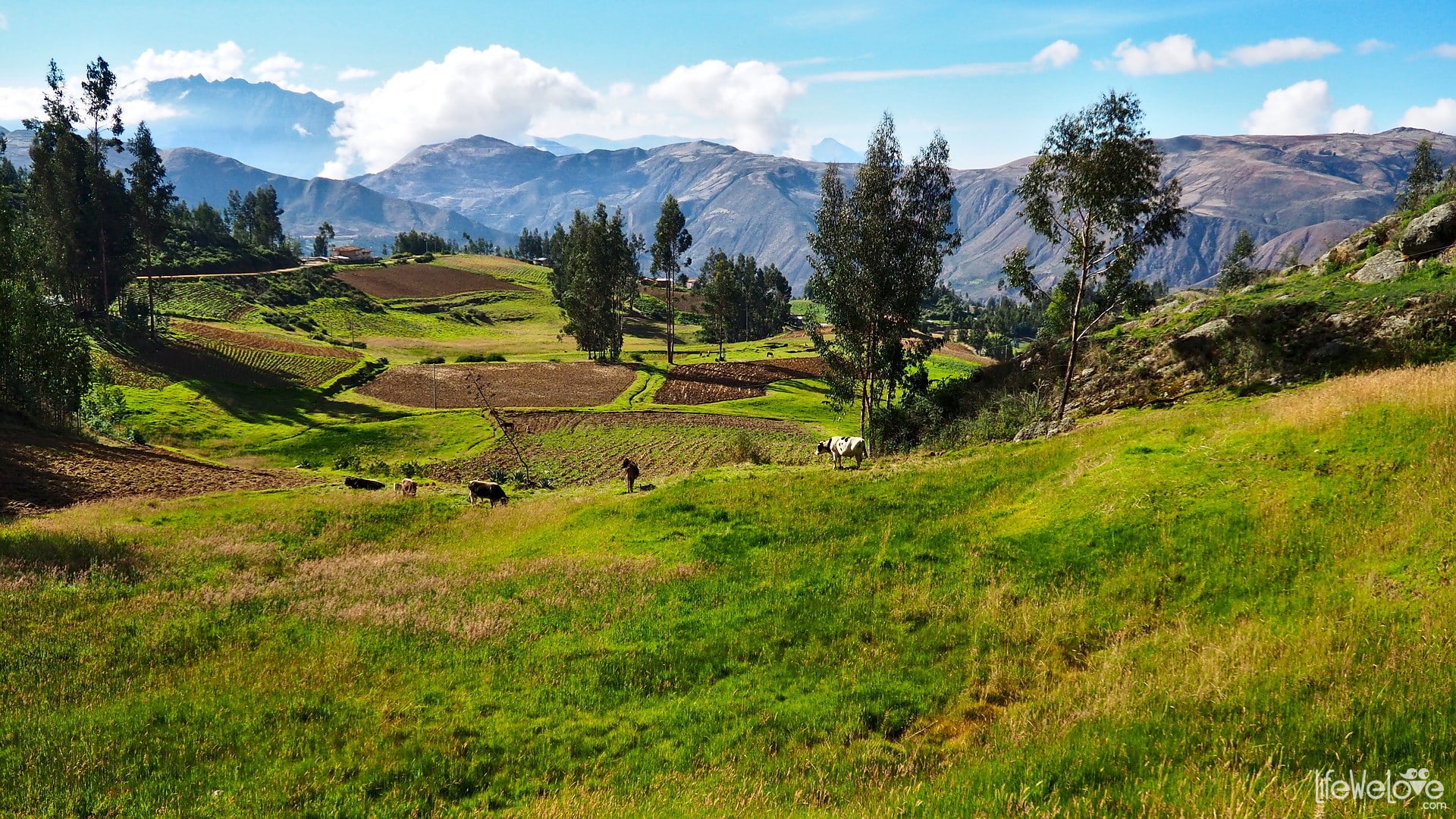
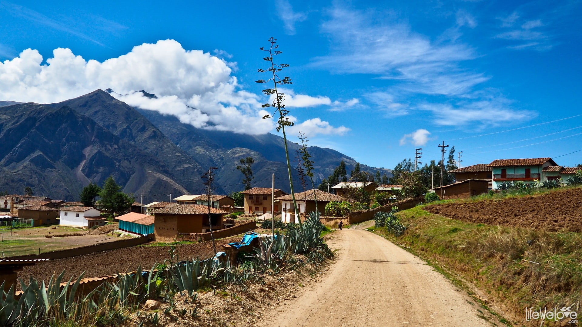
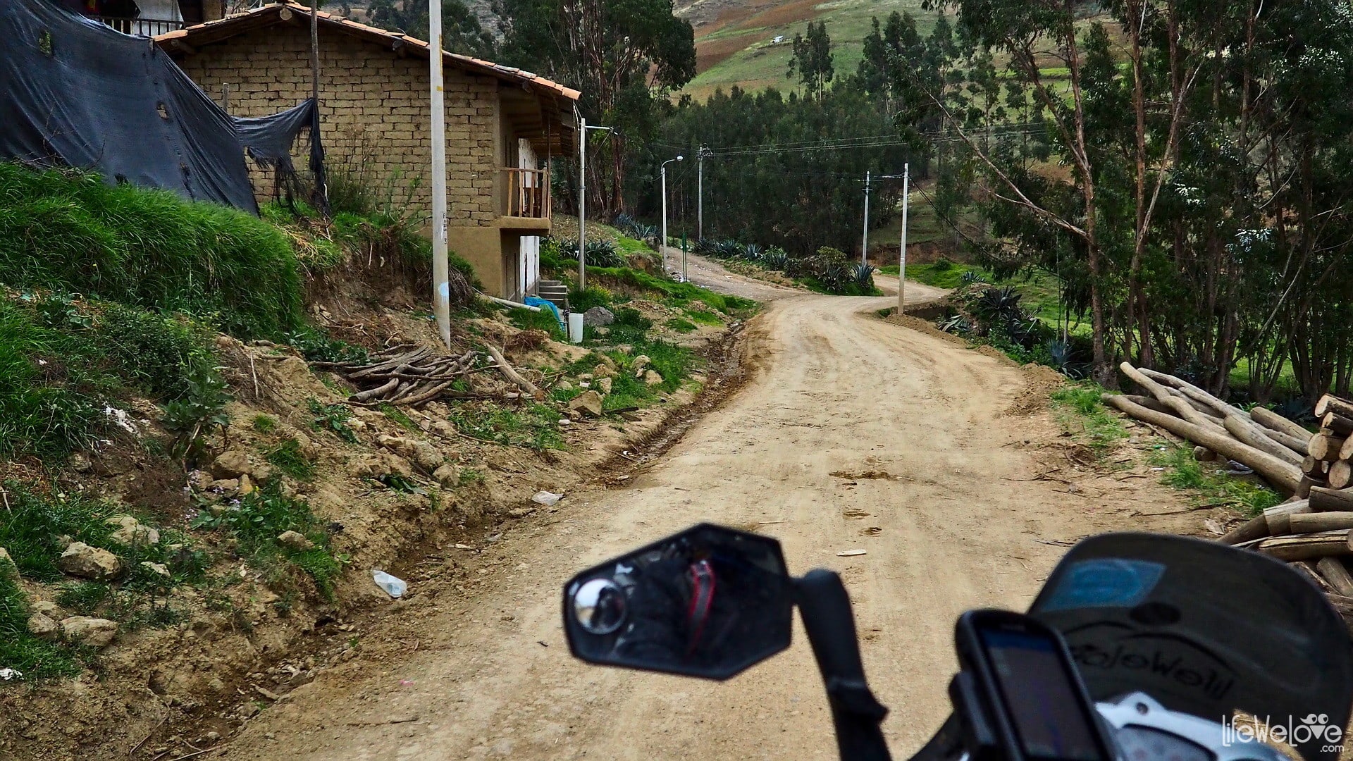
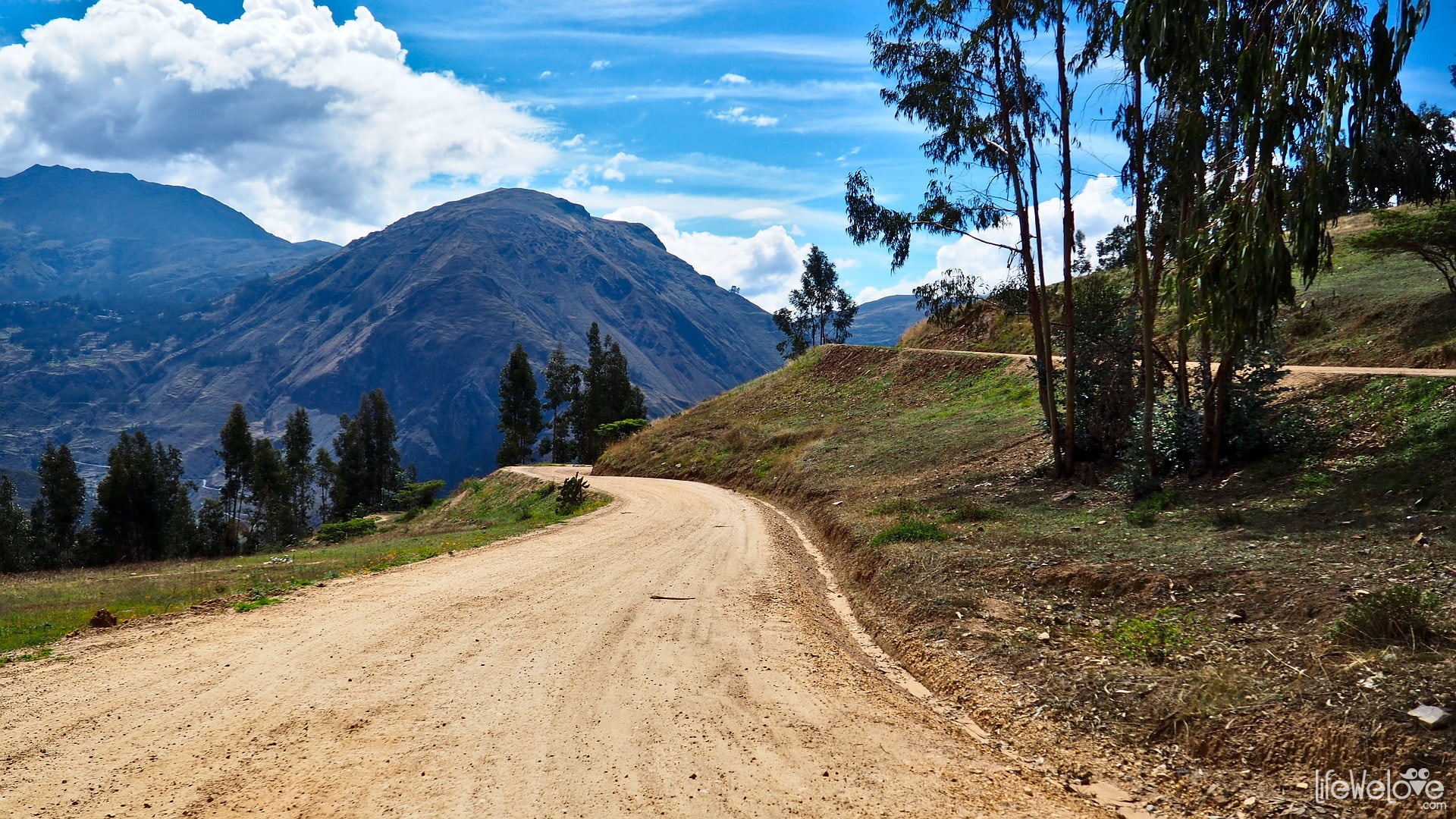
You will step into the colorful world of alpine regions inhabited by the descendants of indigenous people of Peru. The straight asphalt road ends there and a spiral of sensations begins. For 70 km you can enjoy the view of beautiful mountains and little villages that emerge at every corner and observe people working in the field or grazing animals. The route is very pleasant, with good quality gravel, although at the exit from Santiago de Chuco we encountered road works and it was stressful on a short stretch of marshy sand. The altitude fluctuates at 3,000 m above sea level, so the air temperature is very good for driving, it is neither too cold nor too hot.
We made this stretch in about 3 hours, taking our time for many stops and taking photos.

Info about the road
| Distance | 70 km |
| Start / end | Santiago de Chuco / Mollebamba |
| Surface | Good quality gravel |
| Accessibility | Open all year round |
| Hazards | Peruvian drivers, animals on the road, tight curves |
| Traffic | Low |
| Attractions on the way | Beautiful hills, many curves |
| Maximum altitude | 3 456 m a.s.l. |
Map of the route
loading map - please wait...
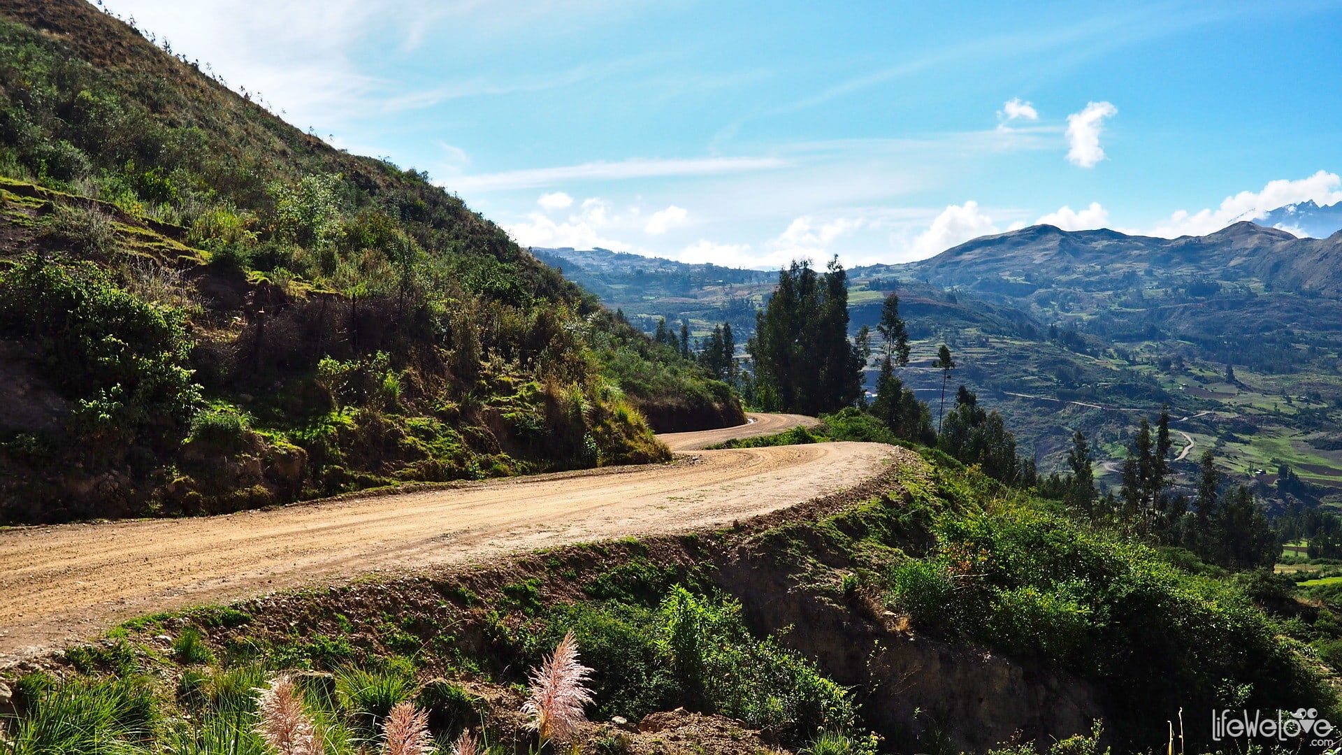
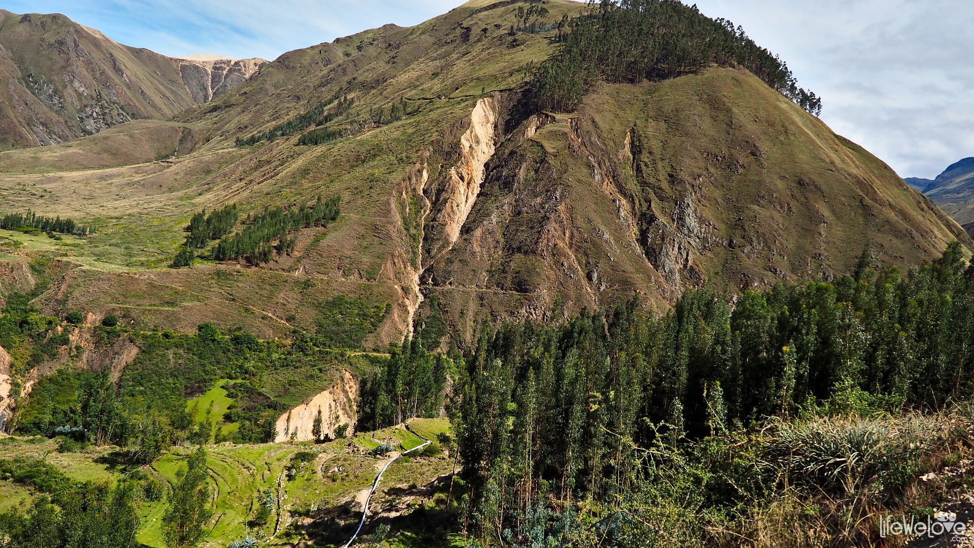
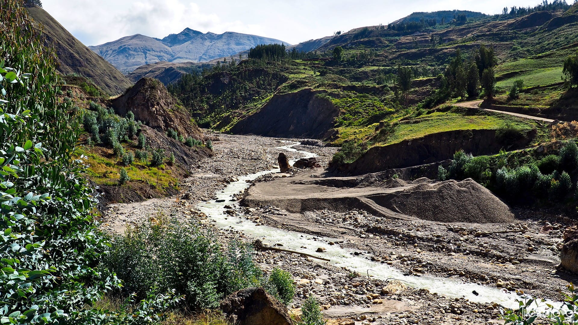
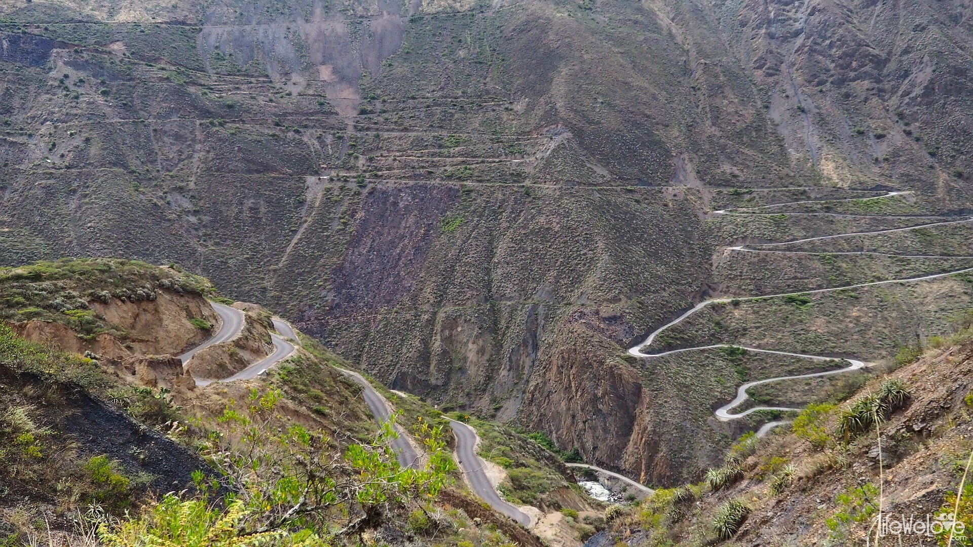
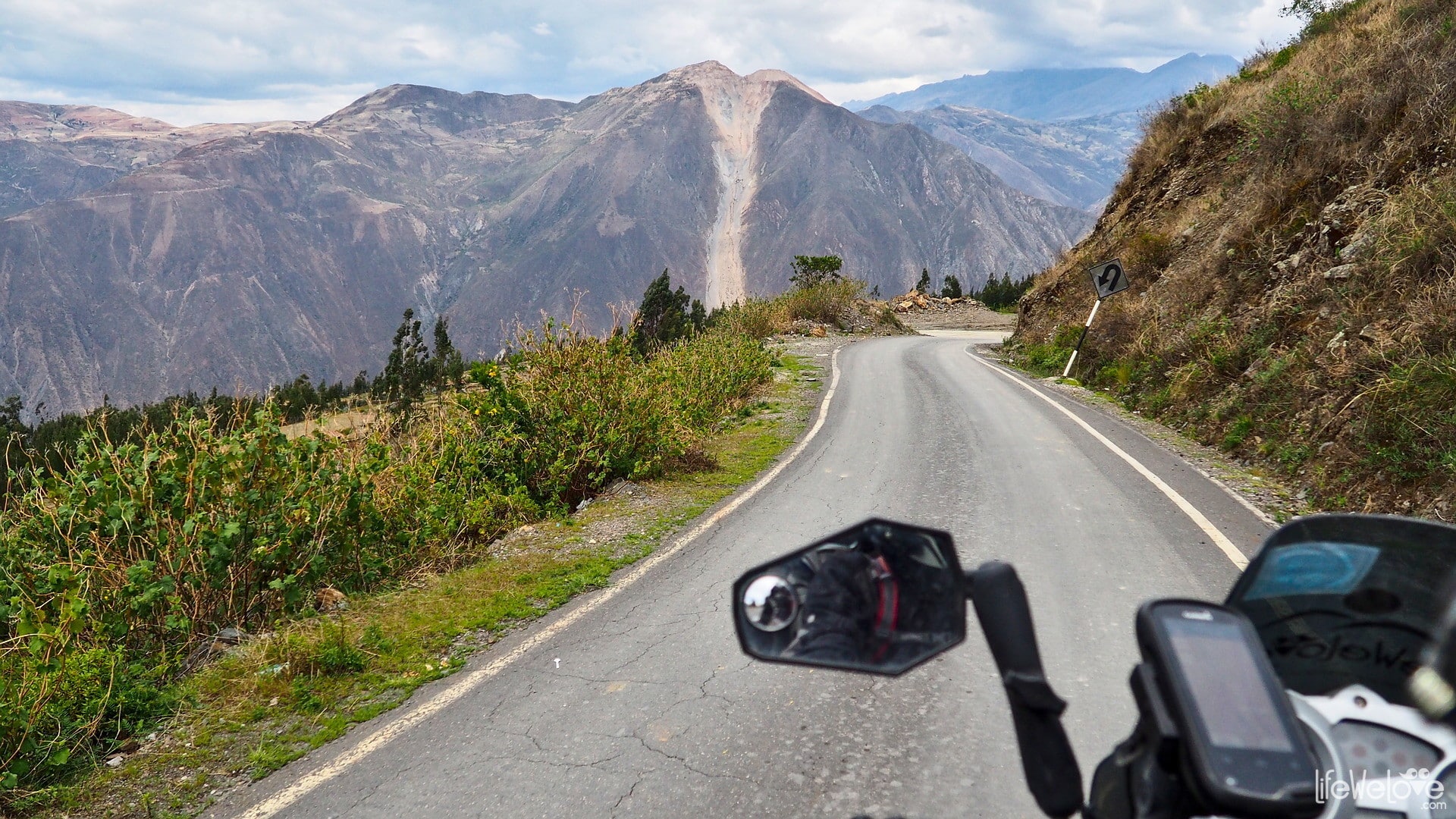
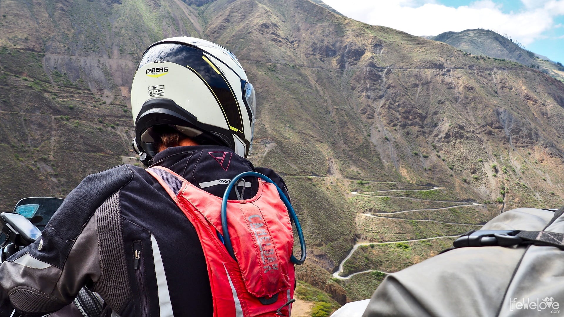
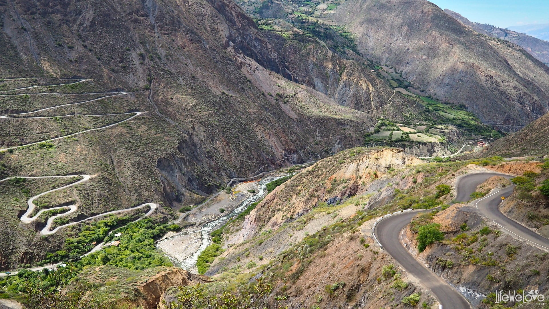
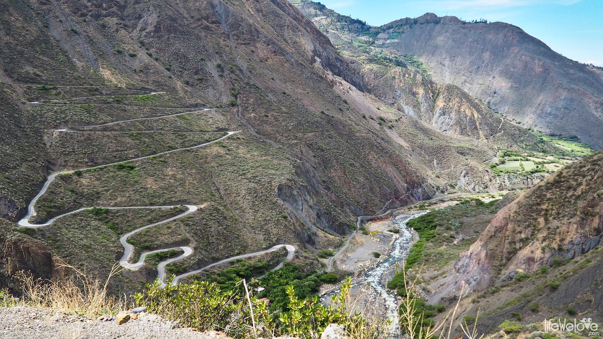
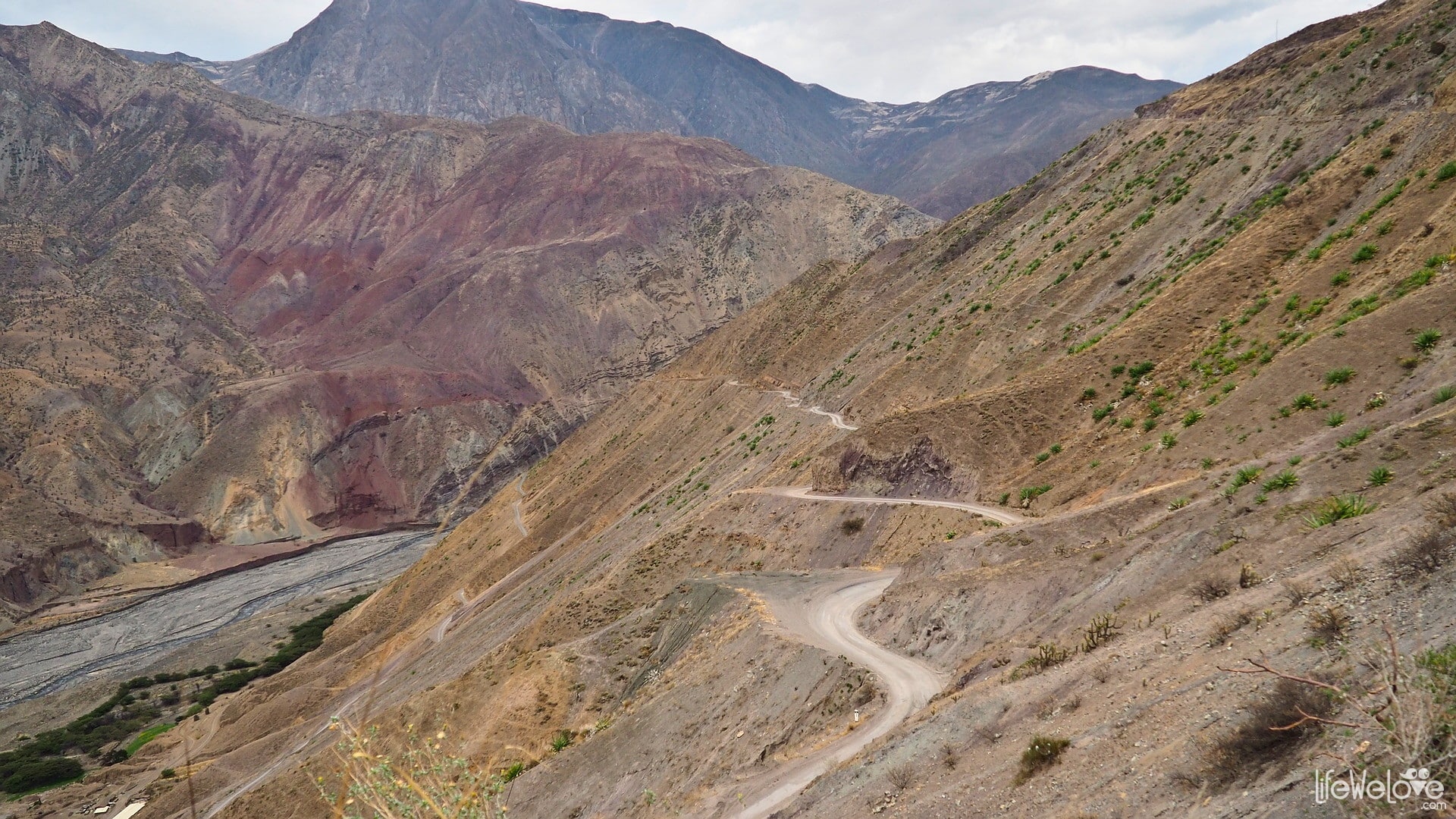
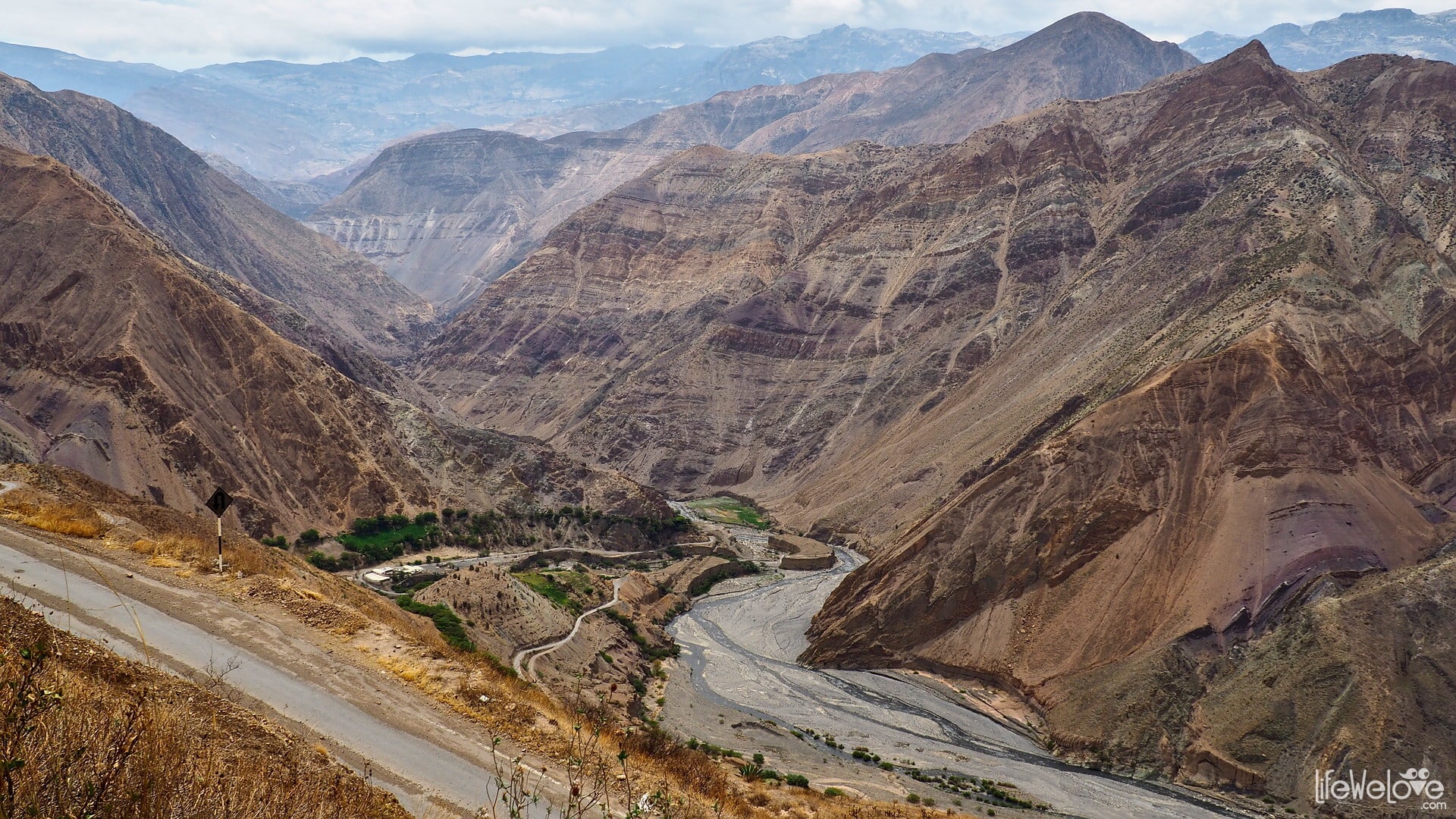
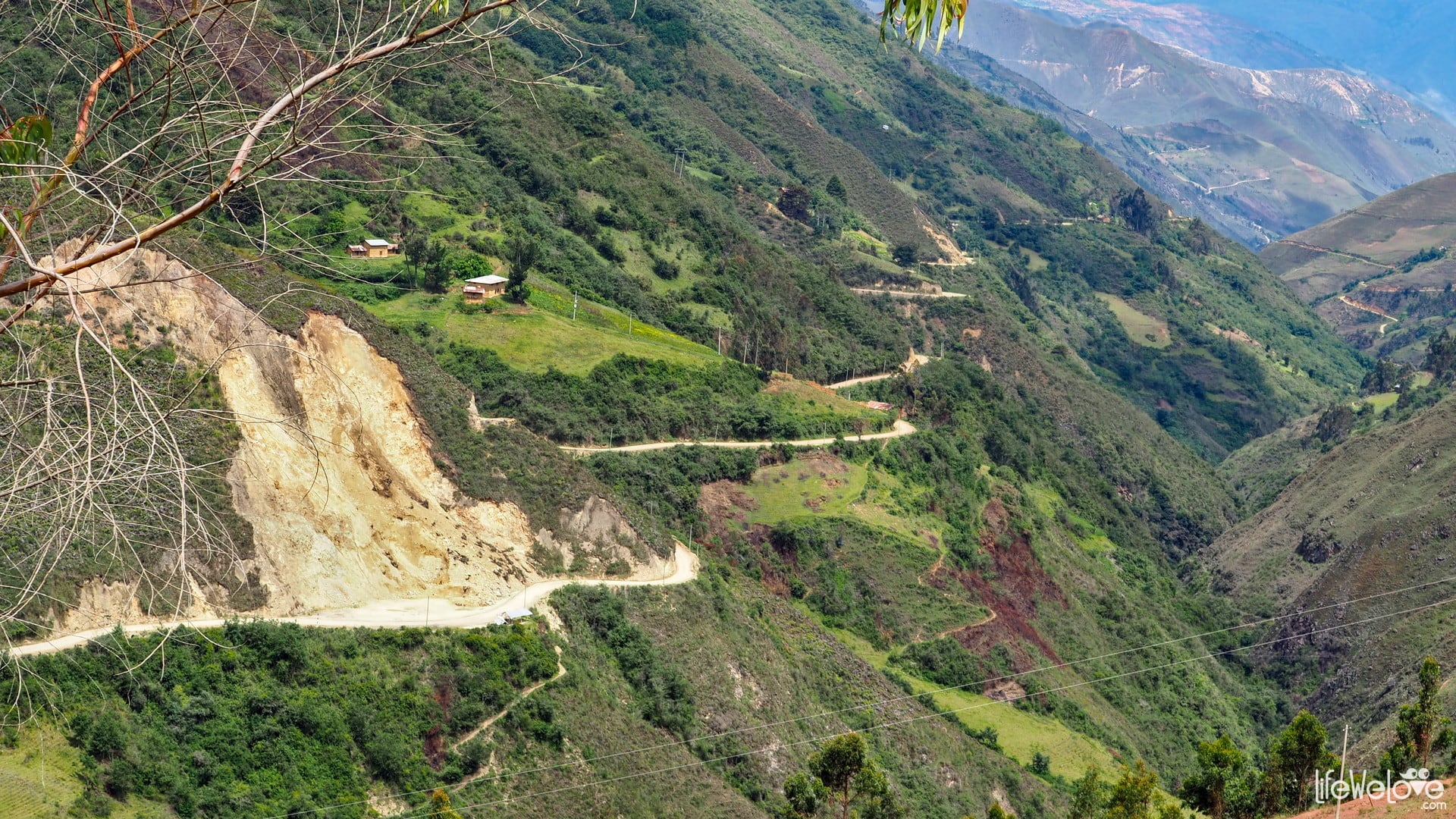
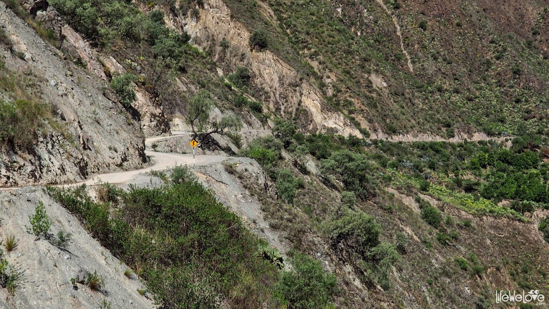
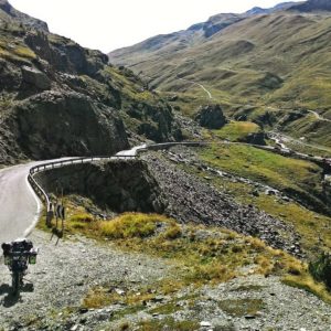
Road from Mollepata to Pallasca
This is probably the most twisted section on the entire PE-3N road. It leads through the slopes of two mountains, literally it descends from one mountain, plunges into the canyon of the Tablachaca River at an altitude of 2 100 m a. s. l. and through amazing serpentine it enters the top of the other mountain. The view of the zig-zags carved in the slope is amazing. The route is asphalted, and the highest point of the route rises to a height of 3,153 m a. s. l., so the temperature is perfect for the ride.
It took us about 2 hours to drive this part, and we stopped many times to take photos.


Info about the route
| Distance | 30 km |
| Start / end | Mollepata / Pallasca |
| Surface | Good quality asphalt |
| Accessibility | Open all year round |
| Hazards | Peruvian drivers, animals on the road, very sharp curves and abysses |
| Traffic | Low |
| Attractions on the way | Tablachaca Canyon, beautiful hills, incredible curves |
| Maximum altitude | 3 153 m a.s.l. |
Map of the route
loading map - please wait...
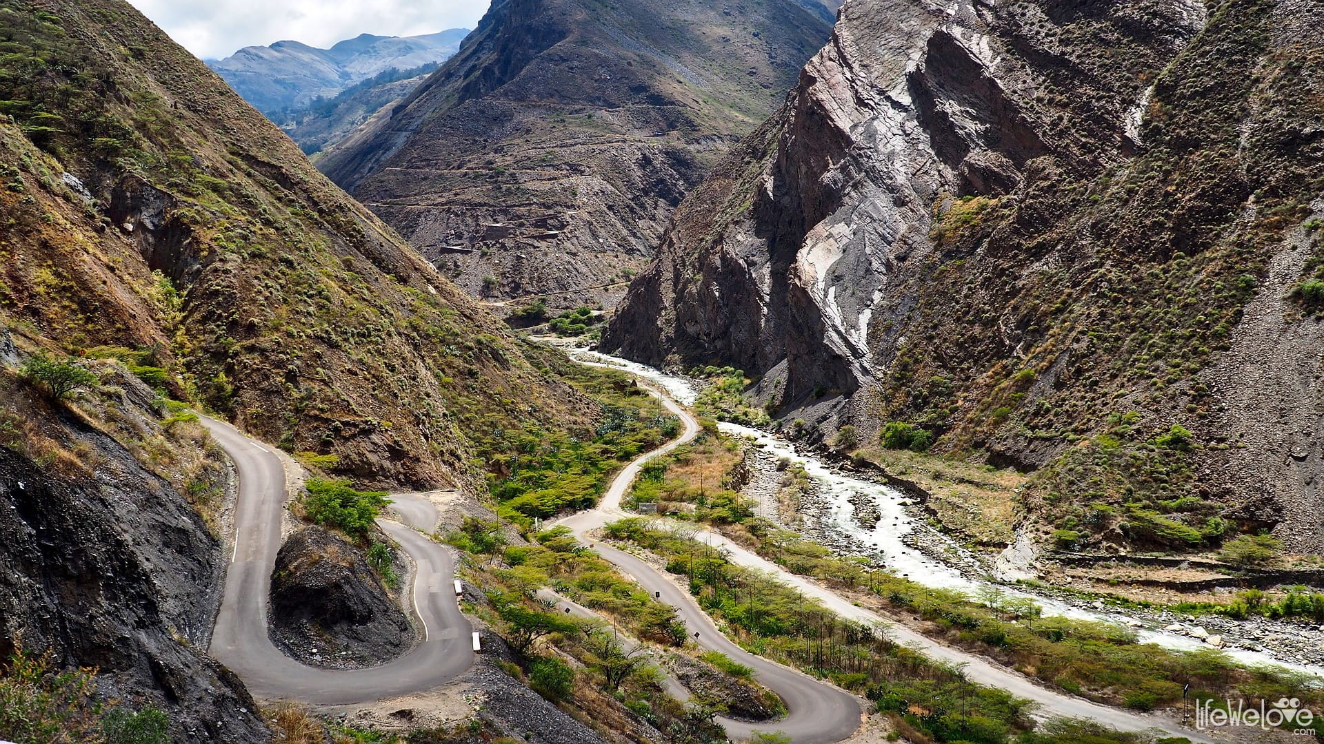
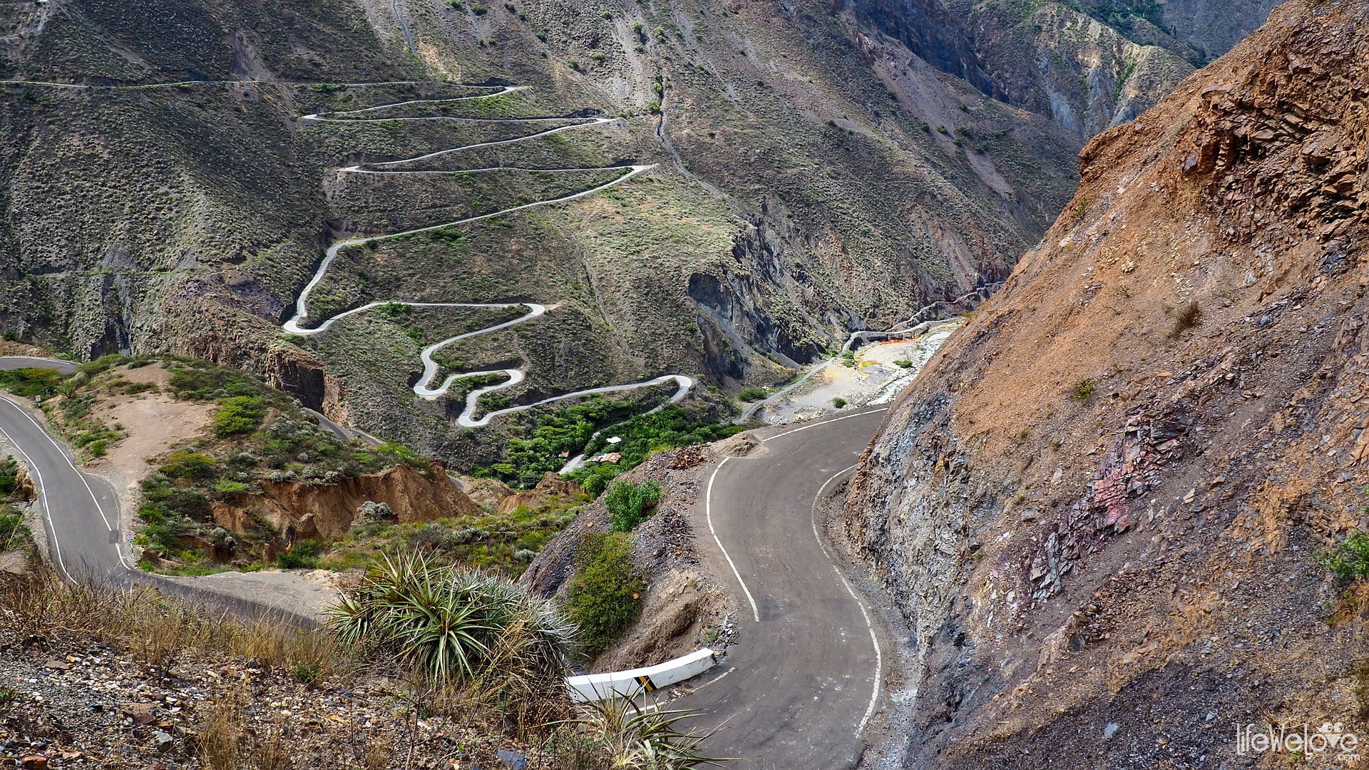
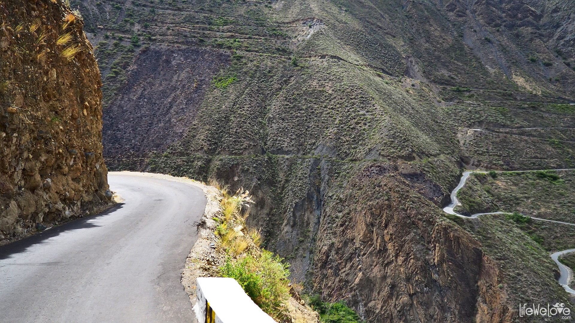
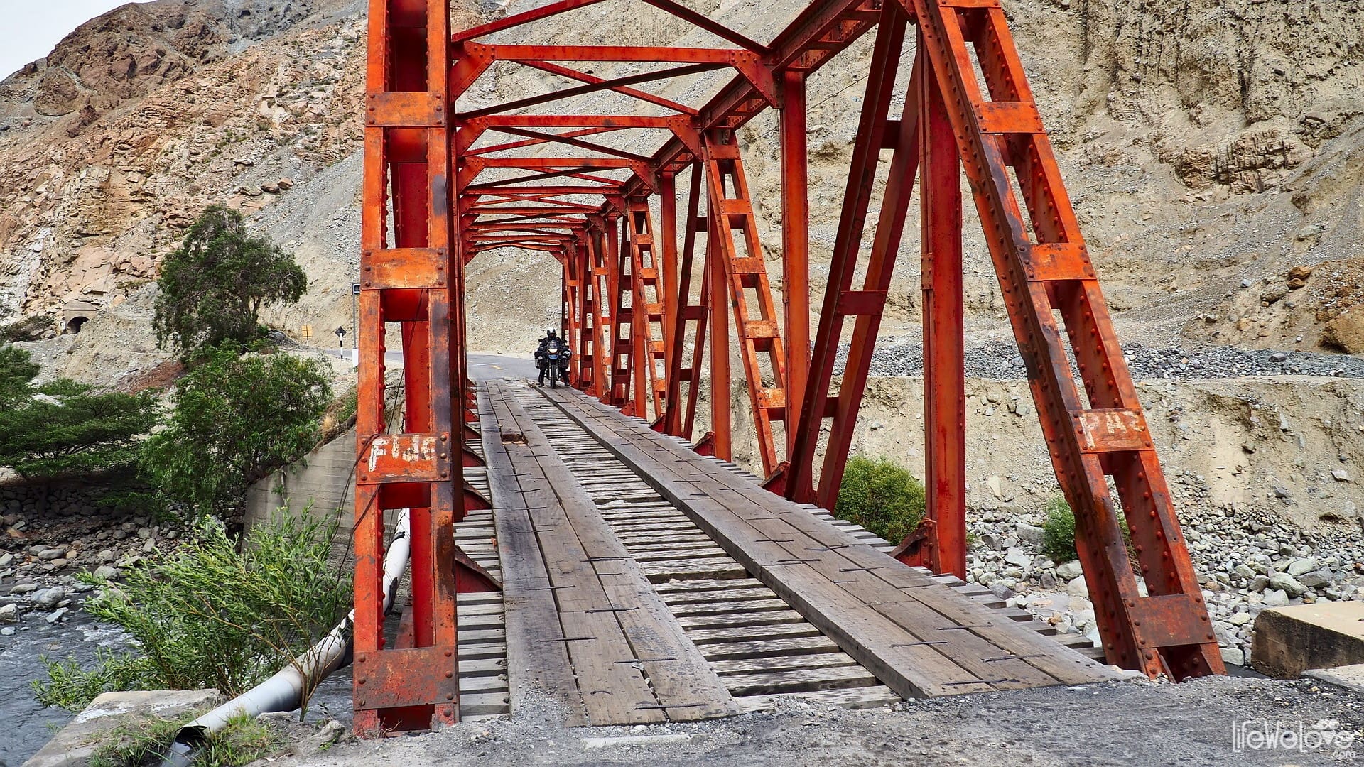
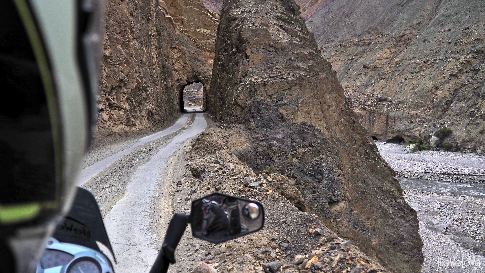
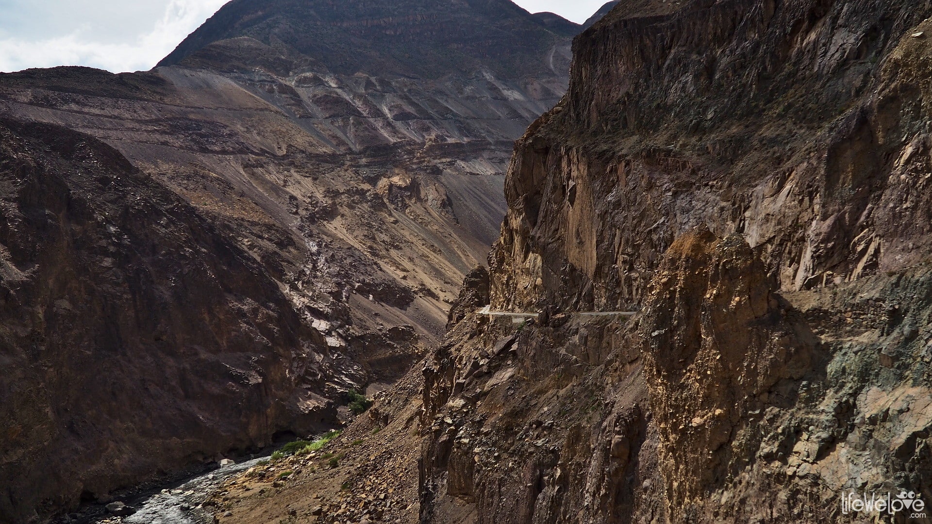
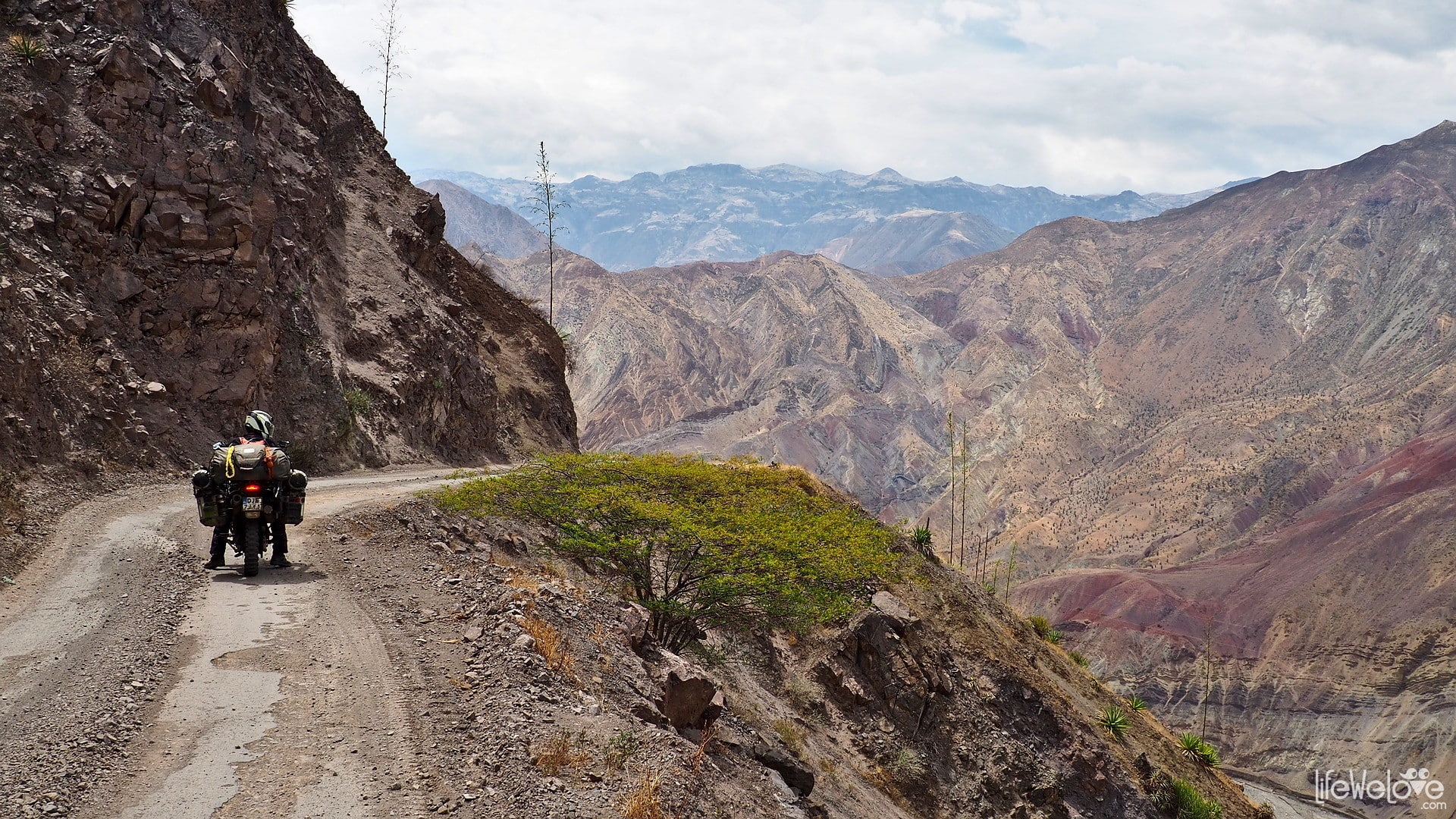
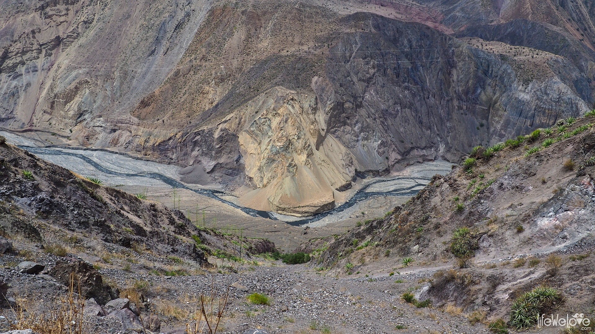
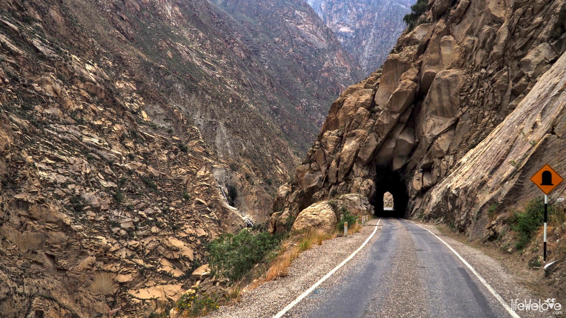
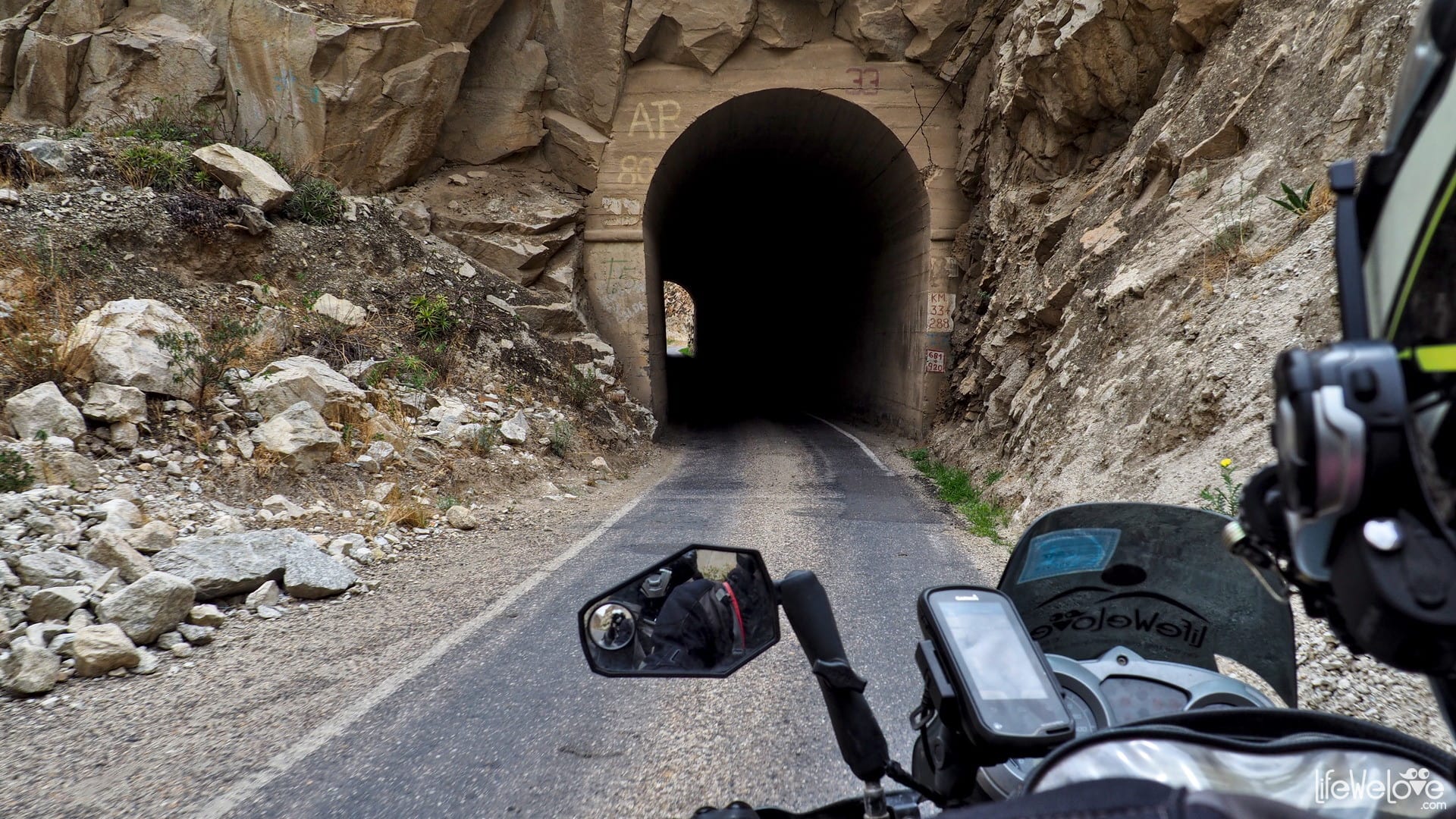
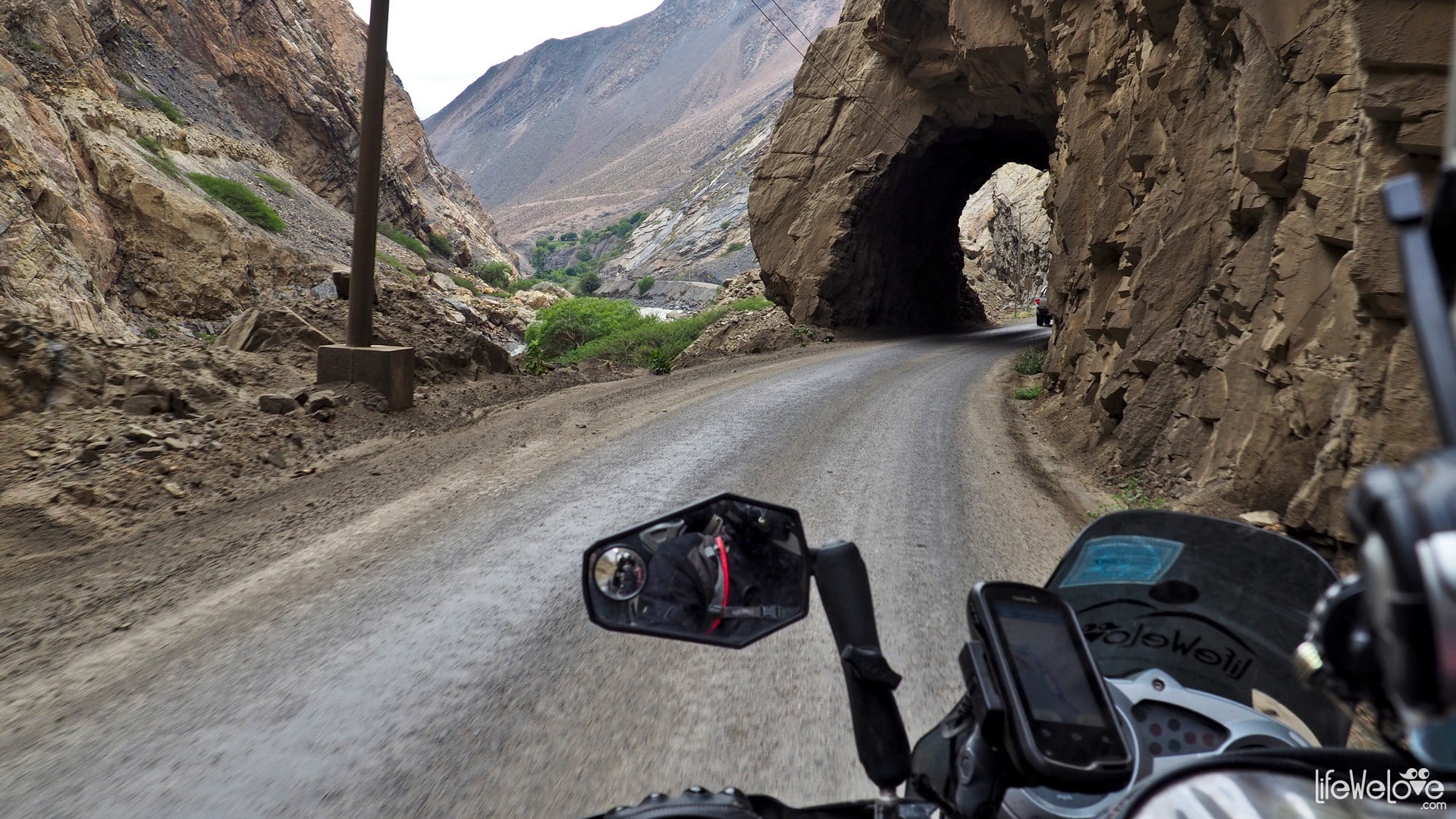
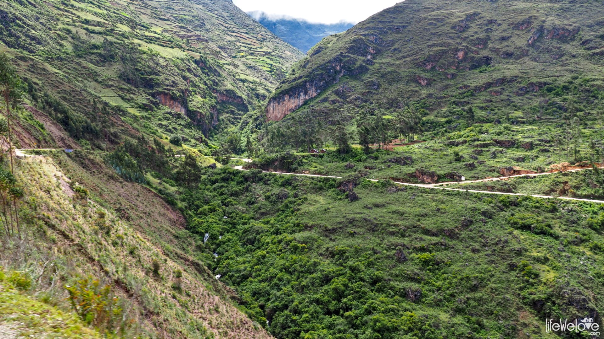
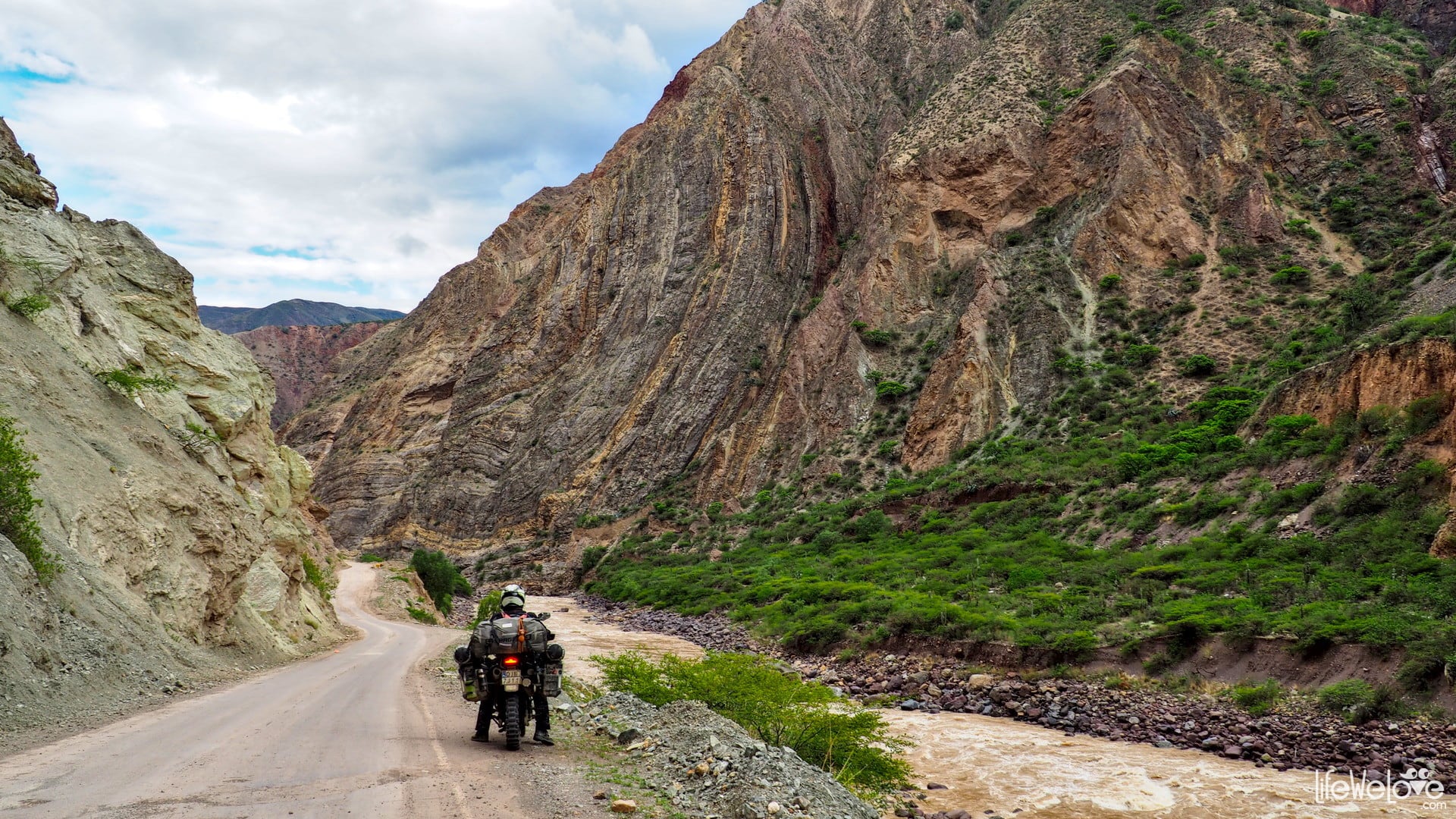
Road from Pallasca to Chuquicara
The section from Pallasca to Chuquicara runs partly along route no. 100 by the canyon of the Tablachaca River. A steep, narrow road with blind bends and numerous chasms is considered one of the most dangerous roads in South America. Add to this crazy Peruvian drivers plus large buses that cover the entire width of the road. I must admit that driving there gives a good shot of adrenaline. The canyon views are amazing, and the winding road provides as many as 100 corners for the first 18 km. There are also rock tunnels and wooden bridges. The route starts at an altitude of 3,132 m and ends at 500 m a. s. l., so it gets really hot down there. Initially, we traveled a good gravel road, then asphalt of various quality.
It takes about 2 hours to cover the distance.


Info about the road
| Distance | 78 km |
| Start / end | Pallasca / Chuquicara |
| Surface | Gravel and different quality asphalt |
| Accessibility | Open all year round |
| Hazards | Peruvian drivers, animals on the road, tight, steep curves, buses |
| Traffic | Medium |
| Attractions on the way | Beautiful hills, Tablachaca river Canyon |
| Maximum altitude | 3 153 m a.s.l. |
Map of the route
loading map - please wait...
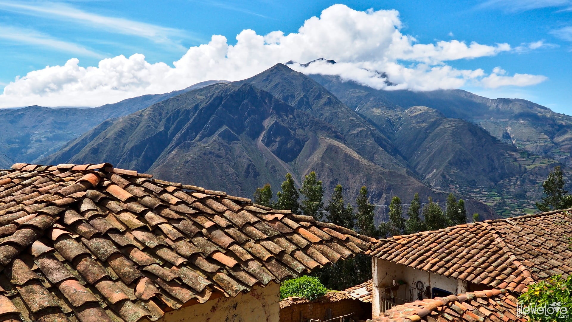
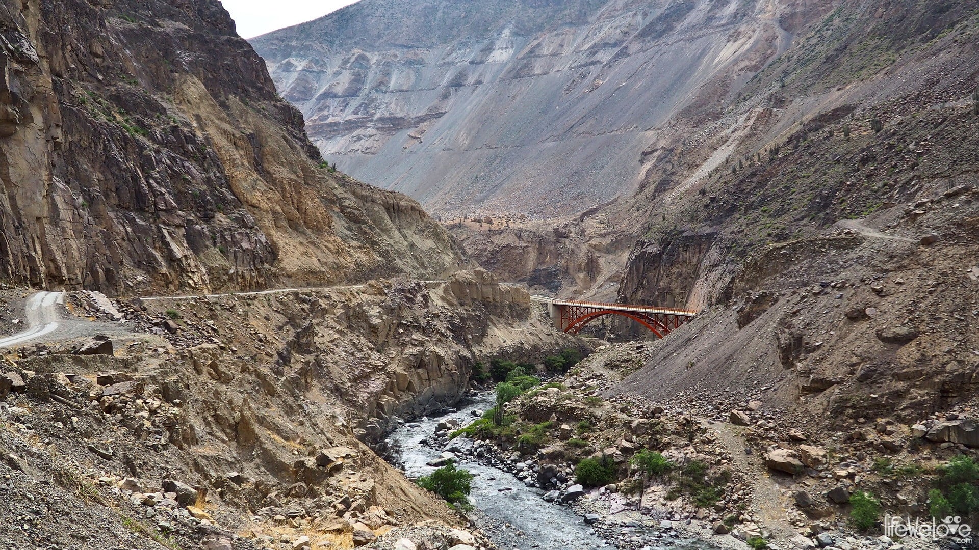
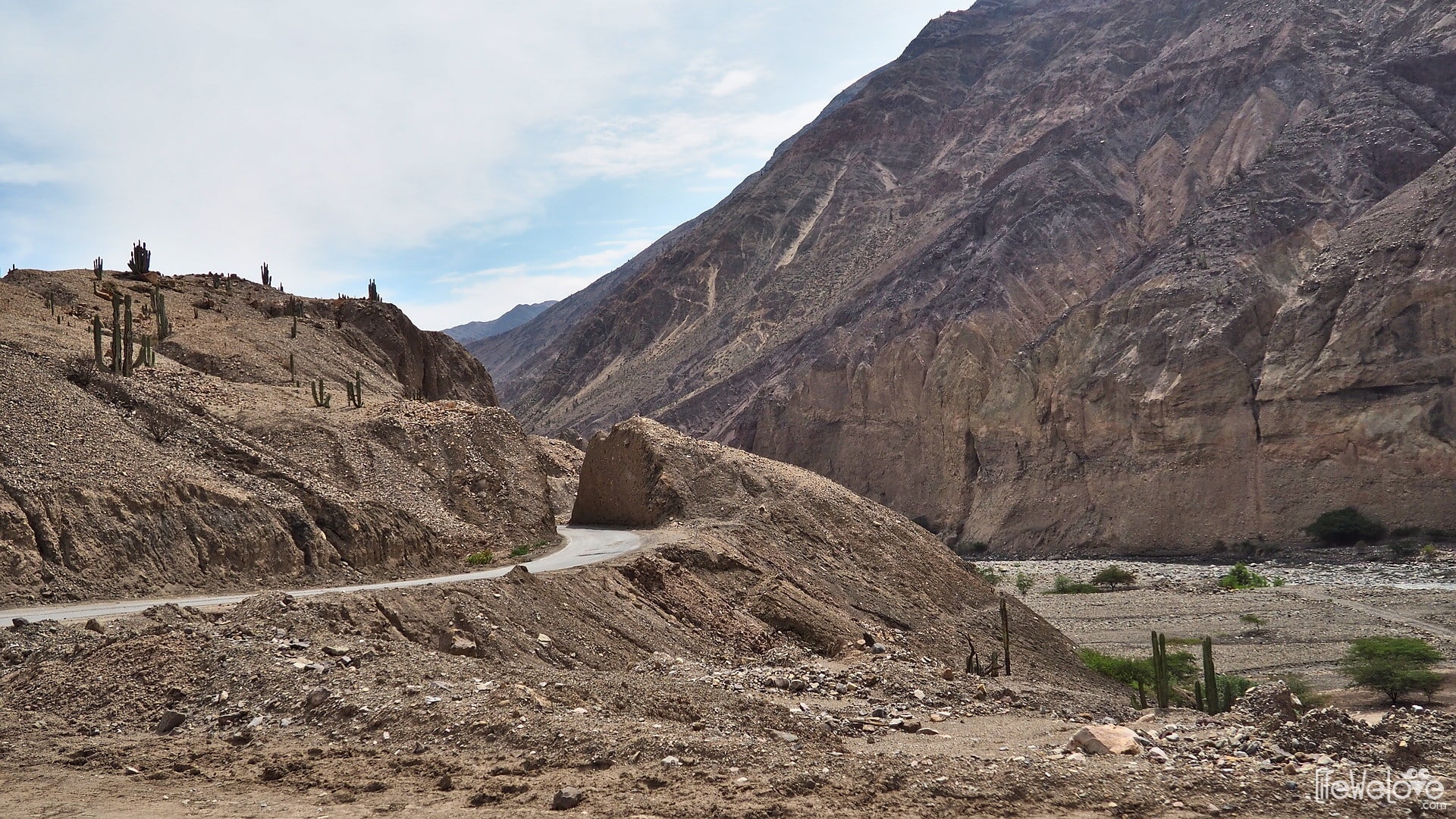
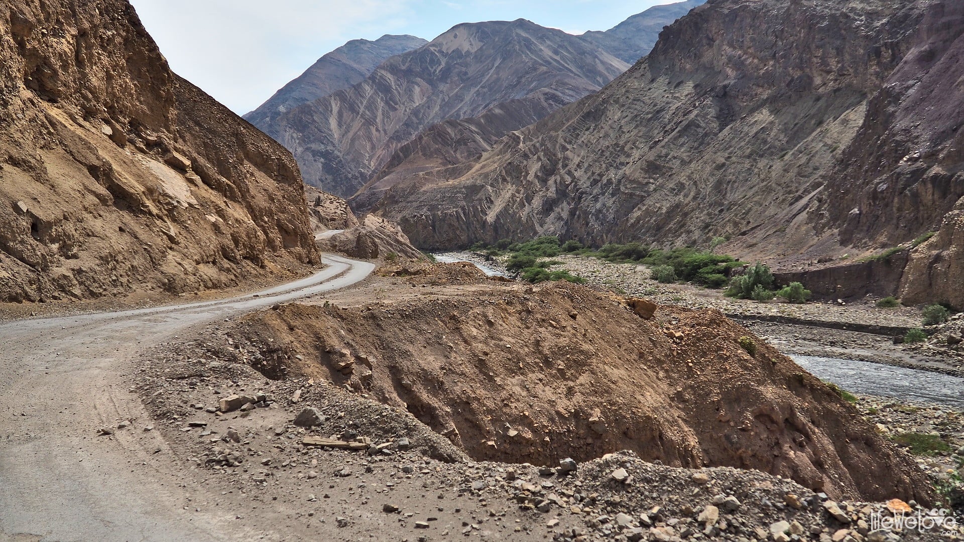
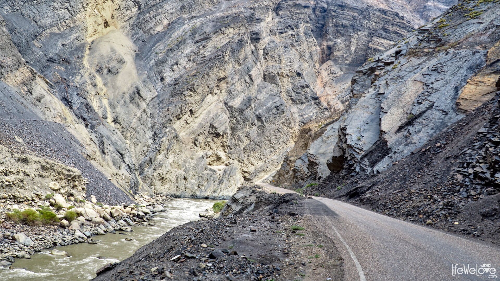
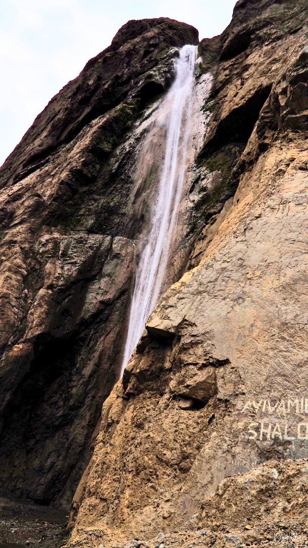
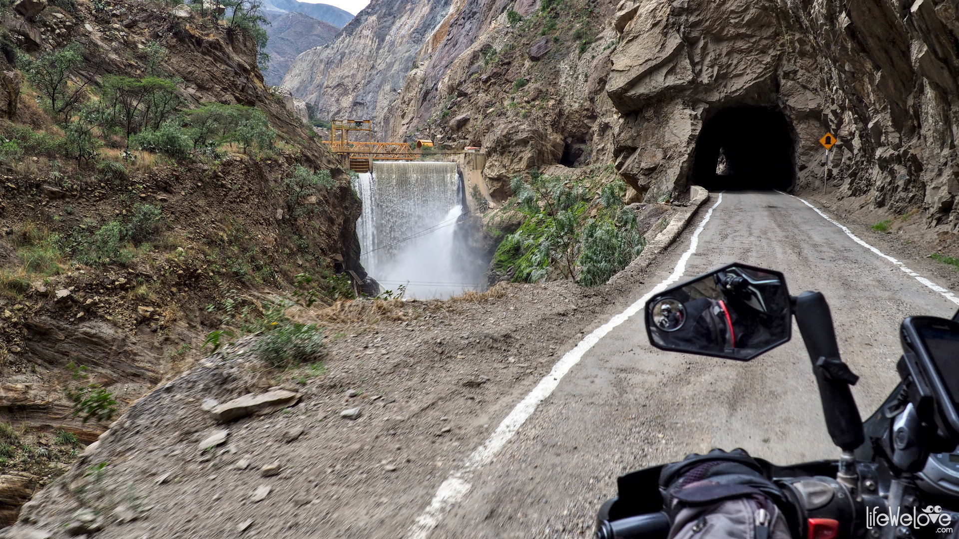
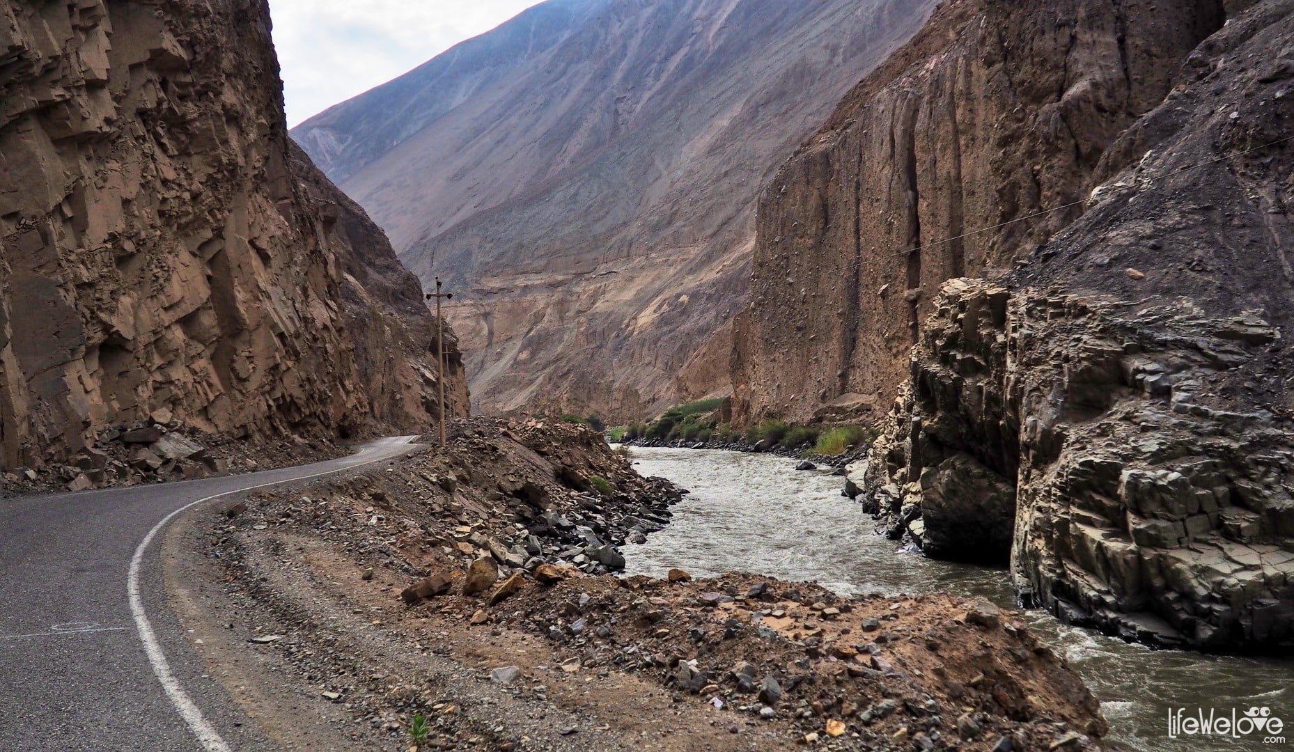
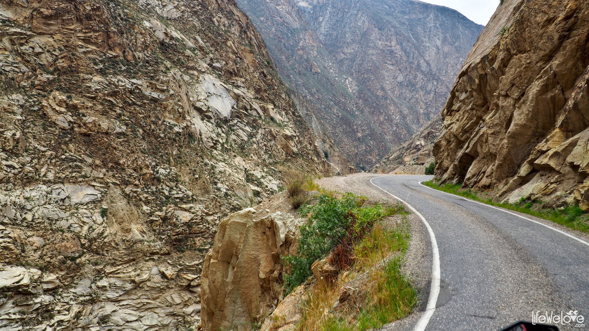
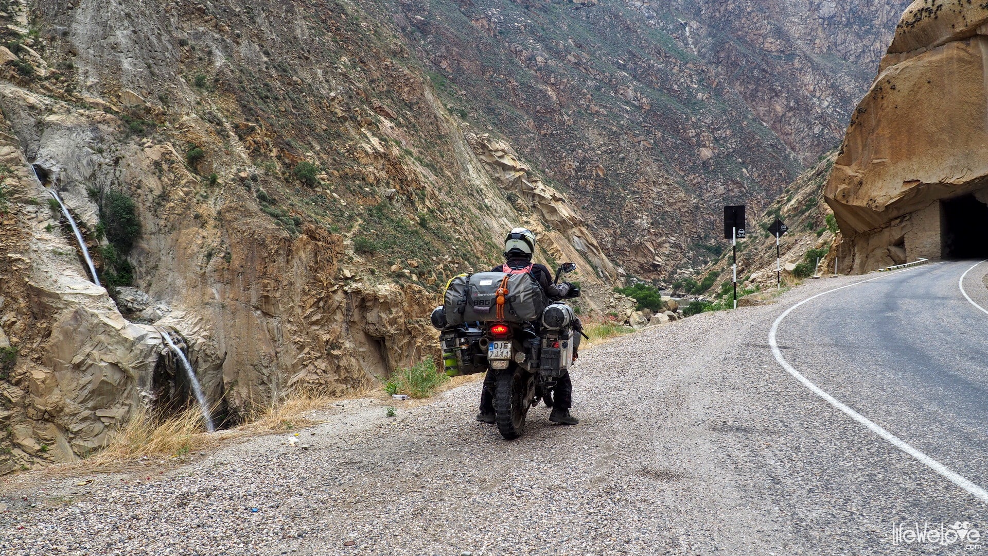
Canyon del Pato
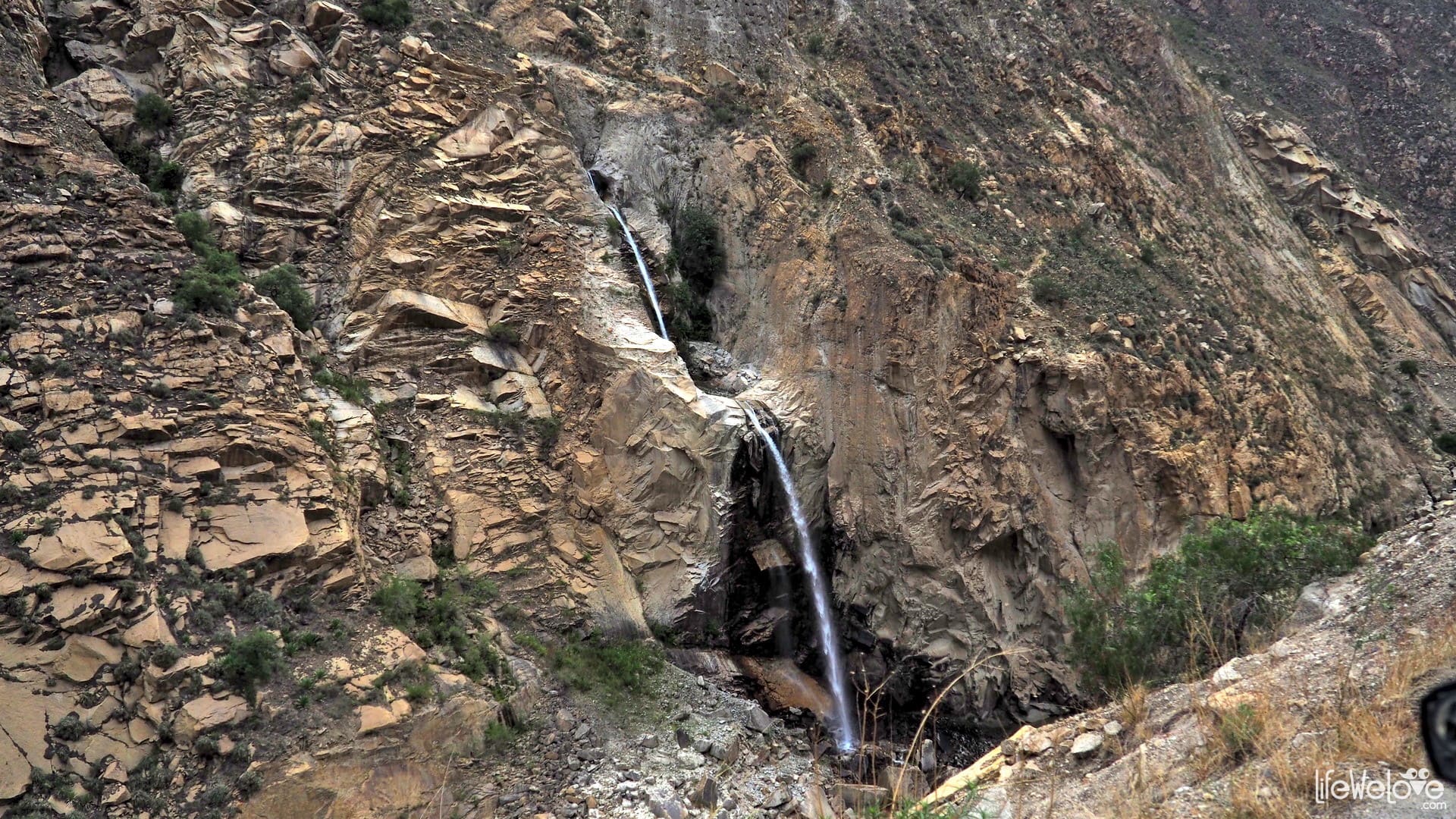
Another section of the road classified among the most dangerous roads in the world. The route winds along the Rio Santa River, where the two mountain ranges meet: Cordillera Blanca and Cordillera Negra, which are situated parallel along the road creating an amazing gorge. The dangers include a narrow road with precipices for several hundred meters and dozens of tight tunnels in which you pray not to meet Peruvian drivers. In addition, there are sometimes rocky landslides. Today the road is asphalt, but a few years ago it was gravel and much more dangerous. The maximum altitude is 2,284 m a. s. l. and it does not fall below 1,200 m throughout the entire stretch.
Driving 51 km of this route with photo-stops takes about 1.5 hour.


Info about the route
| Distance | 51 km |
| Start / end | Yuracmarca / Caraz |
| Surface | Different quality asphalt |
| Accessibility | Open all year round |
| Hazards | Peruvian drivers, animals on the road, tight, steep curves, buses, abysses |
| Traffic | Low |
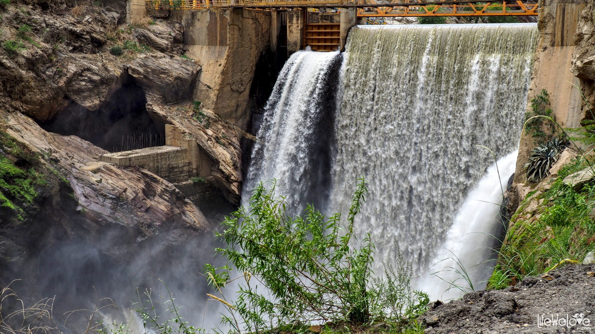
| Attractions on the way | Rio Santa River, water dam |
| Maximum altitude | 2 284 m a.s.l. |
Map of the route
loading map - please wait...
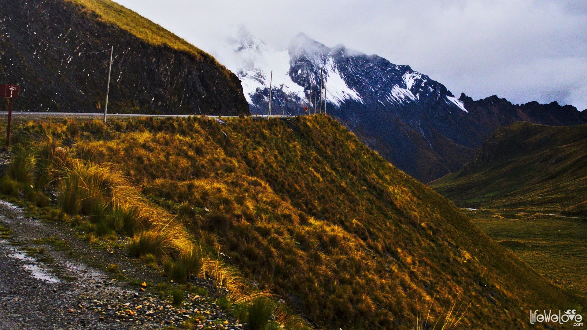
From Caraz it is close to the Huascarán National Park, where you can drive two passes: Portachuelo Llanganuco and Punta Olimpica. Both beautiful, located at an altitude of over 4,700 m a. s. l. in the heart of the Cordillera Blanca range, considered some of the most beautiful routes in South America. Stoping for a while in Caraz town itself is also recommended. It is much nicer than the larger city of Huaraz. Ideally located as a starting point for the above-mentioned passes and the famous trekking to Laguna 69.
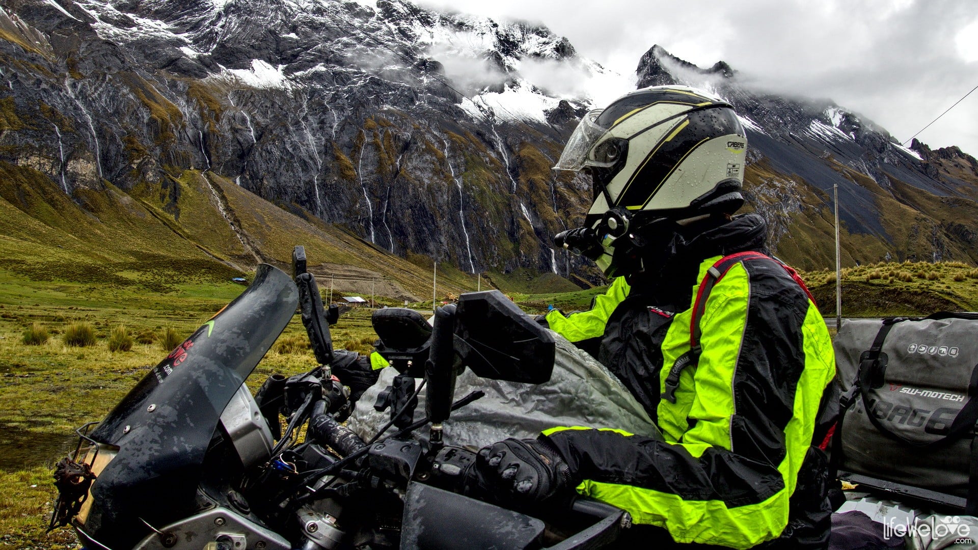
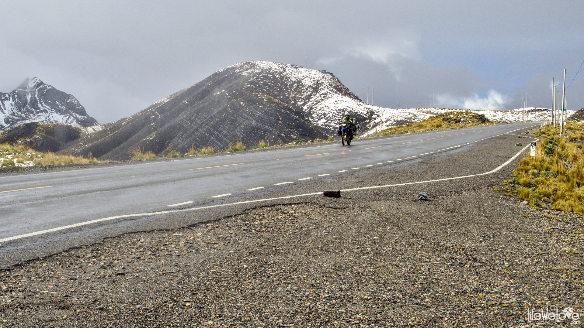
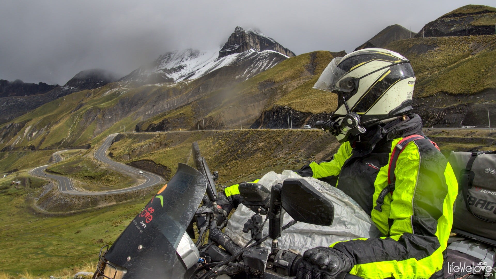
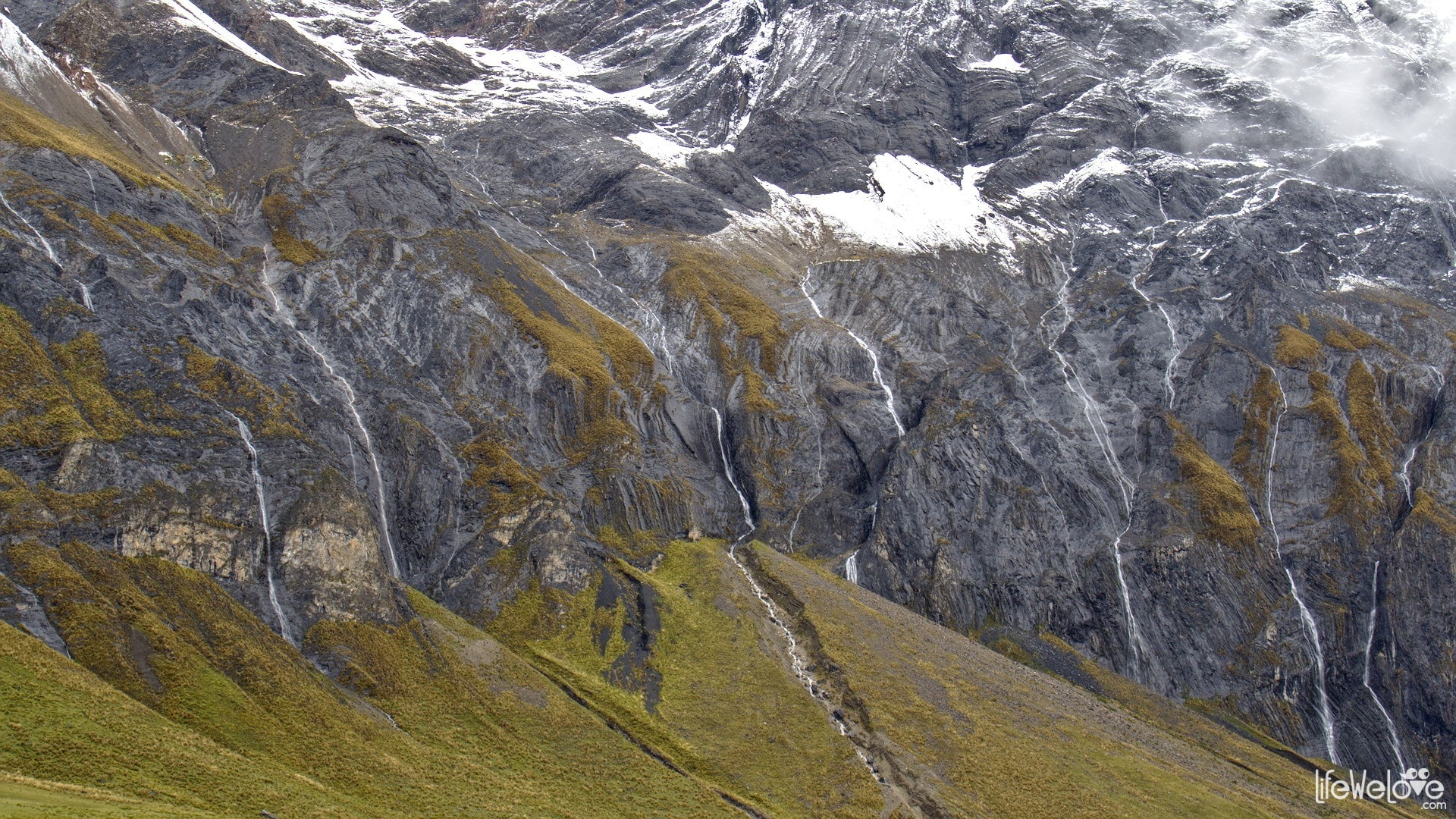
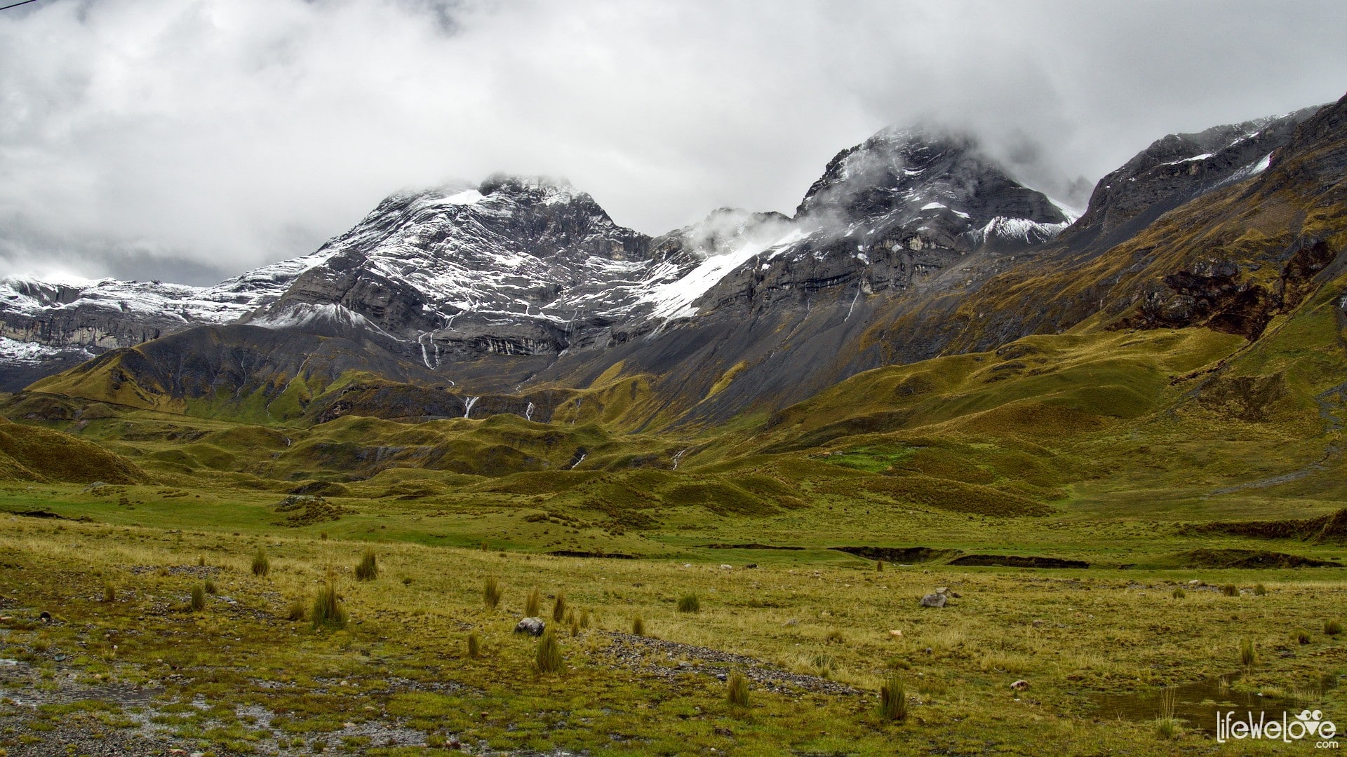
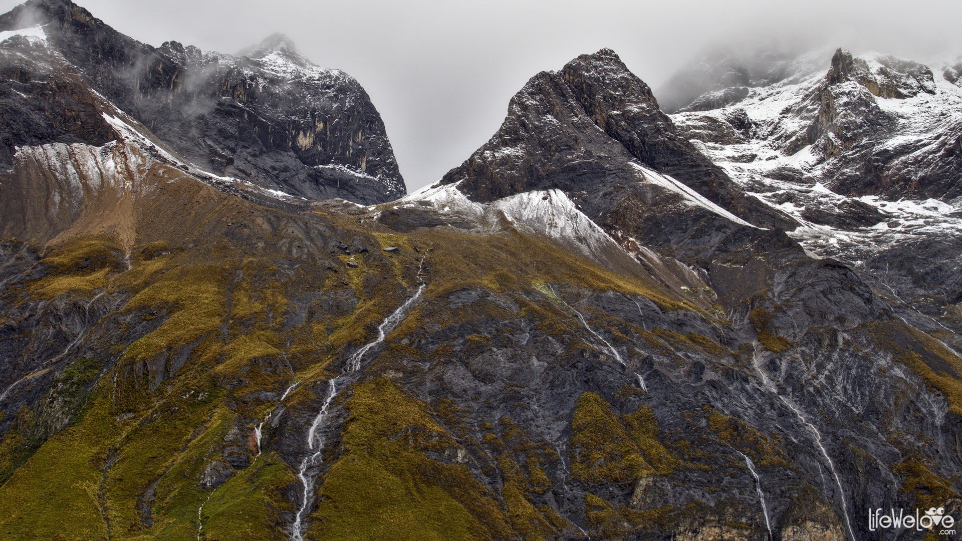
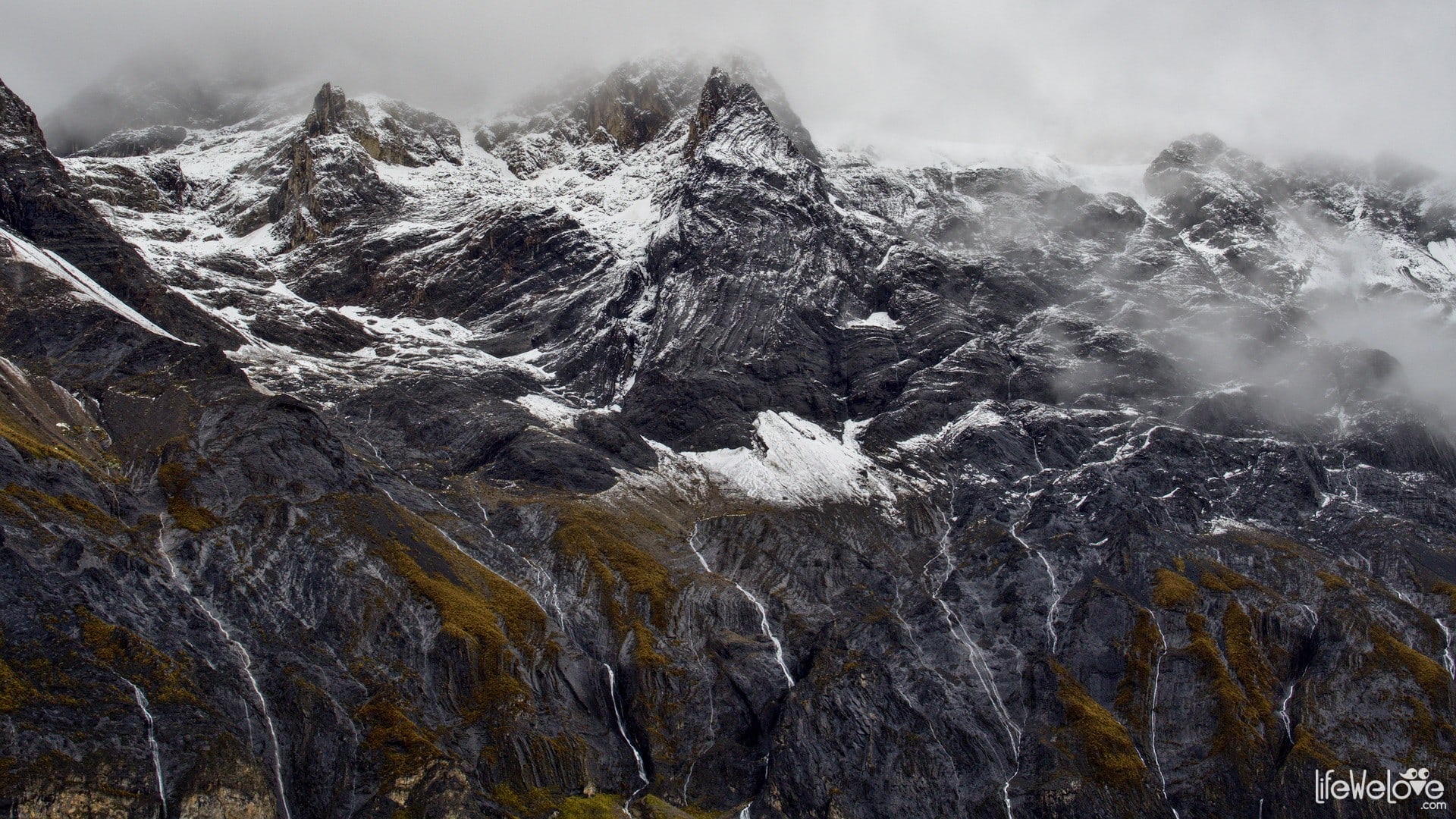
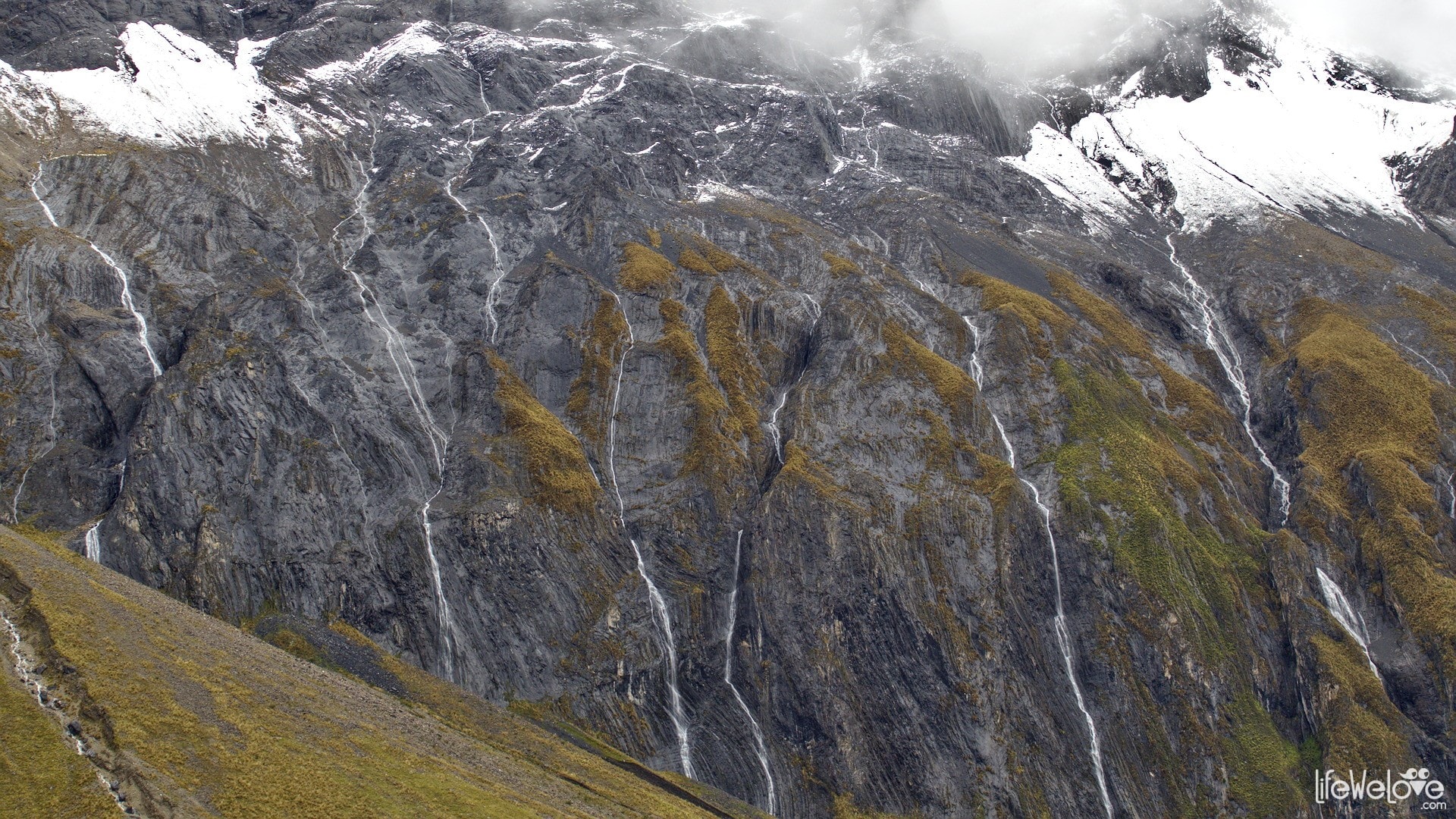
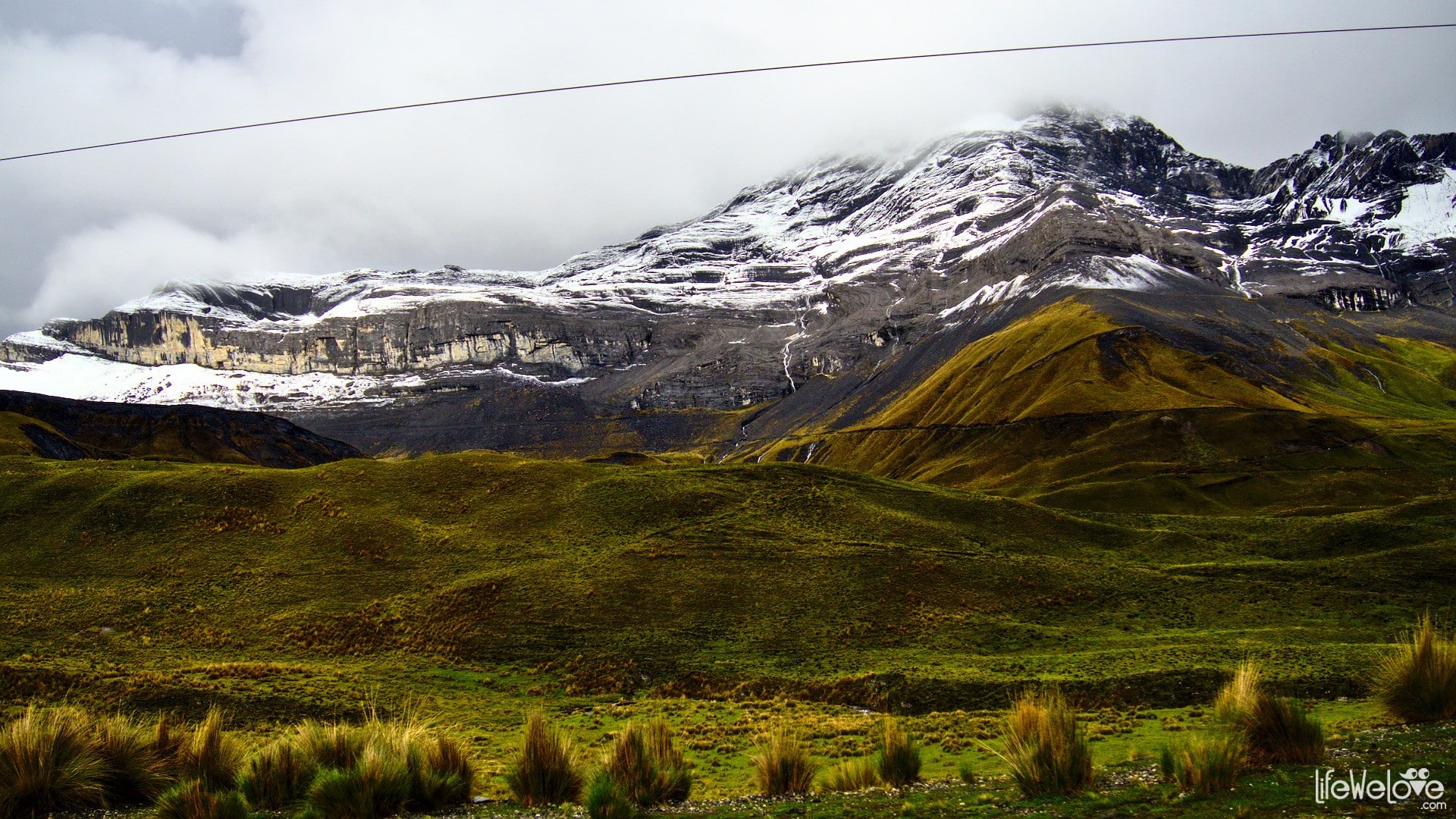
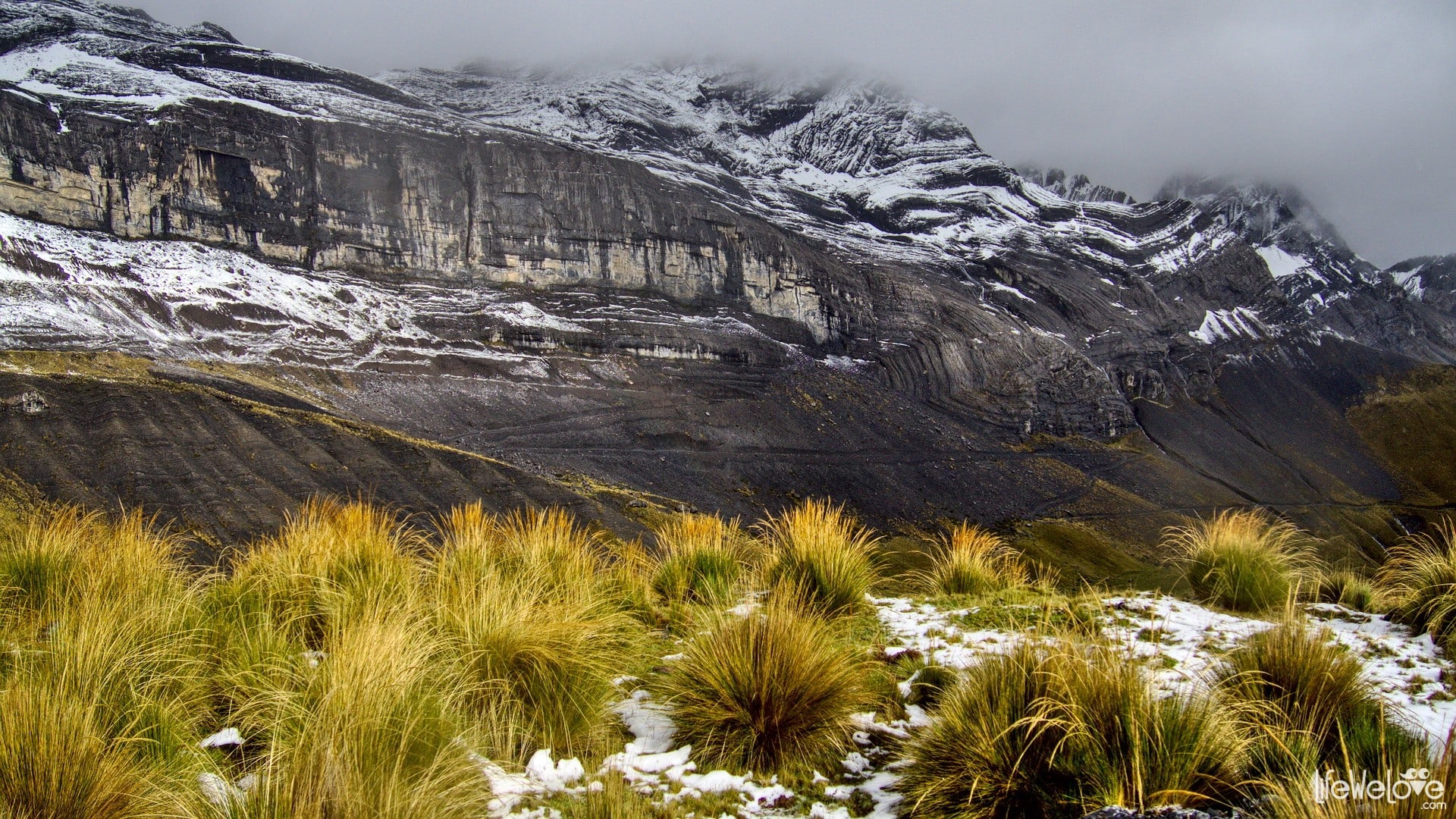
Road from Huaraz to La Union
It is a 190-kilometer section, which captivated us with views of the snow-capped peaks of Cordillera Blanca and silver waterfalls falling from the majestic mountains. From Huaraz, located at an altitude of 3 052 m a. s. l. the route rises to 4,684 m on the Yanashallash pass.
The whole route is paved and it takes about 3 hours to drive it.


Info about the road
| Distance | 190 km |
| Start / end | Huaraz / La Union |
| Surface | Different quality asphalt |
| Accessibility | Open all year round |
| Hazards | Peruvian drivers, tight, steep curves, buses, riding at altitude above 4 000 m a.s.l. |
| Traffic | Medium |
| Attractions on the way | Snow-capped peaks of Cordillera Blanca |
| Maximum altitude | 4 684 m a.s.l. |
Map of the route
loading map - please wait...
Road from La Union to Huanuco
It's a very interesting part of the PE-3N route, which leads along green, mountain slopes, and hence, with muchas curvas, that is a lot of corners. A large difference in height results in numerous, winding ramps and descents. Small, Indian villages with local products on the way add charm to the ride. You can eat, for example, a delicious potato stuffed with meat for as little as 30 cents (yes, we do understand now the striking farmers who get pennies for their harvest). The road is partially paved with gravel sections, and here and there with a lot of holes, which are difficult to omit even by motorbike.
It's about 4 hours to cover this part of the route.


Info about the road
| Distance | 136 km |
| Start / end | La Union / Huanuco |
| Surface | Asphalt and gravel |
| Accessibility | Open all year round |
| Hazards | Peruvian drivers, sharp curves |
| Traffic | Low |
| Attractions on the way | Small mountain villages |
| Maximum altitude | 3 991 m a.s.l. |
Map of the route
loading map - please wait...
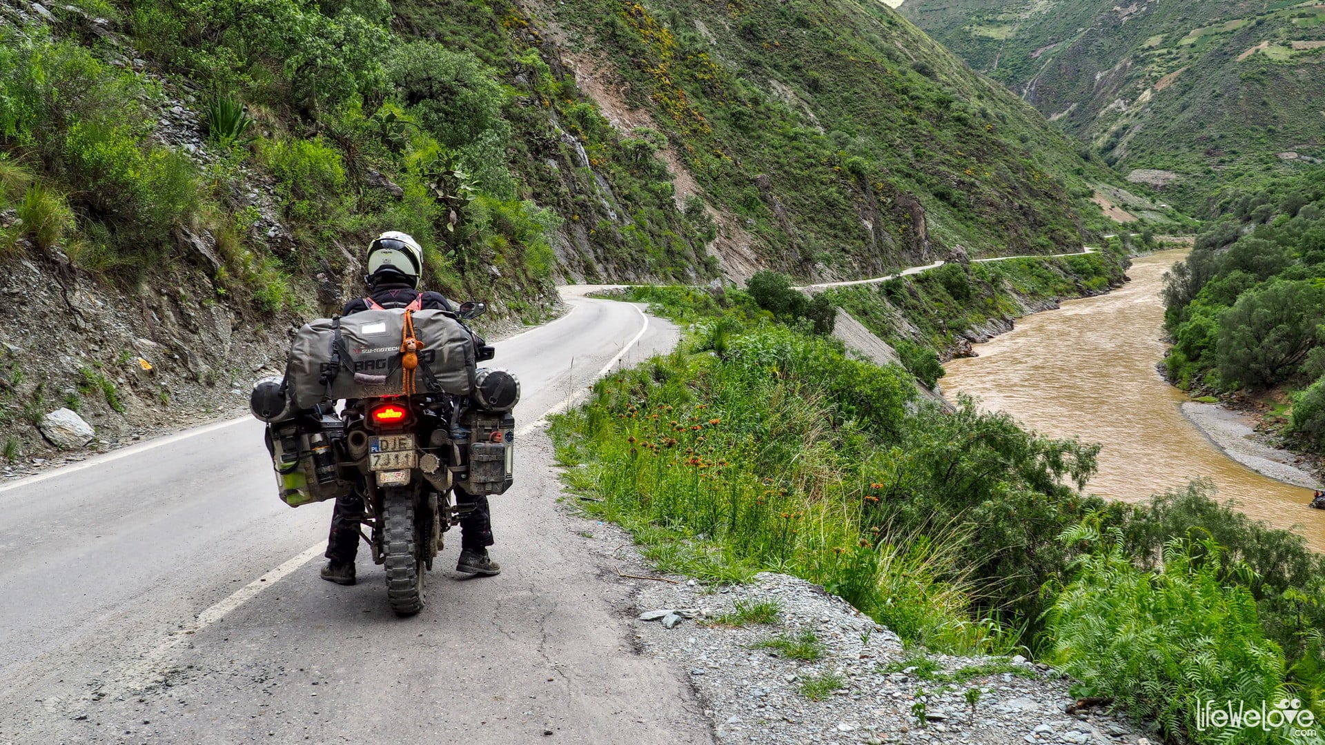
Road PE-3S
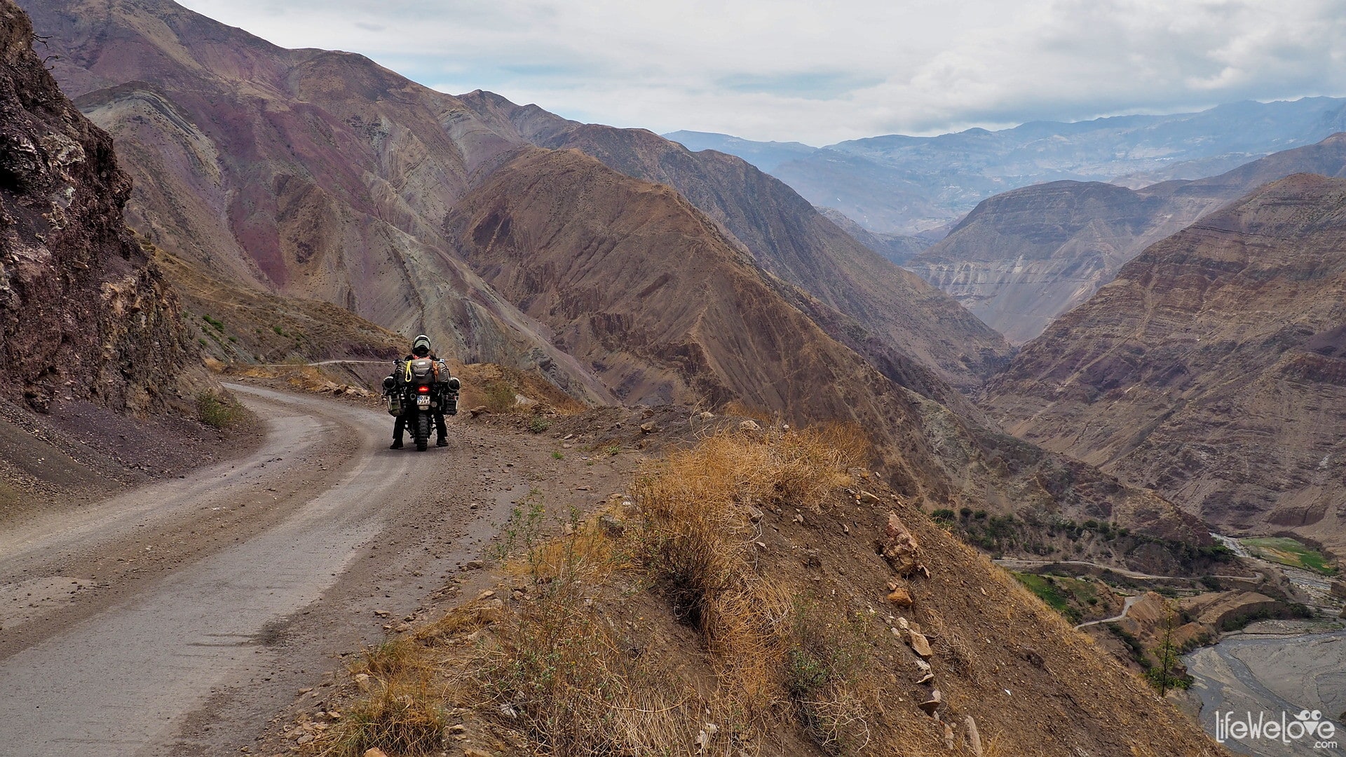
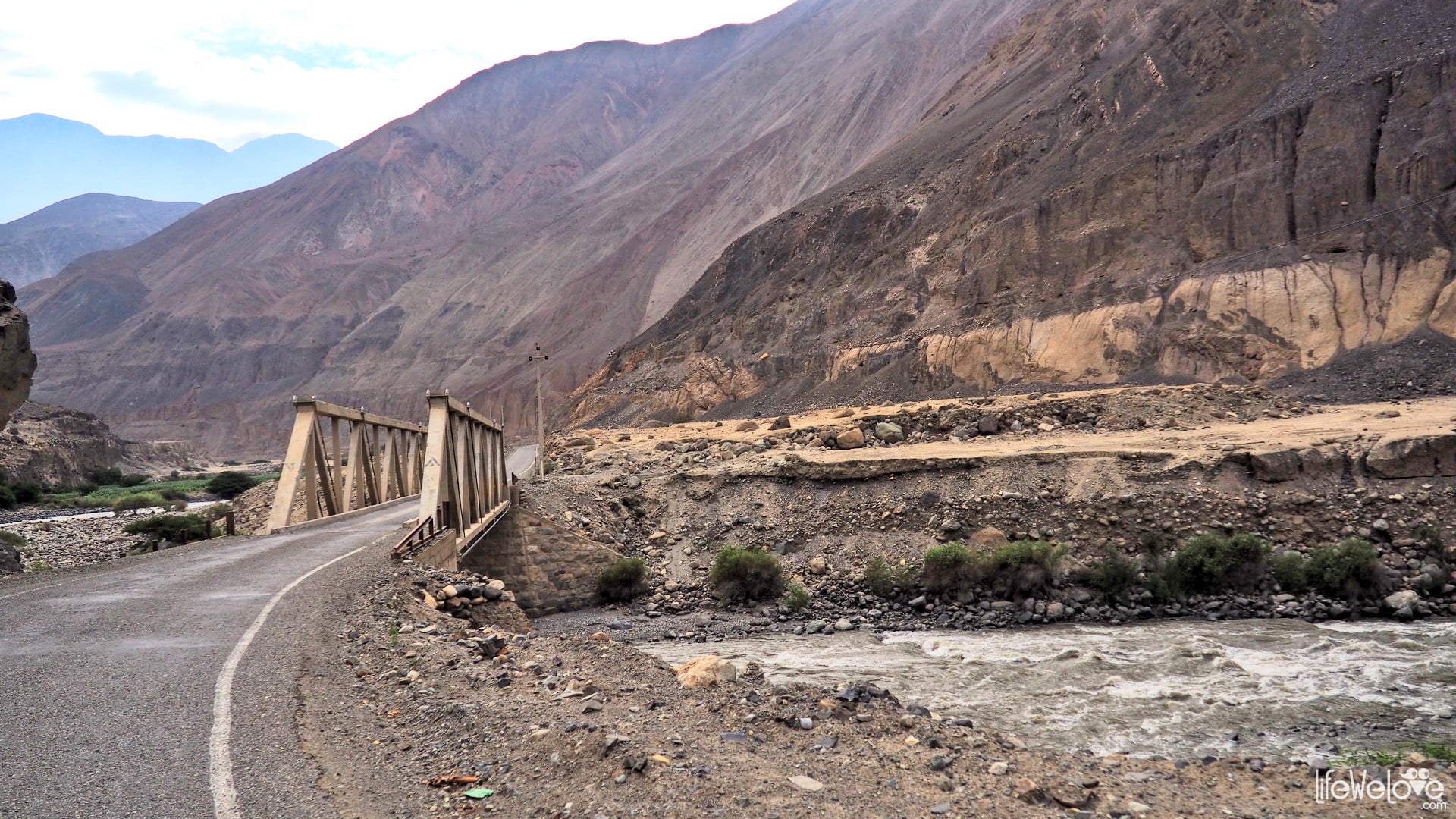
The national road PE-3N in Peru connects with the road PE-3S, which runs to Cusco and further south to the border with Bolivia. The southern sister seemed to be less wild and with bigger traffic, although some parts made our hair stand. Certainly the Canyon del Rio Mantaro running along the river was unforgettable. Dangerous and demanding, because we had to cross the deepest river in our journey. Crosses placed along the road remind everyone that from time to time death collects its harvest there. Taking into account the driving style of Peruvian drivers, this sad truth is not surprising. Excessive speed on the route like this, where the road is narrow and winding, and the chasms are deep to several hundred meters, ends tragically for some.
It takes about 3 hours to cover the route.
Info about the road
| Distance | 145 km |
| Start / end | Izcuchaca / Huanta |
| Surface | Asphalt and gravel |
| Accessibility | Open all year round |
| Hazards | Peruvian drivers, animals on the road, tight curves, abysses |
| Traffic | Low |
| Attractions on the way | Rio Mantaro Canyon |
| Maximum altitude | 2 912 m a.s.l. |
Map of the route
loading map - please wait...
Accommodation and petrol on the way
| A good dinner costs between SOL 6 and 15 (USD 2 - 4) and it consists of soup and main course. There's no problem with getting petrol on the way: gas station are located every 100 - 150 km. |
|
| In every little town and village we were able to find a hotel or private room to rent (of course we are talking about Peruvian standards here, nothing with stars in the name). For 2 people we paid SOL 30 to 50 (USD 9 - 15). There was always some secure place to park our motorbike available. If not in the garage, we were allowed to park inside the building. Most of the stays we planned with the use of iOverlander application. |
185
Robert Hayes
Great photos…..I to road most of this this year but on a 250 Chinese X-terra….didn’t come close to your spectacular pics
Joki
Thanks Robert :)
Johnny Melton
Totally amazed by you two, from when we met in Wyoming to finally making it back to Poland. You both are my heroes, good luck in your future, I would say be safe but why start now. Your friend-John
Liwia
Hehe, thank you John, it was a pleasure to meet you and spend some in the woods (the memorable breakfast we recall even today!) and riding together! We did visit Texas after all and met very god people there. Poland now reminds us how it’s like to have white Christmas, not under the palm trees this time. It’s really nice, I missed it (not so sure about Joki, he can’t ride the bike now). All the best John!
Robert
Outstanding!!!
Enni Saharinen
Nice fotos! How long was your road trip?
Liwia
Thanks Enni. We’re back from American moto-adventure after 2 years and 1,5 month. That was the longest journey for us so far without visiting home country and family.
Szymon
Thank you for sharing the information! Was curious about the Andes side of Peru. Will have to tackle some of those with our sprinter.
Pozdrawiamy :)
Liwia
Hi Szymon! We can see you’re on a great adventure too! Good luck, enjoy it! :) You may find more useful info in our articles about South America: https://lifewelove.com/en/expeditions/south-america/ Let us know if you have some questions. Are you in Mexico right now?
Juan Carlos Restrepo
Hi guys. Thank you so much for your inspirational blog and great advice. We followed your steps strictly from Chachapoyas to Huaraz, although we rode down from Home in Colombia. I found your routes well and truly to my style and liking. I will reconnect with the Lagunas route in Bolivia. Thank you very much. Juan
Víctor
Tomaron hermosas fotos de mi país, lleno de montañas peculiares, montañas que mis antepasados adoraron como seres protectores y pródigos. Muchas gracias por publicarlas.
Liwia
Hay montañas realmente hermosas en Perú. Tenemos un gran respeto por esta tierra y por sus antepasados.