
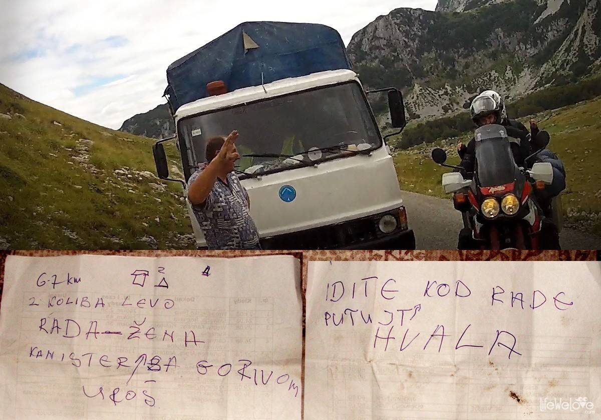
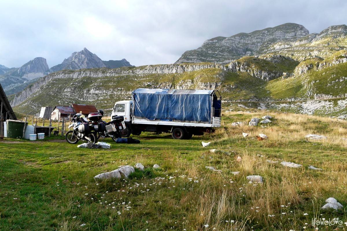
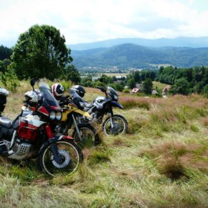
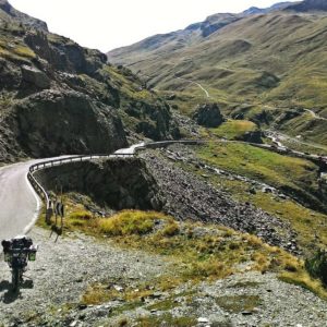
There are neither any typical alpine switchbacks and hills nor huge amount of sharp bends. You won’t meet there hundreds of motorcyclists, that you could greet with your left up. There aren’t any roadside shops with goodies or souvenirs. But, there is a breathtaking landscape and pleasant road that seems to lead through a different world. The world that is really calm, where you think that in a moment you will meet something or somebody unreal, like those groundhogs in the Milka ads. And then you meet a man from there on the road, trying to fix his old truck, and you really want to help him, even though there seems to be an unbridgeable gap between your languages. Yet, you feel an irresistible need to help him in any way you can. That’s exactly how this land works – it strips away all the adulthood with its formalities, and like a child, you dive headfirst into adventure. You take out the sheets of paper, draw pictures, create the map and you mark the mission aims on it. You set off with great smile on your face…
About our adventure in Durmitor, you can read in the articles about the expedition in the Balkans. Meanwhile, I would like to invite you for a movie:
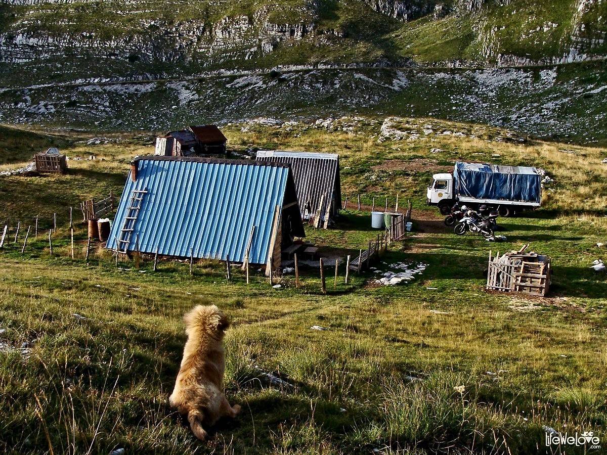
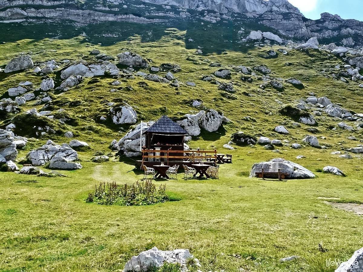
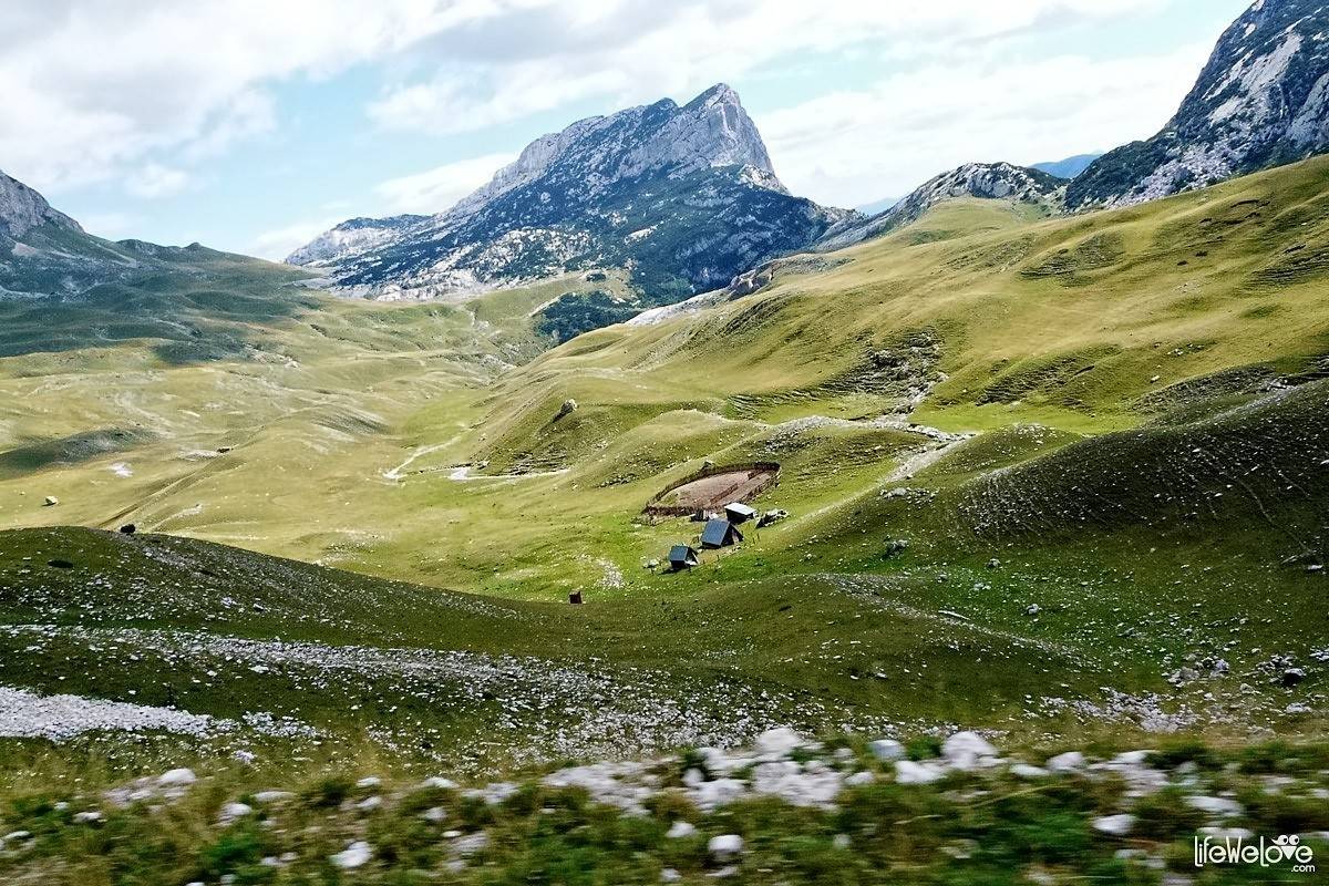
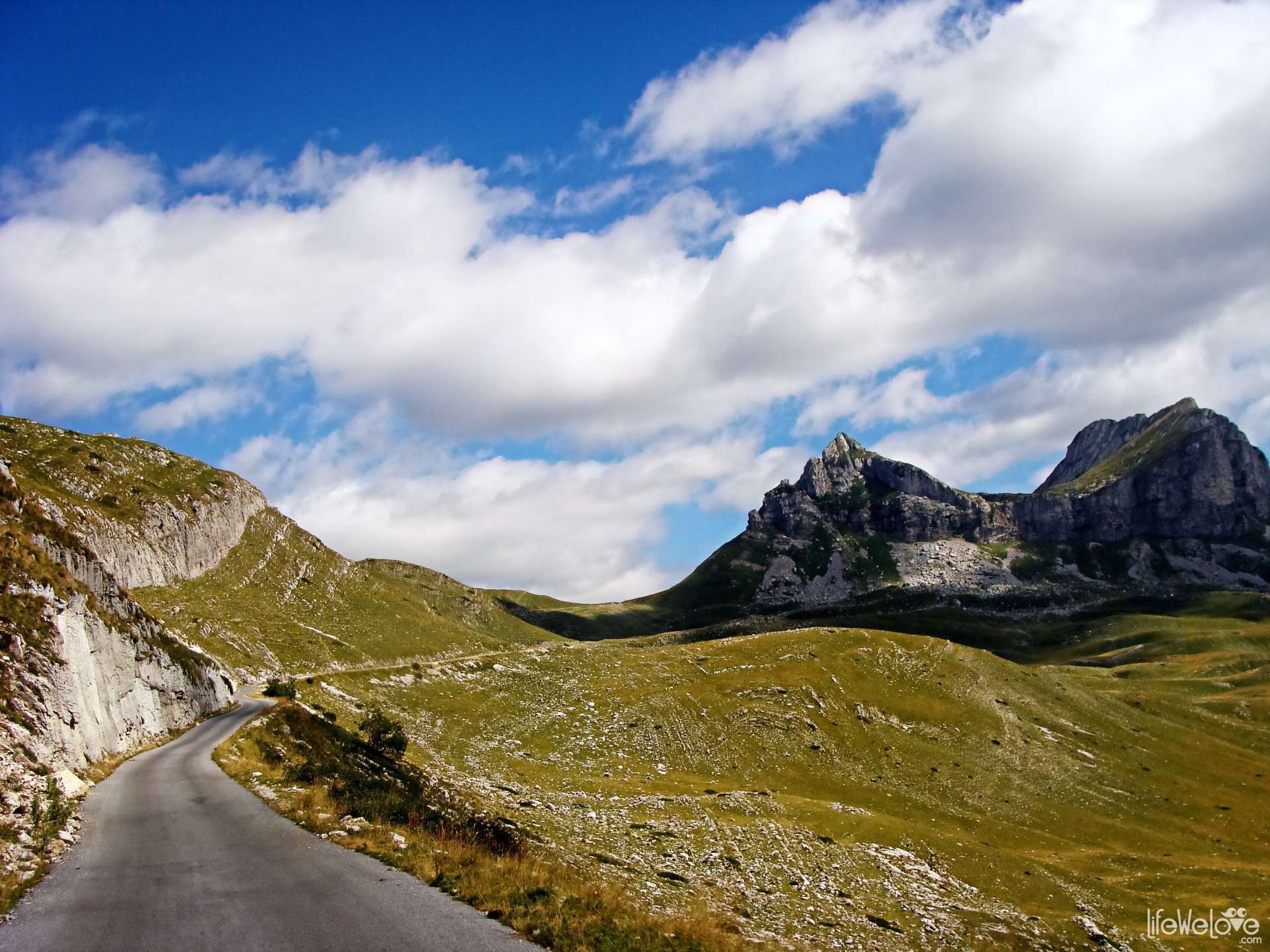
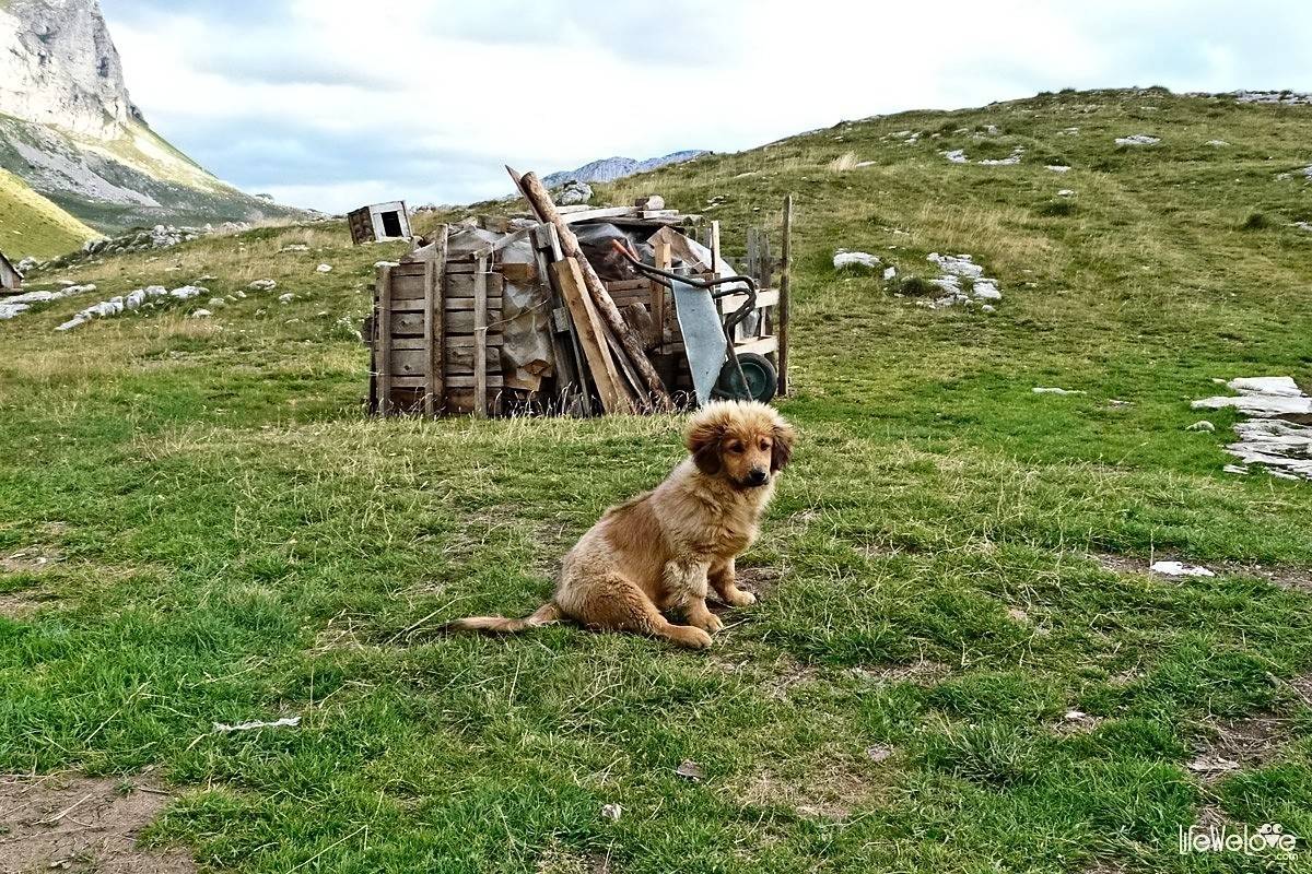
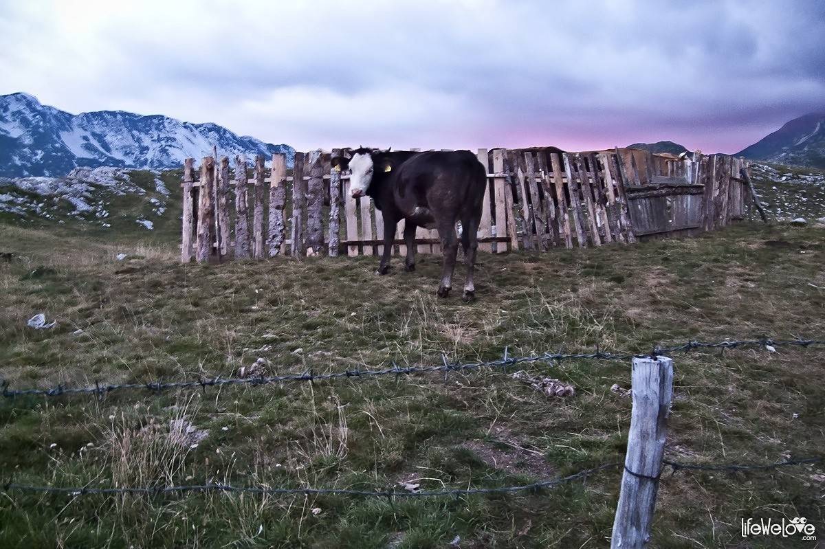
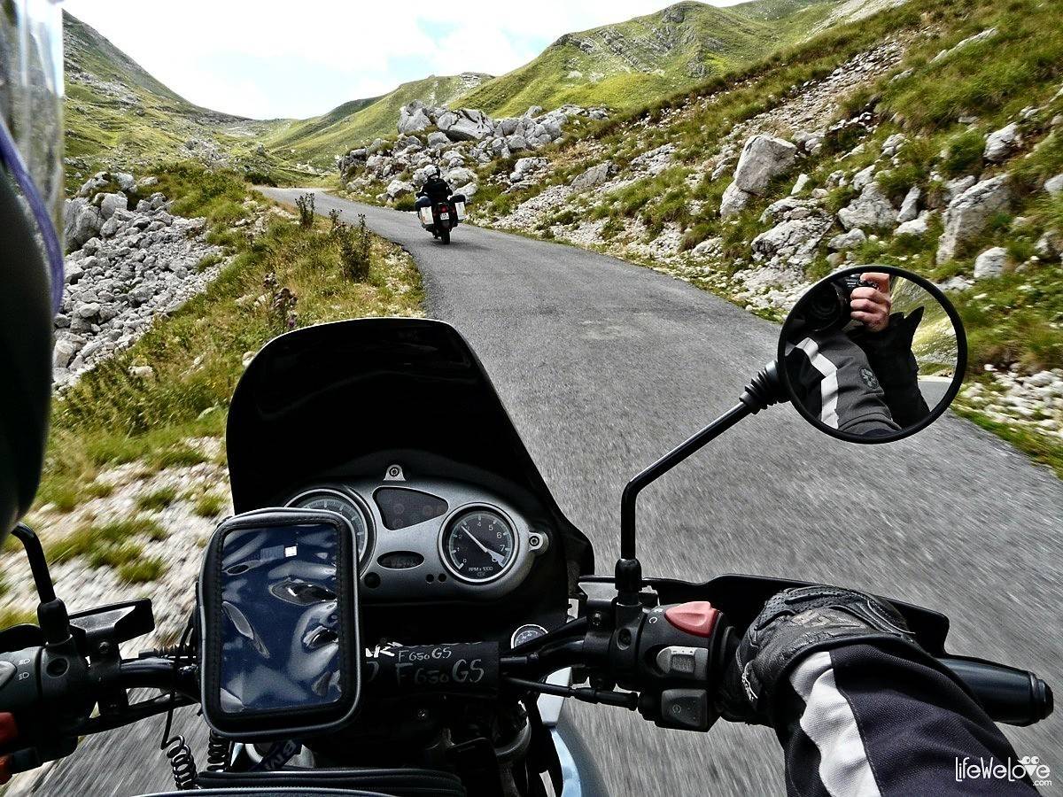
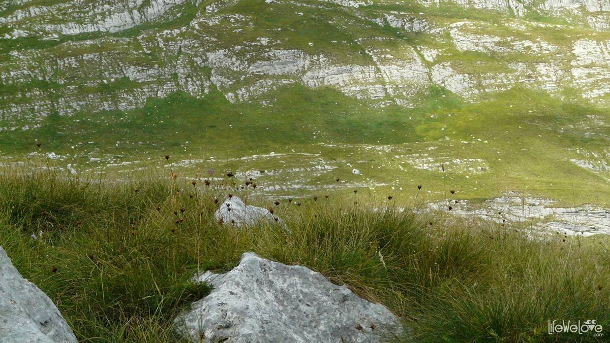
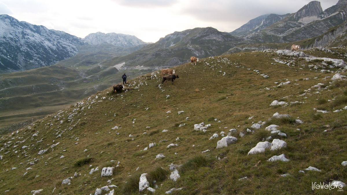
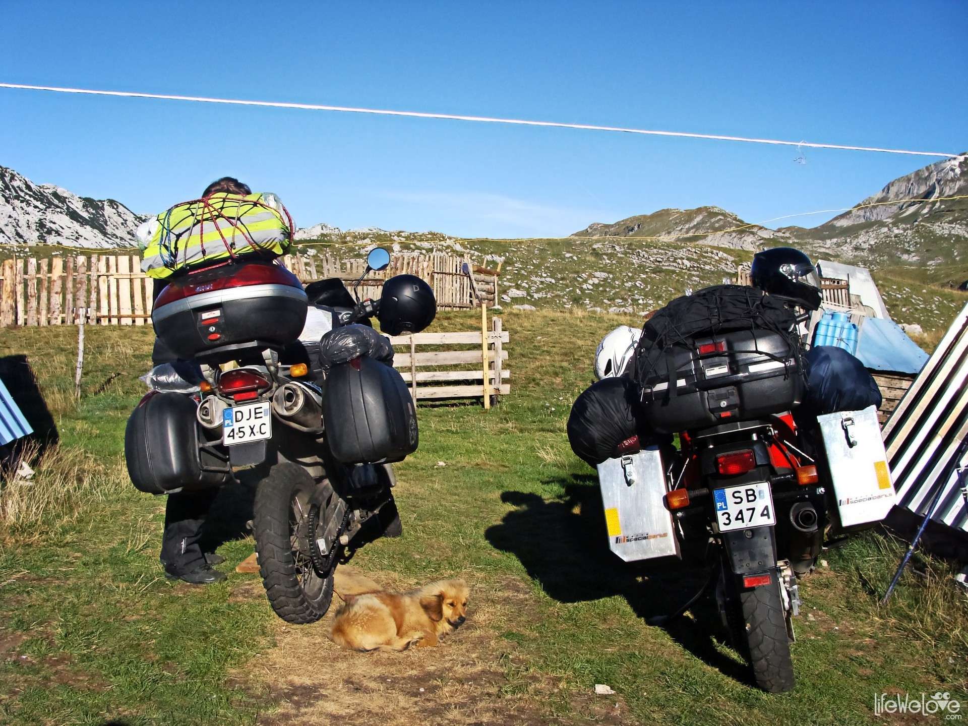
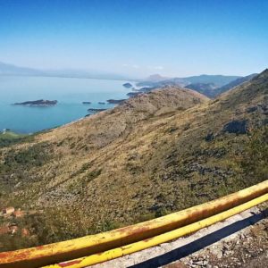
The route through the Durmitor National Park is one of the most beautiful that we covered till that time. The views and climates are equal to the picturesque Transfăgărășan road in Romania, that belongs to the most charming and the best motorcycle routes in the world. Unlike it however, in Durmitor, till this time, there isn’t any commercialism that woulddisturb the natural order, peace and quiet. On the road, we saw just one small wooden pub with some benches, which appeared there as if by magical wand. The one that magically appears on the road of the thirsty wanderers and disappears in a while. The profit on the tourists exists, but it comes down to the sale of cheeses made in small cottages, in their language ‘koliba’. The Montenegrin farmers live there in the summer in order to pasture own flock on the mountain meadows and to make delicious ecological dairy. The living conditions aren’t so easy. Uros and Rada, that we met, spent their summer in the one-roomed cottage, without access to electricity and running water, what is hard to believe, because ‘Durmitor’ in Gaelic means ‘The mountains dripping with water’ or ‘The river flowing from the mountain’. Uros, when we met him by the damaged lorry track, was carrying the huge water tank from the town.
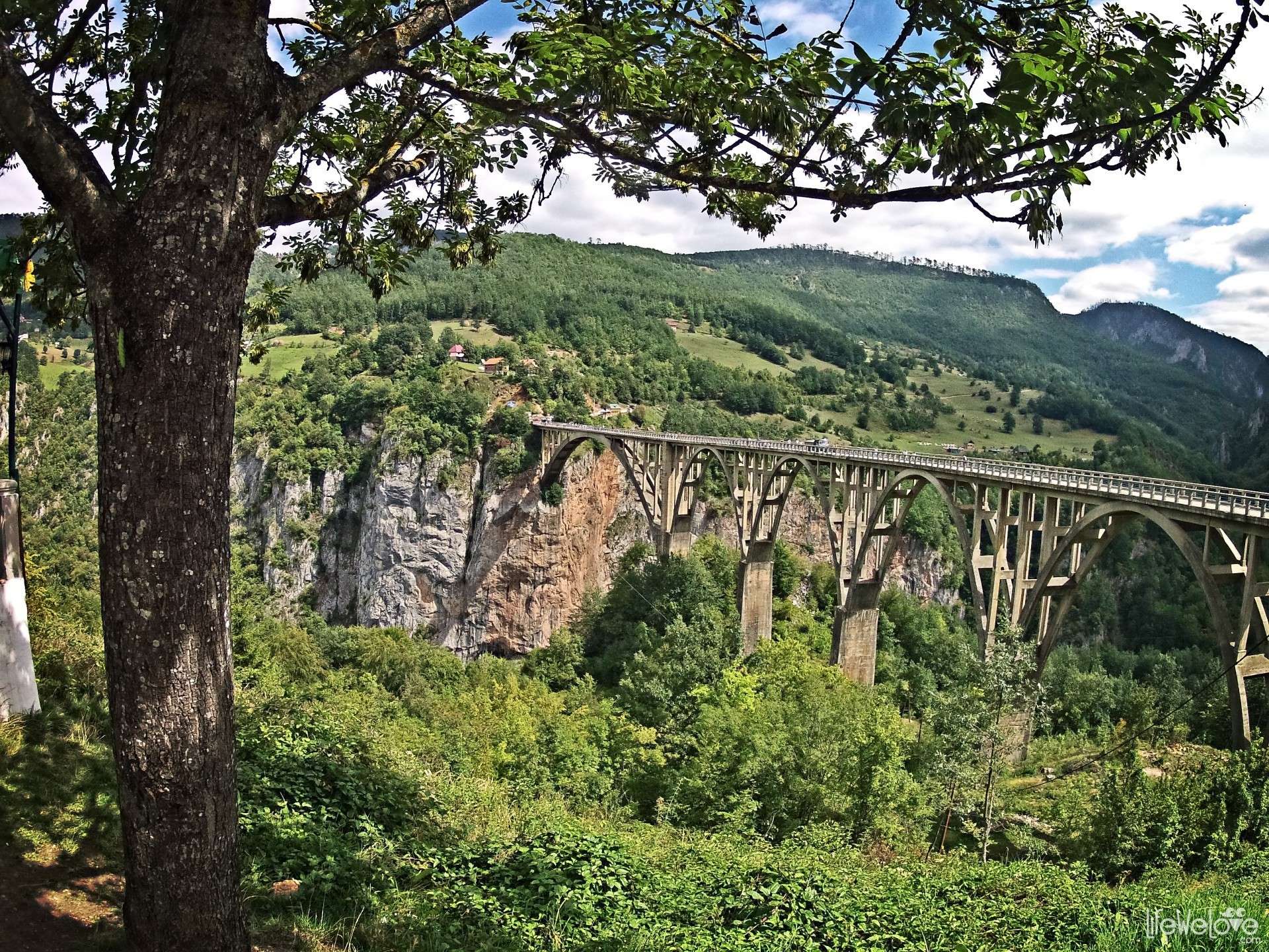
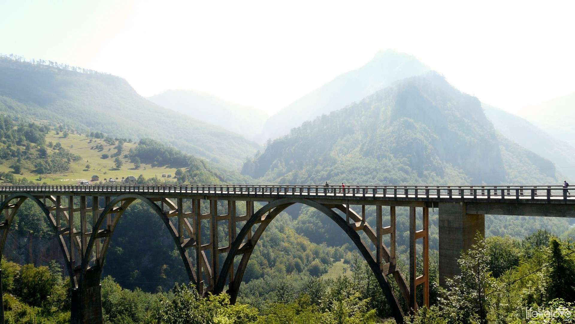
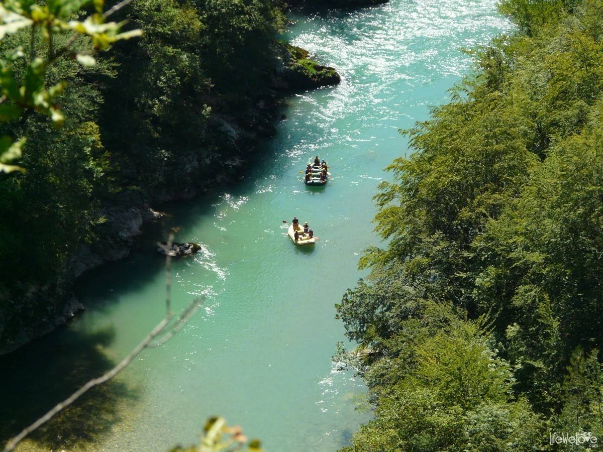
It is better go through the Durmitor National Park from the eastern side, because there is an amazing canyon of Tara river, deep for 1300 m in places. It causes that it is the deepest canyon in Europe. Above the canyon, there is Durdevic’s bridge long for 366 meters. From this bridge, you can admire the panorama of river gorge and the adventurers, using the zip line hung along the bridge.
On the western side, there is another picturesque canyon of Piva river. From that place, you can continue the trip making it longer by the road from Pivsko lake to Ostrog monastery.
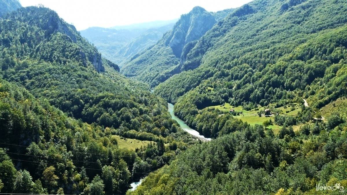
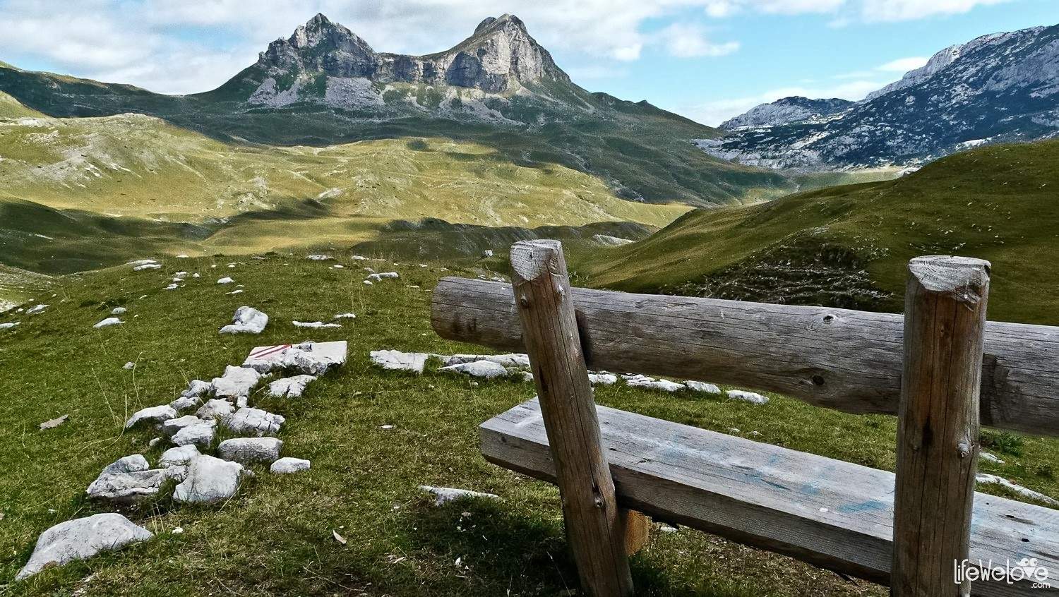
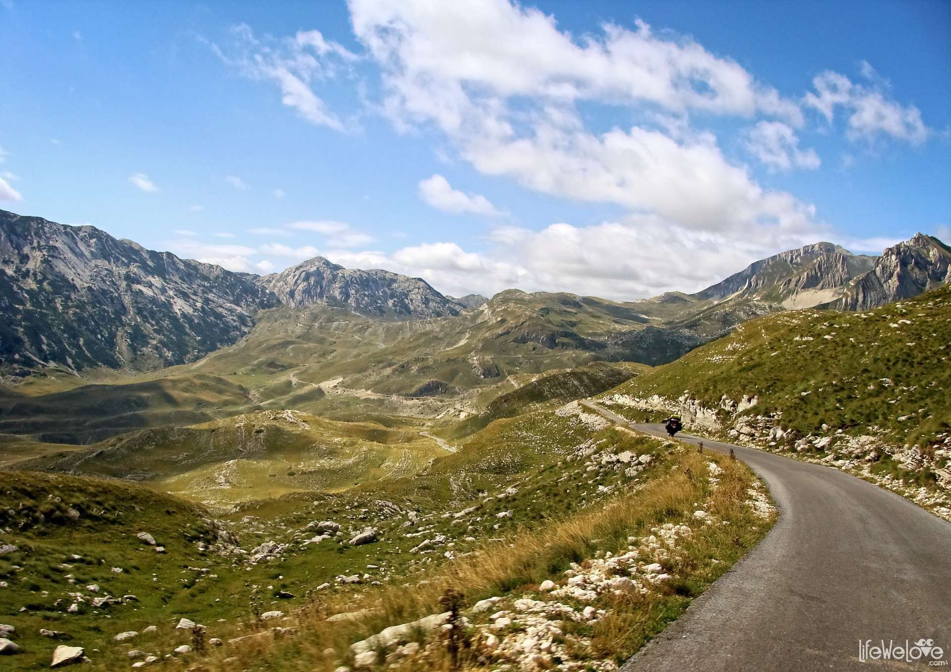
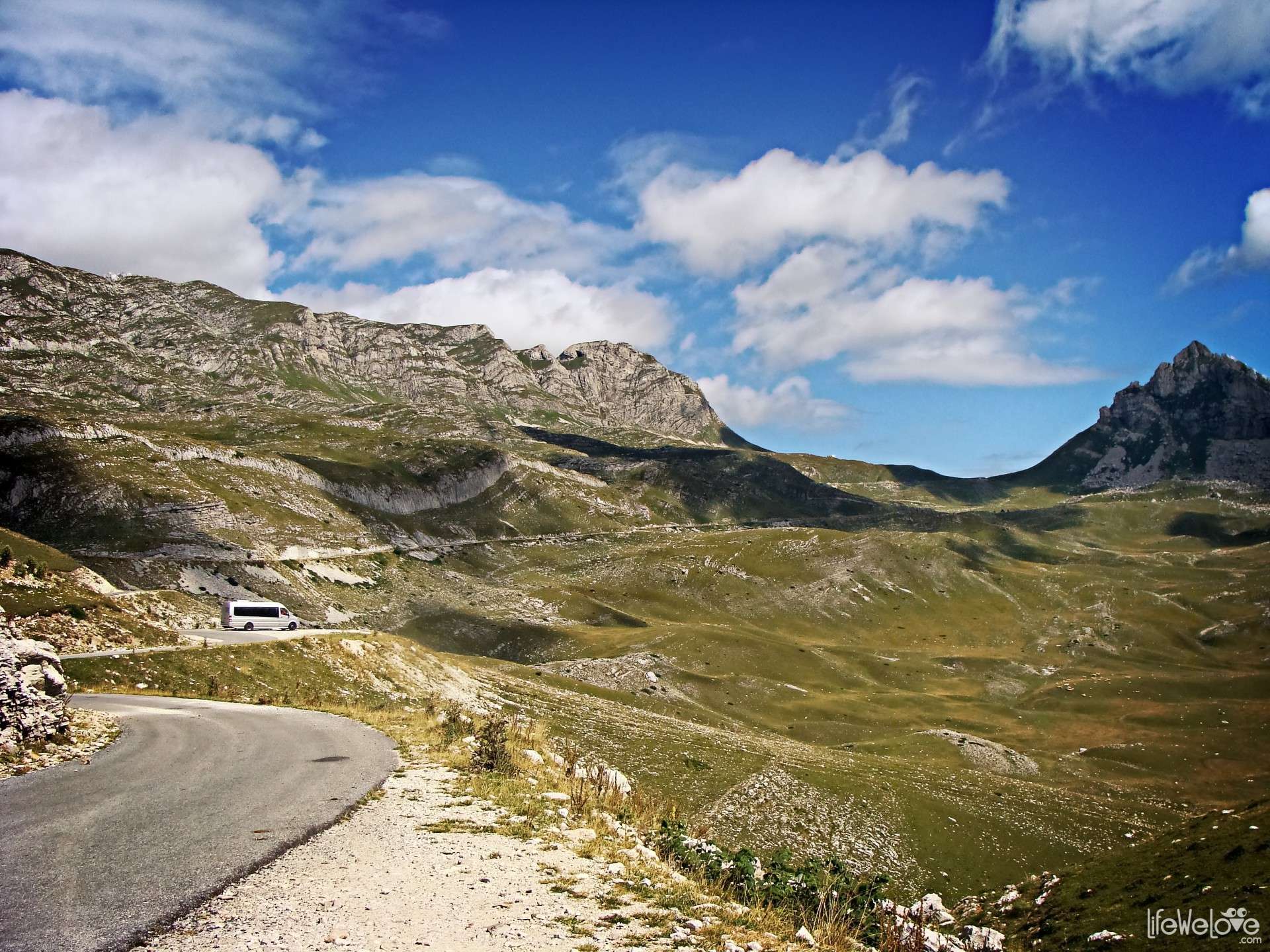
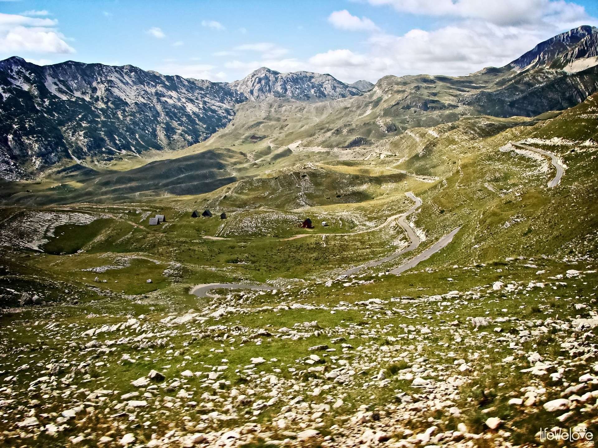
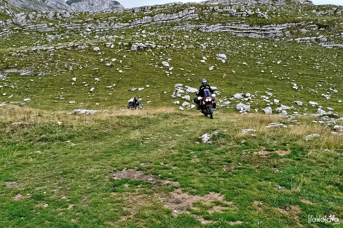
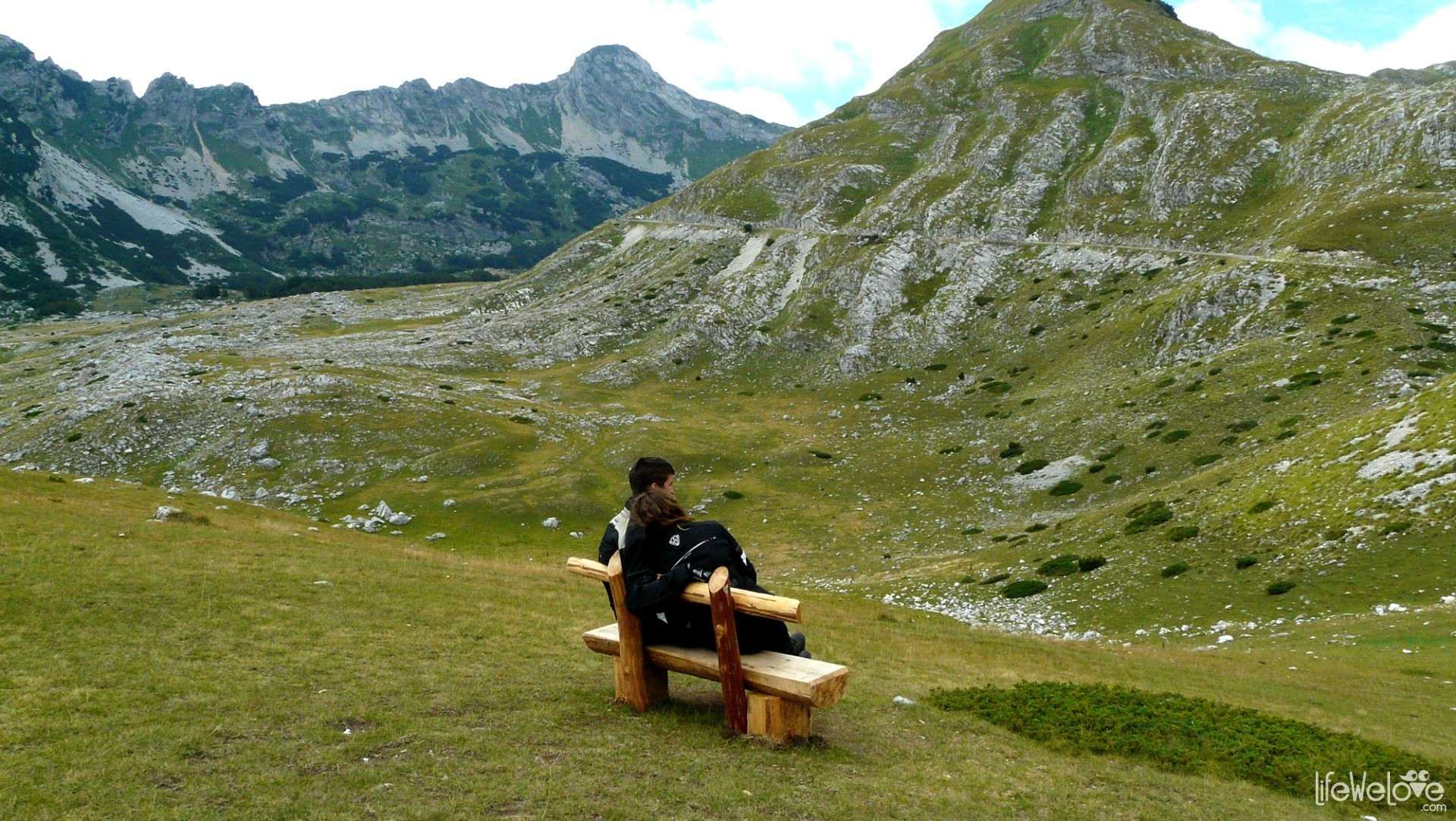
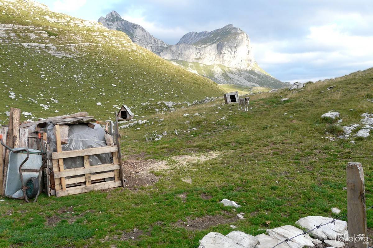
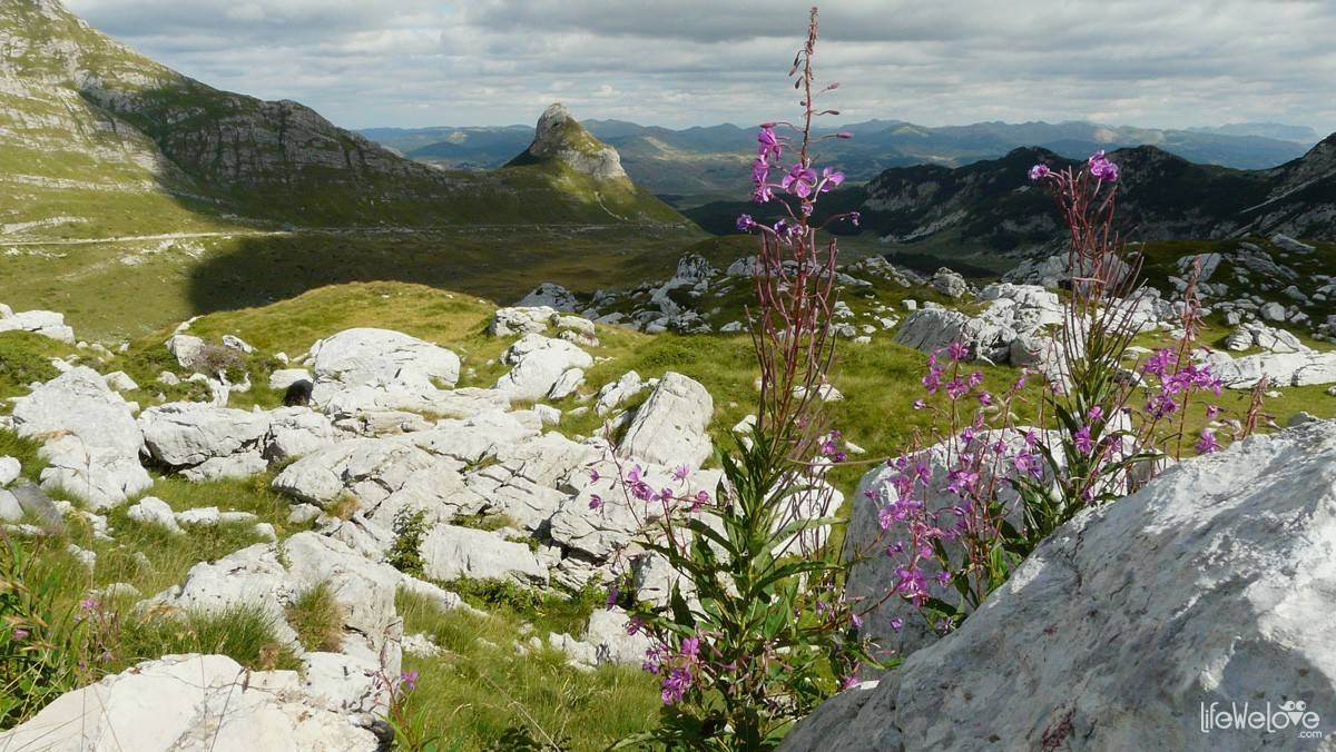
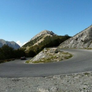
The route through the Durmitor mountains leads through Sedlo pass (1907 meters above the sea level), the road is placed as the highest in Montenegro and incredibly full of beauty spots. Surrounded by calcareous, cragged peaks, among which 48 reach over 2000 m.a.s.l., and 27 over 2000m.a.s.l. Bobotov Kuk is the highest peak in this land (2523m.a.s.l.) which is situated between valleys of Piva river and Tara river. The charm is added also by the shepherds’ ‘koliby’ located somewhere around, on the green meadows and hills, surrounded by flocks of sheep or herds of cows. By the road, there are benches visible from time to time, where you can relax for a while and delight in a beautiful view.

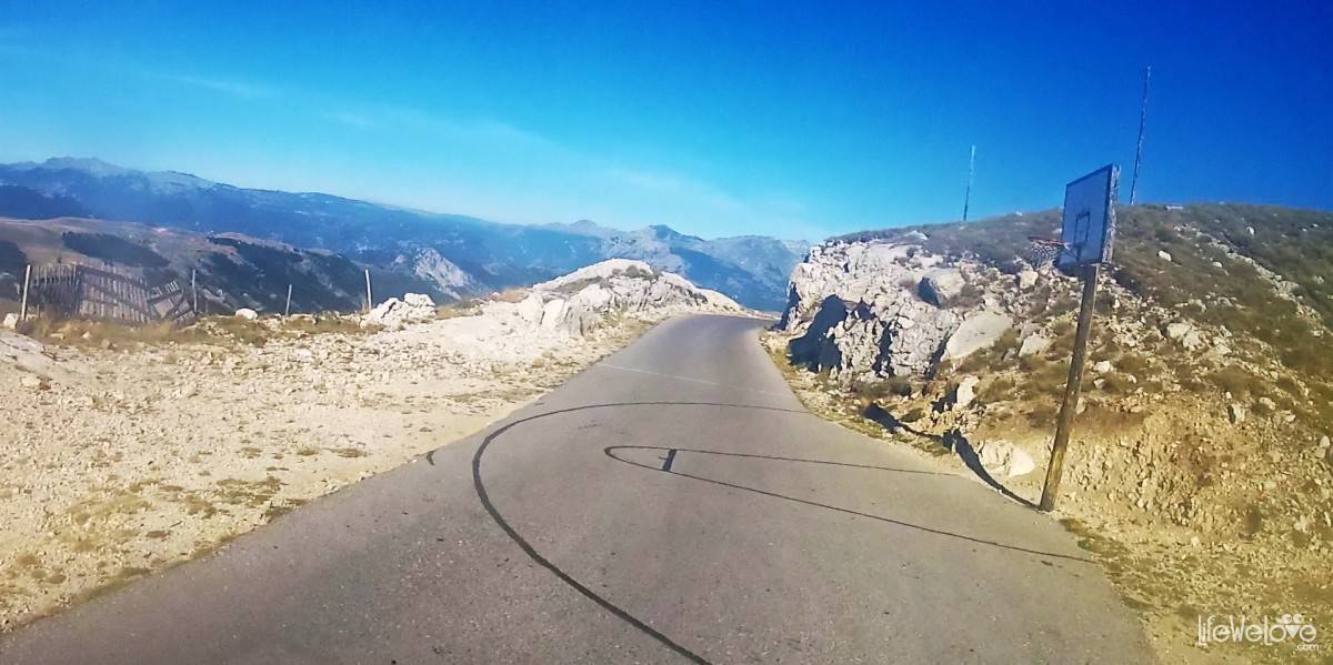
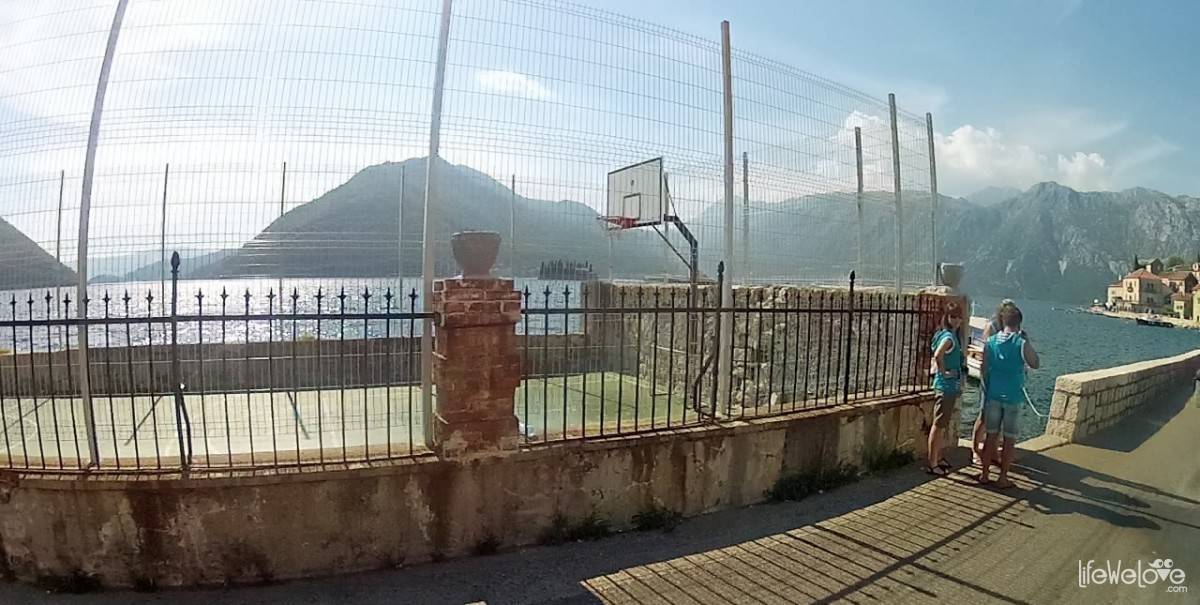
The traffic is small, we met there just the local farmers and the flock of sheep going across the road and one Icelandic couple on their motorcycle. The basketball court was a kind of odd view, because it was located on the road. I was wondering, how many time the ball fell down in the gap. In Kotor, we saw one more outstandingly located basketball court. We can only envy the Montenegrins their courts, in such sceneries the play is supposed to gain additional colour.


Without any doubts, the Durmitor mountains are an amazing place in Montenegro which we can truly recommend because of beautiful landscapes and peace and quiet – not disturbed by commercialism or crowd of tourists. If you are looking for mountain oasis of peace and quiet and fantastic route for motorcycle journey – the Durmitor spaces won’t disappoint you for sure!
loading map - please wait...
| The bridge on the Tara river Tara, Montenegro | |
| The Durmitor National Park Durmitor National Park, Montenegro | |
Info o drodze przez Durmitor:
| The route length | 70 km |
| The beginning / The end | The Durdevic’s bridge / The Pivsko lake |
| The road surface |
The asphalt of good quality |
| The threads | Narrow winding road, gaps, cliffs, cowpats on the road |
| The traffic | Small |
| The attractions | The canyon of Tara river, The Durdevic’s bridge, caves and springs flowing from the rocks, ecological local dairy |
| The maximum height |
1907 meters above the sea level |
7
Philip Hornby
Thanks for the post looks fantastic. I’m going to hopefully get to see it for myself in September as a friend and I will be traveling from the UK down Hungary Czech Republic Romania across Serbia and into Montenegro before I travelling back up through Austria and back home.
Wenzu
Hello I’m planning to visit montenegro next May 2020, is there any closing season for the cause of the weather, like the alps cause most of them are close 8n winter. And for the bike…. I have a racer bike, what you think is good for that kind of roads? And what about petrol station are they frequently or????? Thanks and any kind of help.